Puerto Rico is an island that I have had on my list of places to visit for many years. That was primarily because, under normal, non-touring, circumstances, it is a place that would provide a nice change of scene from my former homes on the mainland, while also being relatively easily, in logistical terms, to visit. Like many such places, however, I had never quite gotten around to making a visit there. Since the Tour route had me in the neighborhood, and especially since I could reach the island by ferry from Hispaniola, it was an easy choice to include a stop there along my way through the Caribbean.
I have long known of the island’s interesting culture, and its early history, being one of the oldest places in the Americas occupied by European colonists, eventually becoming a Commonwealth within the USA as a result of the Spanish-American War. More recent events were also relevant, specifically the devastation caused by two hurricanes in 2017, and civic protests just a month or two before my arrival, which unseated an unpopular governor, with seemingly no one interested in taking his place. What I did not know in advance of the Tour was the status of the roadways on the island with regards to their suitability for pleasurable cycling. I am very familiar with both the North American and Latin American styles of road designs and traffic behavior, with each system exhibiting both positive and negative features. In this case, without any prior knowledge, I feared that the road conditions on the island would combine the worst aspects of each system, leading to a stressful and less enjoyable visit. With that in mind, I did not plot out a particularly long route for this section, which would essentially be just a fairly short loop at the eastern end of the island. However, that should have been adequate to let me visit the San Juan WHS and also a few good birding sites.
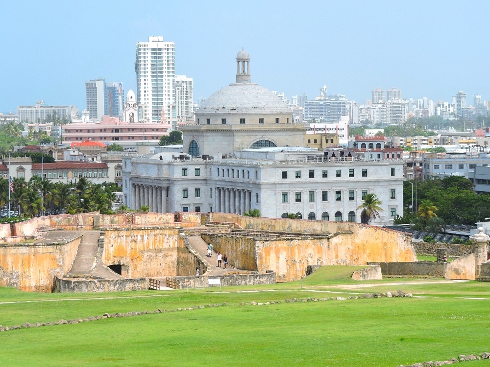
My route began in Old San Juan, near the State House, the Capitolio, shown below, which had no angry crowds nearby on that day. With a high population density, around three million residents living in an area about twice the size of the county I recently lived in in Oregon, I expected that I would not be able to camp easily while on the island. A few years ago, when I first worked out this route, there was camping available in El Yunque National Forest, not far from the capital, and, since that was a place that I wanted to visit anyway, I planned on making a short ride there on the first day, then camping there for two nights. However, the recent hurricanes had almost destroyed the National Forest, and, as such, the campground, and most of the other visitor services, had been closed since then. So, once again, my budget would be strained by more indoor lodging, and therefore I arranged for a room as close to the forest as possible.
That evening, a Monday, while deciding what to order at a nearby restaurant, I happened to glance up at a screen on the wall, which was showing a weather channel. A less-than-encouraging image was being displayed at that very moment, consisting of a familiar multi-colored, swirling-shaped radar pattern that is normally seen with tropical cyclones in various stages of their life cycles. This one was labeled Tropical Storm Dorian, and a forecast storm track was even more ominous, with the text block stating Dorian heading for Puerto Rico,
and a line leading in that direction. Of course, I knew when I first decided to route the Tour through the Caribbean that late August can be considered the start of hurricane season, something that could have a negative effect on a cycling trip, to say the least. However, the probability of any particular location in that region being affected by a storm during any given week are quite low, even at the height of the season. So, playing the odds seemed reasonable in my case.
At that time the forecast was for the storm to pass by the southwestern corner of the island as a Tropical Storm late in the afternoon on Wednesday. Even though I was in the northeastern corner, it seemed likely that there would still be unpleasant effects in that area as well. Clearly, a change of plans seemed in order. Tuesday showed no indication of being anything but a relatively typical day, and since I had originally planned to spend most of that day birding in El Yunque, I kept that in play, but booked what seemed like a sturdy hotel nearby for Tuesday and Wednesday nights, in order to ride out the storm.
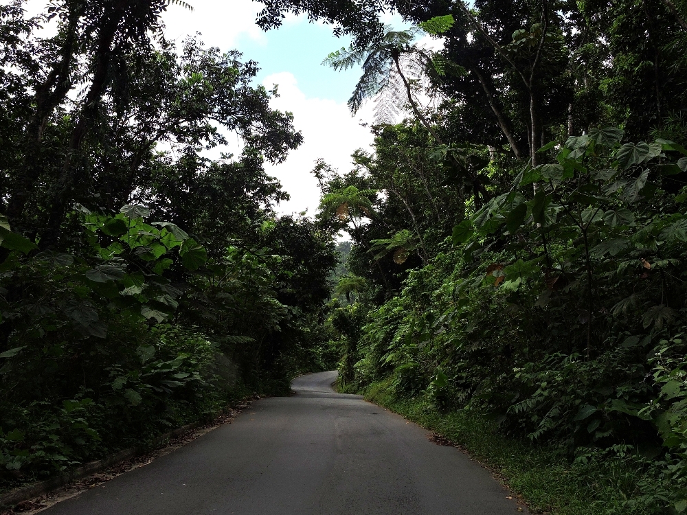
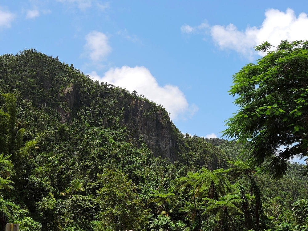
Even without the current storm, riding and birding in El Yunque National Forest would not be as simple as it should have been, because of the previous storm. Hurricane Maria, two years earlier had hit the region full-force and came close to completely wiping out the El Yunque forest, the largest remaining segment of Puerto Rico’s native forests and the only tropical rainforest in the US National Forest system. The road through the forest had been completely closed for a long time, but by the time of my visit it had been partially reopened for a while. The last section, that above 500 meters in elevation, was still only available to walkers and cyclists, so that made the steamy effort required to get up that high a little more worth it. It was encouraging to see that the state of the forest seemed relatively good, compared to images that were taken shortly after the storm. The regenerative capacity of tropical plant communities, possessing a virtual twelve-month growing season, is encouragingly impressive.
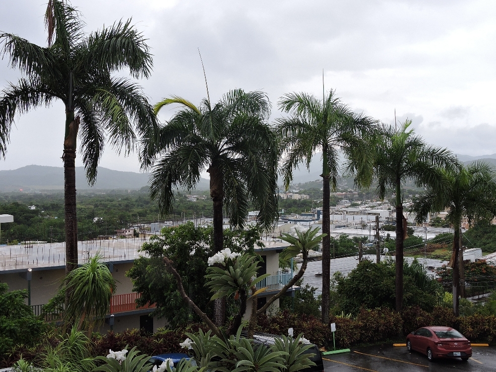
By Tuesday afternoon the forecast track had moved east, such that my location was thought to be in line for a direct hit, though the storm had not strengthened much by then. As Wednesday arrived, the track was even further east, and the actual effects where I was turned out to be fairly minimal. There were a few brief, but heavy downpours, but little wind, as seen in the image below, taken on Wednesday at midday. In fact, I conceivably could have ridden south according to my original plan that day, because the weather was not really that bad, and most of the local residents, still somewhat in shock from Maria two years earlier, were hunkered down indoors, so road traffic was almost nonexistent.
Perhaps I should have done that, because Thursday proved to be the worst day of the week after all. It started fine, and I began a shortened ride south, with another indoor stay arranged about 70 km away. However, by the afternoon, though Dorian was well to the north, it had begun its process of strengthening, and a trailing-side band of heavy thunderstorms appeared over Puerto Rico, and a significant amount of rain fell. Most of the time I was able to wait the strongest showers out under cover, but in the late afternoon the possibility that I wouldn’t have enough time to make my destination began to seem more likely. That necessitated some wet riding, though with the warm temperatures it actually felt refreshing, compared to the wet days I suffered through in North America earlier. The biggest issue turned out to be about 300 meters of flooded roadway that blocked my way. It was about calf-deep, though not flowing excessively quickly, so walking through was possible, if not desirable. Hopefully, I did not adversely affect the bike too much in that process, since it has already been showing premature component wear due to all the wet weather already encountered. I should have taken a photograph of that scene, but in such situations I often forget to do things like that, and that case was no exception. Eventually, I did make it through to my planned stop, significantly soaked, and with the bike covered by previously-floating weeds, but otherwise in reasonable shape, all things considered.
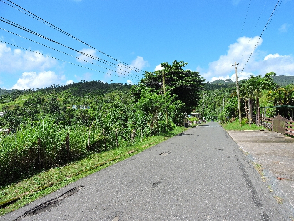
That left me only Friday to return back to San Juan for my transfer to the next island. At a little over ninety kilometers away, that didn’t pose any significant issues, providing the weather cooperated. Though there were no storms that day, it was quite hot again and the two small climbs along the way took their toll. That day, and the previous one, had also provided the answer to what the road status on the island was. Instead of a combination of North and Latin American styles in one place, there were examples of each type in separate locations. In the flat coastal sections, which are where the largest towns lie, the prevailing feel is of North America, with most roads trying to be expressways, difficulties routing away from those that actually are, and too much traffic in general. In the more rural, and mountainous, areas of the interior, like that shown below, the Latin style is more common, with one lane, unmarked roads lined with an almost continuous string of homes and shops. Fortunately, the American policy of emissions control is also in place on the island, so there were few examples of cough-inducing overly-polluting vehicles. That made for a few very enjoyable sections, though not as many as I would have liked. There were also a few cases at the urban-rural boundary which did possess the worst-of-both-worlds situation, but, thankfully, not very many.
Puerto Rico is another case of an island that could be a good place for a short tour, though not so much as part of a longer one. I would have had a better time, of course, were it not for the Gray skies of Dorian.