Section 3: Oriente
September 1: The Day the Calm ReturnsSibanicu to Vado de Jesu Fortunately, the good conditions of the previous evening continued throughout the whole next day. The morning ride was long, but pleasant and rather uneventful. The terrain was a bit more rolling that the day before, but the ride was generally easy. The only real town along the way was Guaimaro, where I stopped to pick up a couple of drinks at the Cupet gas station. From there it was another 40 km of quiet, easy riding to Las Tunas. I found Las Tunas to be a pleasant town. There was a greater choice of restaurants here than in any other town I had seen for a few days. After walking around for a while to choose, I had a nice meal of, you guessed it, fried chicken in a rather dingy-looking eatery with an even dingier-looking bathroom. No matter though, it tasted excellent. It was a little harder to find a small grocery store, but after a little more searching I had managed that as well. In fact, the beginning of the day had gone so smoothly that I, for once, had a few hours to kill relaxing and walking through the pretty little plazas looking at the many monuments. At one point I met a man, Patrick from Belgium, who told me that he was on tour as well, though he was off his bike that day. He apparently had been in the country for a long time, and he said that every three months he had to fly to the Bahamas, get a new visa, and then return. That even makes the hassle that I had to go though to get to Cuba seem mild. In the evening the route turned south and the riding was easy with whatever wind there was now slightly crossing from behind. About twenty kilometers south of Las Tunas I crossed the border into Granma Province. This province was renamed years ago after the boat that Fidel and his companeros used to return to Cuba to begin the People's Revolution. The whole southeastern part of the island is steeped in revolutionary history, and the residents here are proud of that fact. As you cross the border there is a series of patriotic billboards that remind you of those events. After a few more kilometers, I reached the town of Vado de Jesu, which was not mush more than a cluster of five or six buildings clustered around a small junction in the road. There were a lot of people standing around waiting for transport to wherever, and serving them drinks was a cheery woman at a little stand. I bought a Guava Batido from her that was so tasty that I kept coming back for several more. At this point I was way ahead of where I had planned on being by this time, so I was going to sit around for a while killing time. Just then, another nasty-looking thundercloud popped up. I thought I would try to outrun this one as well, but this time I was not as successful. Fortunately, just as the clouds opened up, I was crossing a bridge over the Rio Salado. So, I decided to wait out the storm by hiding under the bridge. It actually was quite pleasant. The rain really cooled things off, and I stretched out and listened to it fall. A bunch of little kids came running out to play in the river during the rain. Their laughter was quite enlightening. With that delay of perhaps 45 minutes, I had lost any big gains in distance that I might have made otherwise. No matter, as the rain stopped, and the sun was going down, I found a spot for the night just down the road at the edge of a big sugarcane field. Distance: 122 km Max temperature: 33 °C; Skies: Sunny, afternoon thundershower Terrain: Rolling, then flat
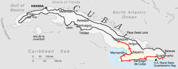
A pretty plaza in Las Tunas
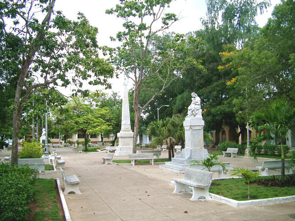
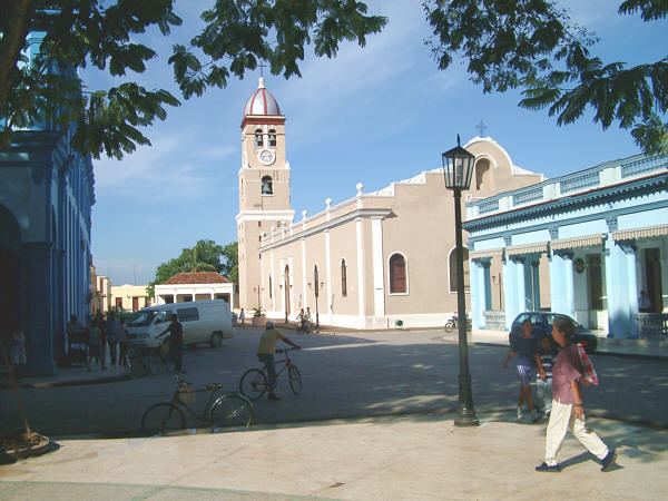
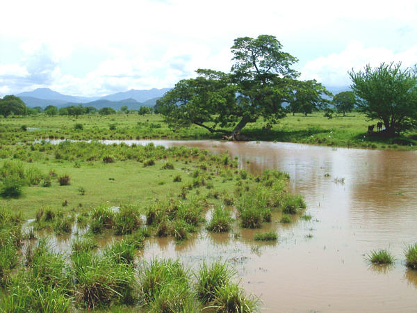
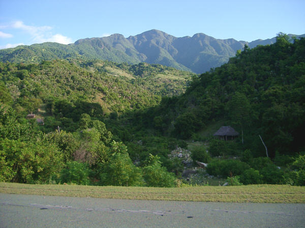
Countryside south of Las TunasSeptember 2: The Day of the Rough NightVado de Jesu to Campecheula Most of this day was wonderful. The end wasn't, but more on that in a moment. The morning section was easy and uneventful, heading south towards Bayamo. The terrain was gentle, and the highlight was crossing the Rio Cuato, Cuba's largest river. Of course it's not large by continental standards, but it makes up for that in its beauty. As with most of the other rivers I saw, this one is also largely undeveloped, a fact that made quite an impact on me. I made good progress, and before long crossed another river, this time the Rio Bayamo, on the edge of the town of the same name. Bayamo was probably the cleanest and most prosperous-looking town I saw in all of Cuba. It had many features in common with other Cuban cities, a pretty central plaza filled with statues, some nice old churches, and a street for only foot-traffic where most of the shops were located. Everything just looked a little spiffier here though, and the people seemed to be very easy going. I had a nice rest here, with enough time to take a quick peek at the very small museum. Inside there was some nice colonial furniture, and an old document from the early 16th century that outlined a proposal made to the Spanish crown to send an expedition northward to establish a colony in the territory known as "Florida". In the afternoon, I turned west for a little while, heading for Manzanillo. This ride was really beautiful, rolling through lush green countryside that was lit up just right by the afternoon sun. In the distance the backside of the Sierra Maestra range rose up to frame the view. I enjoyed this ride tremendously, and passed though the pleasant villages of Julia-Mabay, Barranca, Veguitas, and Yara. As Manzanillo drew closer, the road flattened out as I reached the coastal plain. Manzanillo is a good-sized town though it seemed to be a little bit threadbare. One curiosity was the presence of one of the only "bike lanes" I saw on the whole trip along the main road into town. I think that this was probably installed before the bike revolution of the early '90's. It was separated from the roadway by a series of cement nipples. Out of instinct, I move into it to ride, and soon discovered that to be a mistake. Unlike other roads, which are shared equally by all users, all of the non-motorized traffic was using this narrow lane. That included, of course, horse carts. After a few minutes of weaving around our equine friends, I moved back out into the roadway where I belonged. As I approached Manzanillo, my desires were focused on one thing. I needed a place where I could get some food that also had a bathroom. Well, in the older part of town, which was filled with interesting old wooden buildings, there didn't seem to be much to fit the bill. The only places that were open seemed to be outdoor take-out places. After looking for a while, I gave up and went off to see if there was something at the edge of town. To get out of town you climb up a big hill past a large hospital located at the top. Here there was only a bunch of street vendors and a couple of food kiosks. So, I settled for some quick snacks and drinks, never actually fining the bathroom I was seeking. I anticipated the next few days might be quite remote, and so I wanted to eat and drink as much as I could. There was plenty to drink, including some tasty Pru, a local concoction made from herbs, fruits and sugar, as well as the usual bottled drinks. However the choice of food was not so great. I was a bit worried about not being able to find something for the next day's breakfast. Nevertheless, I knew that I needed to put some more distance down that evening, so that the next two days would not be too lengthy. So I set out at about 5 PM now heading toward the southwest along the coast, where I had my first views of the ocean since Trinidad. After a while I came to the historical site La Demajagua, which was the estate of the Cuban hero, Carlos Cerspedes. Cespedes was the first Cuban to free his slaves and called for independence from Spain in 1868. His former estate is now a tourist site located a couple of kilometers off the main road, and I stopped in to have a look. Unfortunately, the visitor center closed at five o'clock, though the attendant was nice enough to let me walk down to the monument and take a quick picture. By sunset, I had gotten as far as the little town of Campechuela, and decided to bed down just before reaching the edge of town. I found a rough, but decent spot at the edge of a field and set up my tent. The night was balmy and I decided to leave the rain fly off to better enjoy the night sky. At first, this worked out perfectly, and I was really starting to relax. But, of course, in a situation like that there is only one outcome. It started to rain. So I hopped out to put the rain fly back on. In the process, some unseen insects viciously began chewing on my feet, so much so that I was jumping around so much that it was almost impossible to finish the job. Once the fly was finally on and I slid back inside, the real fun began. Almost instantly the temperature inside began to rise until it felt like I was in a sauna. I was dripping wet, and to make matters worse somehow mosquitoes were finding their way inside. Needless to say, sleep was not forthcoming. I tossed and turned all night long, pressing my face up against the netting to try and breath in some cooler air. Of course the rain drizzled on for most of the night, keeping things dreary. I'm not sure I can remember a longer, more uncomfortable night in all of my touring days. Distance: 145 km Max temperature: 34 °C; Skies: Sunny Terrain: Lightly rolling
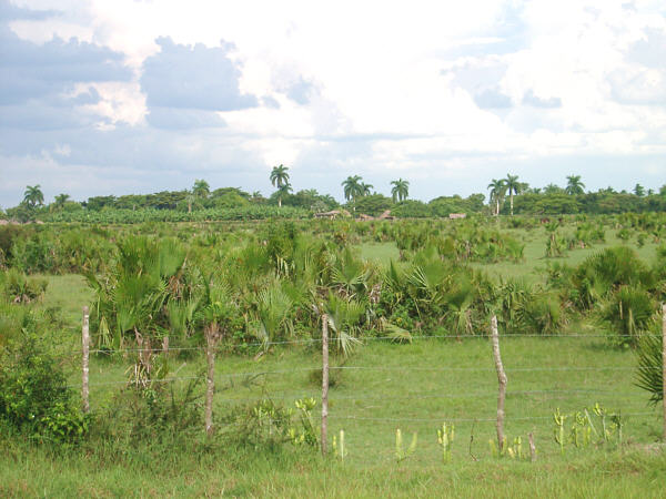
An old Church in Bayamo
A swollen river on the way to ManzanilloSeptember 3: The Slow DayCampechuela to the Sierra Maestra Coast After what seemed an eternity, dawn broke and I was so anxious to get up that I packed up just as the first rays of morning were reaching the ground. I still felt kind of lousy, from lack of sleep and the generally uncomfortable nature of the preceding night. And since I never was able to buy anything to eat for breakfast back in Manzanillo, I decided to slowly roll into Campecheuela, only a couple of kilometers away, and hang out for a while to try and recuperate. Nothing was open at the time I arrived, so I sat at the seashore for a while, where a couple dozen little wooden fishing boats were anchored peacefully in the little cove beyond the brown-sand beach. In a building a couple of blocks away, the local citizens were holding some sort of community meeting, and I could hear their loud applause, cheering, and a couple of rousing songs. Eventually, things started to open up, and I ate a couple biscuits containing some sort of fried meat that were not particularly tasty, drank some refrescos, a couple of delicious guarapos. I was about to begin the stretch of the trip that would be the longest distance without any significant towns, and with, therefore, the most uncertainty about obtaining food and drink. So, when the Dollar store opened up at 9 o'clock, I bought a couple of large sodas, one of which I drank right away, and the other I saved for later. A short while later, feeling a just a little bit more awake from all the carbohydrates I had just drank, I set out, about two hours later than I normally would have done. The route continued to the southwest for about 20 km, passing through the nice little village of Media Luna, there was a pretty, green park here where little schoolgirls were entertaining themselves by dancing in the streets. I bought some more food and drink at a kiosk market, and drank some tasty batidos, which where for sale at the many street stalls at the far end of town. There were some ice cream carts there as well, and a couple of cool cones really hit the spot. By now, I was beginning to get my legs back, which was timely, because there was a moderate climb ahead. About 8 km past Media Luna, the road turned to the southeast and rose over the far corner of the Sierra Maestra range, the mountains that I had been seeing in the distance since Bayamo on the previous day. The contours on my map suggested that the pass would be at least 500 meters, but I 'm not sure it was really that high. As it turns out, it was not a single climb but a series of five smaller ones, as I was told by a family who was riding the other way with a big fish strapped onto the back of one of their bikes. Midway along the first climb, I noticed three men sitting on the roadside selling produce. Since I knew that I'd want to get food at every opportunity on this part of the tour I stopped, though I was disappointed to find that the only item they had to offer was avocados. I really didn't want any, but I knew that I needed to get something, just in case. So, I offered to buy two, but since I didn't have the right amount of small peso coins, and I didn't want to hassle with making change, I gave them a US dollar. Well, that just made their day, and they insisted that I take a whole bunch of avocados. I tried to explain that they would be very heavy and I really only wanted two, but I don't think that I managed to convey that message to them very well. In the end we compromised, and I took three, which I dumped in one of the inner compartments of my left-side pannier, along with a pack of chocolate wafers that I had bought in Media Luna. The rest of the climb was uneventful, and the enjoyable descent, through an area that was not as thickly vegetated as some others, brought me back to the coast at what is marked on the map as the town of Pilon. I didn't see anything that looked like a town here, but perhaps there was something farther away from the highway. There was a Cupet gas station, and I used their restroom and had a couple more drinks. I had thought that my best shot at getting some real food would be at Marea de Portillo, which is a cluster of resort hotels about 8 kilometers away. However, when I arrived there I found that since it was the off-season they were all closed. One of the restaurants was open, but they did not begin serving until 6:00 PM, and it was only about 2:00 when I arrived. So, I had to choose between stopping here for the day, where I could be guaranteed some food, or taking my chances and continuing on. It was a tough choice, because I knew that it was a long way before I would find any more services. Also, my map did not give an exact measurement of the distance for the upcoming part of the highway. I knew from experience that sometimes a road that hugs the coast could be much longer that it appears on a map, due to all the twists and turns it makes along the way. So, I decided that it would be best to try and cover as much distance as possible that evening. It was my good fortune that, as I passed through a tiny cluster of buildings that barely could be called a settlement, I glanced to the left and saw, a couple of blocks off the highway, an open food kiosk. This was probably the only one on this 160-km stretch of road, and I almost missed it. Surprisingly, the fellow who was working there spoke excellent English. We chatted for a while and he told me about his family in Detroit. He also said that there was a Campisimo about 45 km away (he was wrong, it was farther than that), and I said I'd have no trouble getting there that night. I bought as much as I could reasonably carry, though the choice was extremely limited. Some little packs of cookies and little bags of snack bits were all that he had, so I got some of those, as well as some bottled water, and sodas. Now, heavily loaded, I set off, planning on making the Campisimo by dark. The terrain was generally flat, though the excellent, but almost deserted, road occasionally climbed up a small head as it rolled right along the water's edge. At one point a man on the roadside waved me down and asked if I had a pump that he could borrow. Of course, I did, and I gave it to him. But, his tube was so messed-up that the valve stem was pointing off at such a goofy angle that we could not get the pump on because the pump head bumped up against a spoke. His wheel was bolted on, and neither of us that the proper wrench to take it off (Hmm, I should have been more prepared!). After scratching our heads for a while, I realize that we didn't really need to get the wheel off, but by just removing one side of the bead from the rim, we could slide the tube around so that the valve would then point out straight. After a bit, we had him filled up again, but it seemed that his tire might not have been holding its pressure. He said that he only needed to get to Pilon. So, I suggested that he get going and try to get there before he went completely flat again. I wonder if he made it? The rest of the evening I really started to have fun again, as the ride along the coast was quite enjoyable. After a while I began to realize that the Campisimo, might be farther along than I was told. But then I realized that there wasn't any particular reason to try and get there, as I was passing so many beautiful little beaches that looked like perfect places to stop for the night. So, a little while before dusk, I decided to call it a day, and pulled off at a fairly isolated spot. I found a big, bushy tree with leaves the size of saucers just above the high-tide line, and hid the bike and my gear under its cover. The beach was totally rocky, and there wasn't a comfortable place to lay down out in the open. So, I made a little bed for myself under the bushy tree out of its many fallen leaves. I had been anxiously anticipating taking a swim all day, since this would be the first chance I had to do so since Trinidad. Even though the guy at the kiosk told me that one could not swim in the area because it was too rocky, I jumped in anyway. Indeed, the light surf did toss me about on the rocks, but it felt so good to be cool and wet again that I didn't care. The lights of fishing boats floated off the shore and the sun set, with its typically impressive palette of reds and oranges, right over the point where the land met the sea. After a couple of swims, I crawled back under the tree and got a little more comfortable by resting my head on my right-side pannier, and propping my feet up on the left-side one. This turned out to be a bit of a mistake, a fact that I would not discover until the next evening. Distance: 116 km Max temperature: 33 °C; Skies: Sunny Terrain: Flat, hilly, and rolling
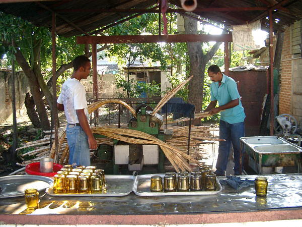
Making Guarapos in Campechuela
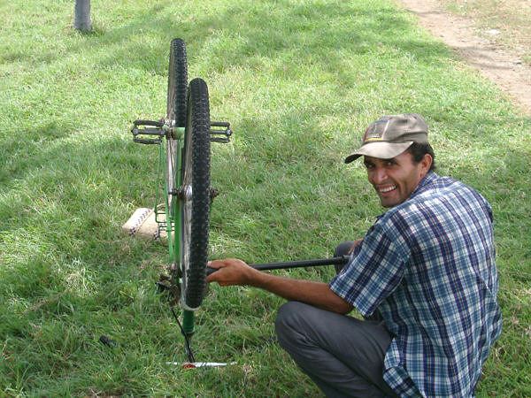
A friendly man borrows my pumpSeptember 4: The Day of the Wonderful RideSierra Maestra Coast to Santiago de Cuba When morning came, I was eagerly anticipating the ride ahead. I set of right after sunrise, and soon realized that I was on what absolutely must be one of the world's greatest bike rides. Those that have ridden California's' Big Sur, will find many similarities to the ride along the Sierra Maestra range. Having now done both, though, I can say that, in my opinion, the Cuban version beats its North American counterpart hands down. Both rides are very similar in that the roadway hugs the coastline on one side with rugged mountains lining the opposite side. In fact, Cuba's highest peaks are here, with Piqo Turino reaching 1972 meters. The riding is pleasant, however and, like Big Sur, the road rolls along the shoreline, only climbing now and then up and over a rugged headland. These climbs are not that strenuous and only add to the fun of the ride. This route wins out over Big Sur in two important respects. First, the ocean is warm enough to comfortably swim in, so unlike California, one could take a quick dip at many points along the way, if so desired. More importantly, this route is almost completely free of motorized vehicles. So, a cyclist can glide along, paying much more attention to the amazing scenery. In fact, along the 100 kilometers from Portillo to Chivirico, I counted exactly 3 cars, 3 motorcycles, and 5 of the familiar dump-truck busses. However, there were many people on horseback, a hundred, or more, walking, and a few local cyclists. Contrast this to the endless stream of impatient city-folk cruising along Highway 1 in California in their luxury-mobiles and oversized RV's, and you'll understand why I prefer this ride. The landscape along this part of the ride made it even more appealing. Tropical foliage clung to the hillsides, which were occasionally cut by small, sparkling rivers. In spite of its isolation, on this stretch of the coast one was never too far from a local household. Simple, but attractive, homes were periodically lurking in on the hillsides, surrounded by groves of bananas and other food crops. I admit that I felt a little jealous of the folks who were able to live a simple life in such an ideal spot. There is only one tiny village along the way, Uvero, which has no services at all except for the Campisimo that I was told about the day before that is somewhere nearby. The road conditions on this route were surprisingly good as well, except of a few rough patches on either side of a few bridges, where flood waters had obviously caused some damage. So, this went on all morning, and I simply forgot about any other concerns and just rode along enjoying myself, perhaps more so than I had done on all but a few days of my cycling life. There are not many more words that can adequately describe this ride better than a few pictures, so....
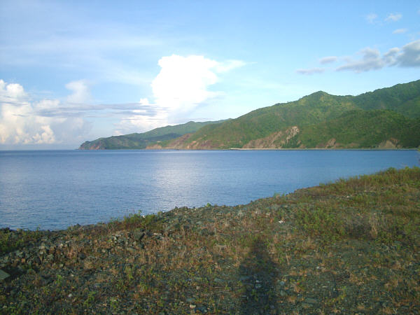
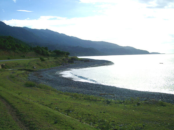
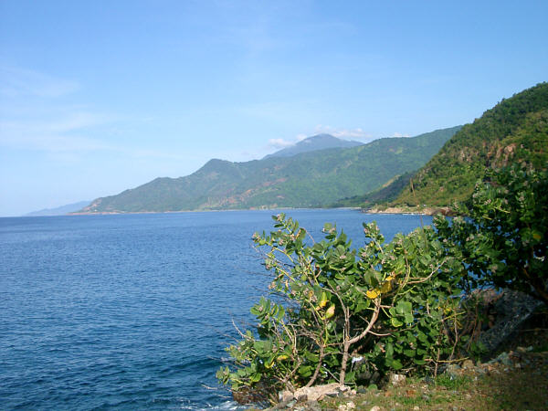
The beautiful Sierra Maestra Coastline
The beautiful Sierra Maestra Coastline
The beautiful Sierra Maestra Coastline
The beautiful Sierra Maestra CoastlineAt midday, I arrived in the only town on this section of coast, Chivirico. There were a few food kiosks there and a simple restaurant, and I had a nice break. While resting on the shady little beach, I decided to modify the plan for the rest of the day. I was about a half day ahead of where I thought I'd be at this point in the tour. So, instead of spending the night just east of Chivirico, as I had planned, I decided to continue on all the way to Santiago. This way, instead of quickly passing through the city, I would be able to spend a little time there and look around a bit. I decided that I would look for a Casa Particular when I arrived, mostly just for the experience of doing so. The ride east to Santiago was very nice, though compared to the spectacular ride of the morning, the scenery dropped off just a little bit. Not by much, though, and if this were the only section I did that day, I would still say that it was a great day. However, the heat really began to rise as the day wore on, and since I didn't take as long a break at midday as I might have otherwise done, I began to feel tired again. As you near the city, there are some small climbs to deal with, which didn't help much either. Santiago, much like Los Angeles, is in a flat basin surrounded by high hills, which gave it a sort of isolation, and a character of its own, over the years. As you approach the city, you enter a more urban setting rather suddenly. On the edge of town, is a large refinery, which you don't see, but rather experience by the coincidental increase in stinky truck traffic. It wasn't too hard for me to follow my nose to the center of town, though this area is really hectic and bustling. After a while I rolled up to the big plaza at the center of the city. I really wanted to just rest for a couple of minutes, and get my bearings after the long, hot day. Of course, I immediately drew the attention of a few locals who wanted to show me to a place to stay. I shooed them away, partly out of habit and partly because I had made a list of a few recommended Casas in town in the tour notes that I had brought with me. After a little while, I set out to locate one of the Casas on my list. Of course, I completely failed at this simple task. A few more minutes of wandering around, lead me back to the plaza, where I was approached again by one of the same fellows that I had shooed away earlier. This time, I meekly accepted his help. His name was Romano, and he took me first to a place that, on the outside, gave no indication that I could see that it was a house, but was quite nice on the inside. This one was already spoken for, so our next stop was the Casa beloning to the niece of the first one's owner. This one was available and as I was registering Romano hung around to make sure everything went smoothly. It was $15 for the room plus $3 for breakfast the next morning. As I was signing in, the owner informed me that I would not be allowed to bring a "Chica" to the room. I assured her that the only thing I was interested in that night was a good night's sleep. I asked if there was a place where I could send an e-mail, and she didn't know, but Romano said that he could show me later. As I was unpacking, I discovered that I had made quite a messy mistake the night before when I used my right-side pannier as a footrest on the beach. Of course, I had forgotten about the avocados that I bought on the roadside and placed in that pannier. They were completely smushed, along with the package of chocolate wafers, creating a gooey mess that has caused me, from now on, to refer to that compartment of the bag as the "Chocolate Guacamole Space." After I had cleaned that up, and removed several days worth of road-dirt from myself as well, Romano walked me through town to find a place where there was 'Net access. The first place was closed, so it was back in the other direction to a second one that was available. He waited there while I wrote a quick message and then showed me to a paladar, where I had a nice meal of pork and fried bananas. After dinner, I said goodbye to Romano, who had waited around to be sure that I was well fed. After all of his help, I began to realize that many of the folks who offer to help strangers are not really hustlers, but genuinely being nice. I then took a little walk around town trying to soak up some of the city nightlife. But soon the soft bed back at the Casa was calling, and I passed out on it at 9:00 PM, and enjoyed the first solid night's sleep I'd had in several days. Distance: 142 km Max temperature: 39 °C; Skies: Sunny Terrain: Light to moderate rolling
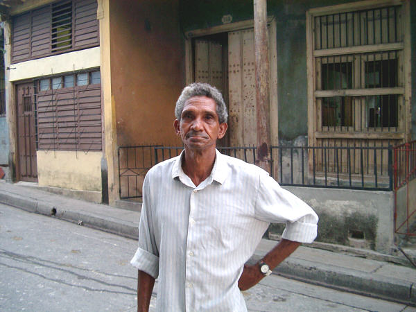
My guide in Santiago, Romano
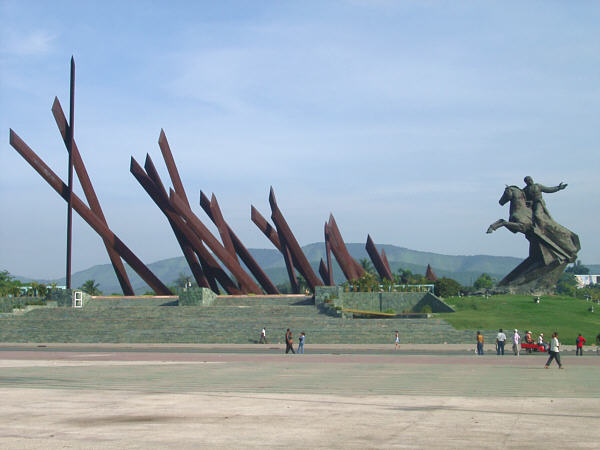
Antonio Maceo Monument in Santiago
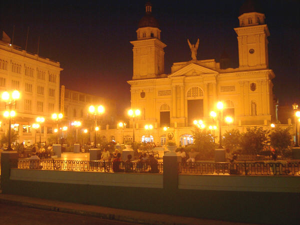
The Santiago basilica at nightSeptember 5: The Day of the Wonderful NightSantiago de Cuba to Tortuguilla It seems only fitting to follow the day of one of my all-time best rides with one of my all-time favorite nights, but more on that in a moment. This day began with a nice breakfast at the Casa in Santiago (Mariluz Lopez's at Corona #608, in case anyone is interested,) after which, I set out, a bit later than normal. Navigating out of the city was not too difficult, but it was busy, and with a good bit of traffic, so I didn't waste any time, and headed straight for the day's main stop, Guantanamo. At the edge of the city the urban nature of the area disappears, but the road still has four lanes, something that was very rare on this trip. At the start, the road climbs up out of the basin that is home to the city and into the surrounding hills. The climb is fairly easy, though there isn't much to look at. After a little while, an almost hidden little road branched off and joined the road that I was looking for, heading for La Maya. At this point, the quiet, rolling green countryside returned, and on this pretty morning it was a pleasure to ride along past the local farms. In La Maya, I stopped for a few minutes for a drink, or two, and then continued on toward Guantanamo. It was another 50 km, with not much along the way except pretty scenery. As the city approached, the road widened but remained largely empty. Guantanamo is a decent sized city, about 25 km from the U.S. Naval base of the same name. It does not appear to be a very cosmopolitan town, which is fine with me. However, I found it quite annoying in that it was the only city that I had any real difficulties in finding my way around. Normally it wasn't hard to find the center of town, where most of the facilities are typically located, by simply looking for a steeple, or other landmark, or, even more straightforwardly, by following a series of signs. However, in Guantanamo I just couldn't make heads or tails of the city layout. It took 45 minutes of riding around and asking several a local people before I finally found the city center. Once there, I was able to relax for a while. I cooled off and had a little pizza in an El Rapido, bought some food in a lightly stocked Dollar store, and some fruit at the farmer's market. Afterwards, there was still enough time to stretch out in the shade for a while in the plaza. Though, it was at this point that I felt the first rumblings in my stomach that indicated that I might have eaten or drunk something I shouldn't have in the preceding days. Nevertheless, after a little while I was ready to go for the evening ride. Just outside of town, the road heading east quiets down rather quickly and crosses some very flat ground that is at the head of Guantanamo Bay. Some thunderclouds moved into the area and threatened to dump some rain, but they did not, at least not on me. About 25 kilometers outside of Gunatanamo, a road forked of to the right, heading south, but it was barricaded by the Cuban army (in fact, the only such barricade I saw on this trip). This is the route one would take to the eastern entrance of the U.S. Naval base. Naturally, given the current political situation, there is restricted access. This was probably for the best as far as I was concerned. Gunatanamo Bay was the location for the notorious "Camp X-Ray" where captives from Afghanistan were being held. As I passed by, I wondered what the guard's reaction to me would have been had I been allowed to approach the gate, wearing stinky clothes, a shaggy face, covered in road dirt, and carrying all of my meager possessions with me. After this junction, the road crossed a small range on its way to the coast. There is one short, but rather steep climb. I had to stop and wait on this one, not because of the difficulty of the hill, but because a loaded bus passed me on the climb, which was barely going faster than I was. It left a thick black cloud of diesel soot behind which seemed to take forever to clear away and wasn't much fun to ride through. In this small range the vegetation changed dramatically. The extreme southeastern coast of the island lies in the rain shadow of the mountains to the north, and so, has the most desert-like landscape in the country. Palm trees and banana plants gave way to cacti and yucca, and hedgerows of these spiny plants surrounded the homes along the way. It was an interesting change of pace. As dusk grew closer, I saw many places that looked to be excellent spots to sleep for the night. However, this was one case when I was glad that I kept deciding to go "just a little bit farther." After a while, the road hit the coast, at the tiny resort of Playa Yateritas, there looked like there might have been some lodging here, but I wasn't too interested in that on this occasion. Instead, I kept on riding and in a few kilometers, passed though the little settlement of Tortugilla, which was too small to merit a dot on my map. Just east of this spot I found a place to sleep that made me glad that I didn't stop earlier. Let me try to set the scene. The land here was a narrow, flat plateau that was once a coral reef but was now raised about 10 meters above sea level. The edge dropped off vertically into the sea. There were some footpaths around the old coral boulders, and I followed one that lead me to a place where I could find some cover behind a clump of bushes and larger boulders. Just beyond this spot was a place where the plateau has collapsed into the sea, and the resulting sinkhole was now connected to the ocean beneath a natural bridge. The waves could still get through and made a pleasing clap-clap sound each time they did so. I would have loved to climb down inside and take a quick dip, but the wall looked too steep, and if I had done so I might still be floating around down there. Well, this seemed the perfect spot to rest for the night. As I was right on the seashore, there were no mosquitoes or other biting insects, and the temperature was absolutely perfect as well, so I decided to leave the tent packed up and sleep out under the stars. As I lay down, enjoying a pineapple I had bought in Guantanamo, I was treated to a spectacular show. The first act; an intense sunset behind the hills that I had just crossed. Act two; lightning from distant thunderstorms far out to sea, which went on for at least an hour. The final act was a display that became apparent as the last glow of daylight finally disappeared and the thunderclouds moved off beyond the horizon. There was a new moon that night, and not a cloud in the sky. As the sky darkened, the Milky Way painted itself across my field of view, and a moderately intense meteor shower kept me entranced. It's times like these that make me so sad that we have lost nights like this at home in favor of making our nights seem like daytime. I don't really know how much sleep I got that night, but it wasn't too much. I simply enjoyed looking at the sky and listening to the water splashing around in my little bowl of ocean for that. Sleep wasn't an issue on this night, however, and this spot now resides near the top of my list of all-time favorite touring nights. Distance: 146 km Max temperature: 33 °C; Skies: Sunny, afternoon clouds Terrain: mix of flat, rolling and hills
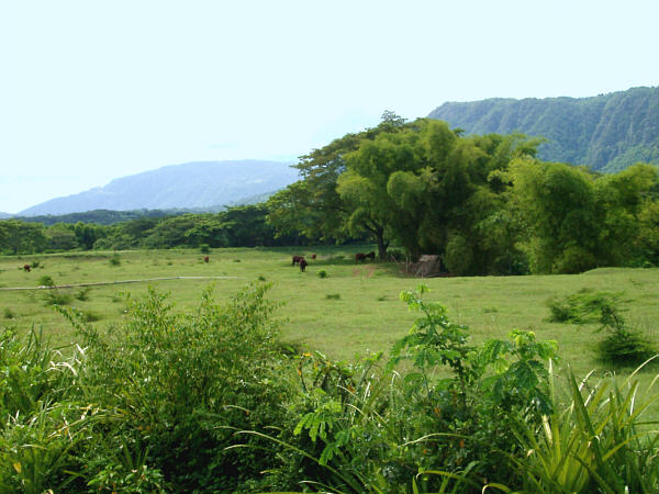
Countryside on the way to Guantanamo
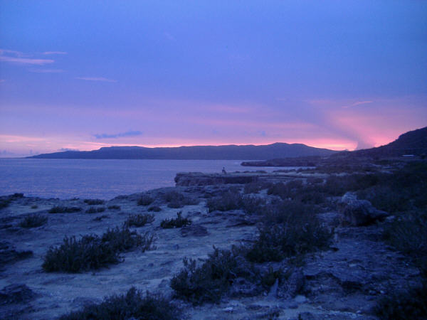
Sunset at my favorite campsite, TortugillaNext: The Eastern Tip§ Main § Section 1 § Section 2 § Section 3 § Section 4 § Section 5 § |