When one finds themselves at the small border towns at the frontier between Guyana and Brazil, there is really only one place to go next. Technically, there are two, since it is still possible to enter Brazil briefly and then turn north to enter Venezuela. However, as I mentioned in the previous post, visiting that country is significantly problematic for the time being. That leaves just one route heading south along the only road in that region of Brazil, which leads to Manaus, a former rubber-boom town and the only large city in Amazonia, nine hundred twenty-five kilometers from the border. Seeing that part of South America has long been of interest to me, but as the start of that section of the Tour approached, I was feeling less than enthusiastic, and a little apprehensive, about what lay ahead.
Brazil is one of the countries on the Tour route that I have bicycled through before, specifically for almost four months during the Tour of Gondwana, and it is the type of country that I generally enjoy. Its large size, with a variety of tropical-themed environments, melting-pot society, with a fairly laid-back attitude, and normally reasonable level of infrastructure, are all aspects that I find to be appealing. Additionally, at the present, another factor had a positive impact. Compared to my prior visit, the exchange rate between the US Dollar and the Real has significantly shifted in favor of those who hold the former currency, making Brazil seem considerably more affordable than it had been in recent years. Normally, I don’t obsess about such financial issues, but most of the first twelve countries of the Tour have been skewed towards the very expensive side, so I distinctly appreciated that change. I also find the food in Brazil to be typically satisfying, especially since the lunchtime barbecue buffet is the most commonly available food option, which can certainly fill up a hungry traveler. However, for that to work out, one must encounter such an establishment at the right place and the right time, and that fact was the primary source of my unease regarding the forthcoming section of the route.
The distance to Manaus was not particularly daunting, and the terrain had only a few rolling sections, with no significant climbing along the way. However, when examining the route I could see that there would be some rather long sections where the ability to obtain food along the way could be questionable, at best. Google Street View has essentially all of Brazil covered and using that service I was able to locate a few tiny rural restaurants or shops along the most isolated sections of the highway, though those were not always spaced out in a particularly advantageous way. Furthermore, I had already been burned more than once during the Tour, when some expected food establishment I had located with Google turned out to have been long-shuttered by the time I arrived. Such errors will likely only increase in the future, further demonstrating that an over-reliance on that type of technology should be avoided. I have ridden through many similar food deserts
on previous tours, and by now the experience has lost any appeal that it may once have had. In the end, however, most of the sources I had previously located were still there and, while what passed for meals on a few days was less than enjoyable, I didn’t starve. As it turned out, there were other factors, or events, that would contribute to this section occupying a rather low rank on my list of favorites.
The first few days of that section continued to pass through the same savanna biome I encountered in Guyana and the route first led me to Boa Vista, the capital of Roraima State. It is a mid-sized city that is shadeless and rather charmless, and a day off there was only useful for doing laundry. Two more days through the continuing savanna were nominally easy, but with the associated intense sunshine it did not really feel that way. On those days there were very small towns spaced out somewhat appropriately but, while restaurants were usually decent in that region, supermarkets and smaller stores were decidedly deficient, especially with regard to portable food and snacks. Consequently, I became salt-depleted in the afternoons of both of those days, and had to fight off cramps in the evenings. Because of that, I stopped early the next day, after only ninety minutes of riding, to recover and cool off in Rorainopolis, the last town for the next three days that had full-service lodging.
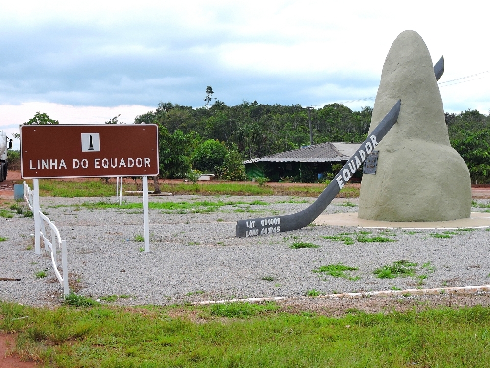
Following that respite, the Amazon forests began to dominate the land around the route and with that change came generally cloudy skies, which were very much appreciated. Close to the highway, however, much of the original forests had been removed many years ago. It is worthwhile to mention that most of those deforested lands do not appear today to be particularly thriving, economically speaking, with many abandoned structures and relatively little to show for the waste of the natural ecosystems. The only other site, or event, worth mentioning in that area was my third crossing by bicycle of the line of the Equator, the other two having been made in Kenya and Ecuador. As you might imagine, this is usually not all that exciting in reality, and I would have been happier if the apparent attempts made some years ago to turn the Line into a minor tourist destination, with a restaurant, had been successful, but that structure now also sat abandoned.
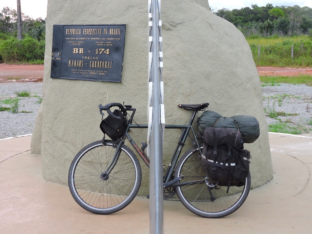
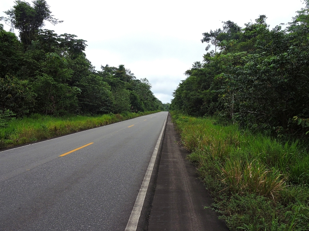
Further south, the highway leaves Roraima State and enters the state of Amazonas, but also passes through the territory of the Waimiri-Atroari people, which remains, except for the road itself, totally pristine. There was also another example of Google being somewhat out of date in this area. In both the satellite and Street View modes of Google Maps, the entire length of that particular highway appears shoulderless. By the time I arrived, however, shoulders had been added for all but forty or fifty kilometers of its length, though, in typically Brazilian fashion, they were sunken relative to the main lanes. In Roraima they were usually full width and often smooth, while in Amazonas they were generally narrow, a fact that caused me some trouble at one point.
In fact, the twenty-four hour period that began at midday on the day I entered Waimiri-Atroari territory may have been one of the least enjoyable days in my touring career, or at least it was in the bottom five, with a series of mishaps, or generally foul circumstances, of which I will only mention two. The territory in question extends around one hundred thirty kilometers from north to south along the path of the highway, and, while the Waimiri-Atroari people still live in the region, apart from numerous signs along the road extolling drivers to not run over the animals, there is essentially zero visible human presence in the area. Their society is, of course, actually there, but intentionally kept a certain distance from the highway. With many more kilometers to the north and south of their territory that are also sparsely occupied, there was more than one full day of riding that was certain to be completely without services.
In situations like those, I always plan on finding a nice, isolated spot during the middle of the day where I can relax and have a meal, albeit a rather basic one, and rest for a while. I had done just that, when the skies that had been pleasingly gray all day quickly darkened further. Rain in the Amazon is exactly as you would imagine it to be: transitioning from the first drops to full force in mere seconds, and completely living up to the terms cloudburst, downpour, deluge, and most other similar nouns. With such a quick start to the rain, and with precisely zero possibility of shelter within fifty kilometers, I simply laid there under my tree and let the shower fall. For a while it felt pleasant and refreshing, however, I knew from past experiences that storms in the tropics often don’t move the way they do in the temperate latitudes, but, rather, sit in essentially one place and continue to produce precipitation until they have exhausted themselves. In that region, the length of time this usually seemed to require was about two hours, and while the cool shower felt nice at first, by the end of that period, well, not so much. The next four days had similar storms but they started at seemingly random times during the day. Fortunately, for those other events I was already under cover, or would be able to rapidly get that way.
One benefit of storms in the tropics is that they significantly freshen the air, dropping the temperature by several degrees, and once the rain has finished cycling becomes a little more comfortable. That certainly happened in that case, and I had a relatively easy time completing the day’s planned distance. I had intended to camp for most of the nights during this section, but had not done so up to that point. One reason was that, near the end of each day, a very affordable indoor option was not far away and, as it turned out, it was probably very fortunate that I made use of those facilities. Another was that my three previous camping nights, in the Caribbean, were decidedly miserable thanks to sweltering heat and mosquitoes, and those experiences had slightly soured my desire to do that again for a while. However, in this case I had had no choice, so as sunset neared I located a suitable spot for the night. At first, all seemed well. The temperature was pleasant, I had partially dried out, and I was hopeful that restful sleep would ensue.
After about an hour I felt a large ant crawling over my arm and didn’t think much about it as I brushed it off. A short while later, there was another. When I investigated, I discovered that many of their kind were moving about on the outside of my tent and some were finding their way inside through a hole in the netting that was about three fingers wide. I thought, I wonder how I did that?,
attempted to close up the hole as best I could, then tried again to fall a sleep. Not long after that, I began to notice ants inside again and, assuming that I hadn’t sealed the hole completely, I took another look. That time I was shocked to see six more large holes in the same area, and an increasing number of ants gathering outside. These were Leaf-Cutter Ants, and they were either cutting through the tent netting just to get inside, or they thought is was a large leaf (it is green) and were taking chunks of it away to feed to their fungus garden. Either way, I couldn’t let that continue. To make matters worse, while the initial intruders were fairly harmless, mostly declining to bite, the later-arriving members of the colony, possibly emboldened by their now-superior numbers, did not seem to be so accommodating.
I normally keep a level head in most situations, but I confess that I came close to panicking at that point in time. Though I was unsure exactly what to do, there was really only one option, considering the possibility that my entire tent might be gone by morning. I had to go outside, gather up everything in the dark, while brushing off all the ants on my legs, and move somewhere else, being careful not to leave anything behind. For Plan B, I remembered that there was a large area of smooth rocks between that spot and the road without much organic material on it. I hoped I might be able to sleep out in the open there, and be relatively unmolested. For a while that seemed to work, but before long a few ants appeared. Unwilling to wait for the entire colony to arrive again, the only possibility left at that time was to load up the bike once more and walk along the highway.
It was ten in the evening at that point, and road traffic had mostly ceased for the night, so I soon realized that it would actually be better to be riding. With a full Moon rising, and my headlight, it was easy to do so, but I still felt a little uneasy. There are jaguars in that region, and when I was in Guyana a man said that several years ago a cyclist was eaten, presumably by a big cat, on that same highway. I discounted the tale as probable hysteria at the time, but I admit that this story was on my mind as I rolled along, keeping to the center of the road to maximize my distance from the forest.
Fortunately, it was only about five kilometers to the large reservoir that is the southern boundary of the Waimiri-Atroari lands, and after that there was a slightly increased human presence that made wildlife encounters less likely. A little farther ahead was a truck weighing and inspection station, and I hoped that I could find a semi-comfortable place to sit there until morning. The station seemed to only be partially active, but the night watchman indicated that if I wanted a place to sleep, I could use the wide, elevated, stone porch of the adjacent building, which was empty at the time. Sleep was only minimal under the circumstances, but the location was fairly cool, mostly quiet, and, best of all, there were no ants. I have camped out several hundred times while on tour, including many nights in the tropics, and though there have occasionally been some troubles with insects, I can never remember any occurrence quite as disturbing as the one I had that night.
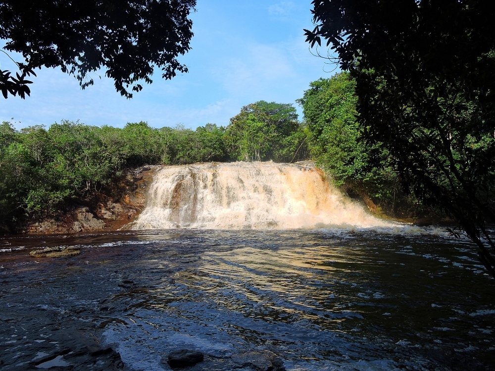
At least the next day would be a relatively short ninety-five kilometer ride, since the only significant town in the southern section of the route, Presidente Figueiredo, was ahead and I planned on taking a day for birding around one of the hotels that are located in the forest close to Iracema Falls, just to the north of town. Of course, that day was when the cursed twenty-four hour period came to an end, but not before the poor road shoulder design mentioned above caused me to become skuffed and sore. The birding there was productive, and given all the trouble of the previous day, I decided to linger a little the next morning and then move just the short distance to the town for a little more rest in a cool indoor room. Combined with the earlier delay, that left me two days behind schedule.
The final portion of that section was one full day to the state capital city of Manaus. I had been looking forward to seeing Manaus, as I thought that it might be a funky jungle city like Iquitos, Peru, which I saw on my last Tour, had been. Ultimately, I was disappointed in that regard and it didn’t take long to come to that conclusion. Manaus is the largest city in Amazonia, by far, with a population nearing three million inhabitants. The city center, where I needed to be, is at the southern side of the city, on the banks of the Rio Negro, and, since I was approaching from the north, I would need to make my way through its entire extent. I had previously spent a considerable amount of time scouring Street View to find a decent cycling route that I could use, and came up completely empty. Since there is no rail service in the city, and the busses don’t have bike racks, I had already decided before the day began that I would have to ride to the edge of the city and then take a taxi to the Centro. That day’s rainstorm came in the afternoon, and after waiting that out it was close to sunset when I approached the sprawling urbanization. As luck would have it, taxis were nowhere to be found, possibly because it was a Sunday evening. That caused me to ride farther into the city than I might have liked, on roads that were totally unfriendly. After a while, I noticed that the airport was not far from my route, so I diverted there, riding along roads that were even more unfriendly, eventually locating a taxi at the arrivals terminal that could take me the rest of the way. That ended up being a good decision, because the remainder of the route looked horrendous.
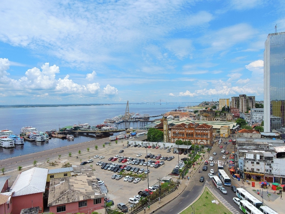
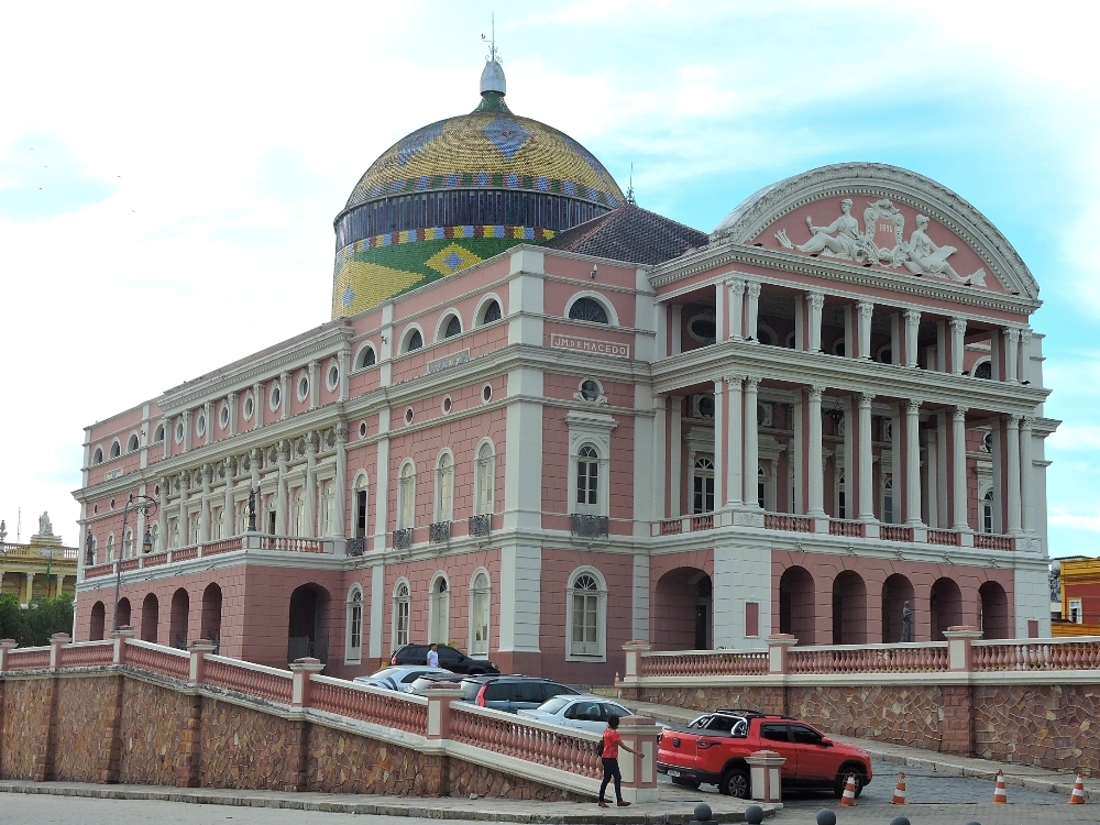
In fact, Manaus is now a strong contender for the title of the most unpleasant city of my touring history. Actually, Dhaka is judged on a separate scale from all the others, and will likely never be displaced from that title, but Manaus has come close. The city has almost no redeeming factors, perhaps excepting its role as the major river port of the Amazon. It appears as if it exploded in scale around the 1950s, and now, after seventy years worth of tropical decay, everything built during that time is now an eyesore. Originally, the city was a boom town during the rubber era of the late nineteenth century and there are a few relic buildings from that time period that still exist. However, while they were architecturally interesting when new, many of them have not been well preserved, with some now being covered with graffiti. The city’s one famous landmark, the Teatro Amazonas, built in 1896, is quite attractive, but on its own is not enough to lift the profile of the city.
I don’t want to sound too disparaging about this section overall, since every region has its good points, and some of the negative aspects of this section were magnified by being coincident with other problems. However, there was a noticeable feeling of relief when this one was behind me.