Part Three:
The Southwest and Toliara
April 13
Back on Solid Ground, Bound for Toliara
- or -
Perhaps the Boats Weren't So Bad After All
To avoid being spotted in a place where I probably shouldn't have been, I awoke as early as possible after a reasonably restful night's sleep. It was just starting to get light, nevertheless, there were already people out and about on the road. My head was filled with cobwebs after the exhausting events of the previous day, and my plan was to ride back into Ambahikily for some food and a chance to sit and wake up a little more completely. There was not very much that looked appealing in the only Tiko store open at that time, so it was another meal of cookies and cola. It was a bit of a struggle for me to finish enough of the now-tiresome fare, but I knew that I needed a lot of energy so I cleaned my plate, so to speak. The little jolt I received from the caffeine was appreciated as well. I sat for a while and slowly regained my faculties and then checked over my gear for the ride to Toliara.
There were about 250 kilometers between Ambahikily and Toliara, all on R.N. 9. If I had been able to stick to my earlier plan, I would have ridden this distance in two days. But now, with my newfound commitment to not push myself too hard, I was willing to take as long as necessary. Still, back in Belo, Hanta had told me that R.N. 9 was an "excellent road for bicycles", and though I didn't really accept this as fact, I thought that I could reasonably expect to cover 90 kilometers on each of the next two days. That would leave me a short distance to Toliara that I could do early in the following day, to leave nearly a full rest day there. With that in mind, I set off along R.N. 9 that initially lead to the southeast.
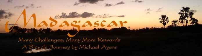
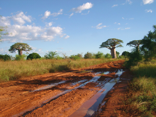
My map showed a paved road for about the first twenty kilometers out of Ambahikily, and I was looking forward to a bit of comfortable riding, if only briefly. In any case it felt great to be up on the bike again, and to be back in control of my own traveling destiny once more after the layoff caused by the five previous days on the sea. For a while, the road was indeed fairly easy riding, though a little damp. Before too long, however, the number of rough potholes began to increase, and eventually the surface had degraded to such a state that I would not really refer to it as a paved road. Compared to other surfaces that I had already experienced, this section of road was not all that bad, even when the so-called pavement ended and the official dirt section began. There were many large, deep puddles, often taking up the entire width of the road, that needed to be ridden around and this slowed me down a little. These would be familiar sights for the rest of the trip, and I imagined that they were essentially permanent features, after being enlarged little by little with each passing truck. The terrain from here as far as Toliara was generally flat with only a few gentle changes in elevation along the way. The lack of interesting vistas, and the need to concentrate on avoiding road hazards, was largely made up for by the existence of several impressive groves of baobabs in this area.
The pavement on R.N. 9 wasn't in great condition, but the baobabs were a nice distraction.
In spite of some quite slow riding, I seemed to be making good progress, and it was still fairly early when I stopped for a quick rest break a spot on the map that I believe was called Talatvalo. There I bought some bananas, which were a nice change of pace, and another bottle of soda. The latter, much to my surprise, was served cold, the first such drink I had had since Morondava. Most beverages are provided at ambient temperature, whatever that may be, due to the understandable difficulty and expense of maintaining refrigeration equipment in the countryside. In many cases, when cold drinks were available, they were sold at a slightly higher price to cover the extra cost. In this case, I took my snack and sat under a shady tree and enjoyed it there, felling a little more rejuvenated.
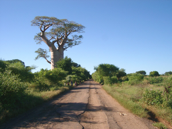
Continuing on, the road conditions remained reasonable for a while, though the number of large puddles and muddy sections was beginning to increase. This did not surprise me much, as all morning the road had closely paralleled the swampy course of the Mangoky River. The map showed that after several more kilometers, the road would take a turn towards due south, leaving the river behind. I assumed that as I traveled further into the supposedly dry interior the road would dry out again. In reality, the change of direction was so subtle that I did not realize it until well after it had already occurred. Adding to the confusion was a disturbing fact that, for some reason, the amount of water in the road was actually going up. At first there were just the usual big puddles to walk or, if I was lucky, ride around.
Three Baobabs along the now-dirt R.N. 9.
However, before much longer, I encountered several significantly more difficult sections of mud. In many places on the island, the dirt roads have been worn down below the level of the surrounding land by decades of use by trucks, busses and zebu. This has formed a sort of catchment basin where water collects during the wet seasons. Trucks, and others, still attempt to pass though, however, and each time they do, the road literally sinks into worse condition. Often people walking or cycling have created parallel paths around the worst mud holes, which, though treacherous in their own right due to the many thorny plants close by, provided a slower, but cleaner, way through the area. In this case, the thick bush, which grew right up to the road's edge, without leaving the slightest space to walk by, forced travelers to brave the mud. These places seemed to be up to fifty meters long, and there were many of them strung along the roadway. I had no choice but to slog along through, trying to keep the bike and gear as clean as possible.
There was not much chance of that happening, however, and as I pulled it through, the sticky mud clung on in giant clots. My bike had been performing admirably across the rough conditions that I had encountered so far, but I learned there that it has a bit of a problem shedding mud due to some tight clearances. Consequently, after making it through each of these obstacles, I had to spend several minutes picking off the worst of the detritus with a stick or some other object. This was not all bad, as it forced me to rest a little each time. The day was warming up, and pulling the heavy load through the mud was really wearing me out. Add that to my overall lack of food for the previous days, and my progress was slowing down considerably. To make matters worse, my general tiredness made it harder to avoid scraping into my legs with the bike's sharp parts as I tried to carry it though places that it really didnt want to go. As a result, I was frequently enlarging the already large wounds on my lower legs. It was now well into the early afternoon, and it felt like it was taking an hour, or more, to cover each kilometer. Fortunately, I had enough water with me that I was not in any danger of dehydration. Hunger was another matter, though.
Eventually, after slogging through a particularly wet series of holes, I was surprised to see a river ahead that I would need to walk across. I did not see any rivers on the map in the area where I thought I was at the time. As it turned out this was the Befandriana River, a small, shallow course that was destined to disappear into the dry earth before reaching the sea. I was pleased to realize this, as it meant that the only town along the route that looked to be large enough to find food, Befandriana, was only a couple of kilometers away. It was now about 2:30 P.M., and I had traveled about 75 kilometers so far, though it felt like much more. As I looked at the river, which did not appear to be more than 45-50 centimeters deep, I decided to take my gear across in three trips. My only reason for doing this was to allow me to spend more time in the cool, refreshing water.
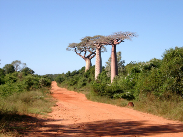
Befandriana was a hot, dusty town with a few buildings scattered along the roadside. It appeared to be a waypoint for the taxi-brousse and trucks travelling along the route to Toliara. As such, there was not much there in the way of supplies. I did wander into an interesting-looking hotely called, a little surprisingly, Hotel California. It was fairly standard looking, with rustic wooden tables placed about the large dining area, but distinct due to its cartoonish murals on the walls depicting smiling, white Americans (presumably) frolicking on the beach. There was no one there, except for the hostess, who was asleep on the floor when I came in. She didn't seem to mind being woken up to serve me, and in a few minutes brought me a nice bowl of vary with meat, and several pitchers of water. This was only the second serving of cooked food that I had eaten over the past four days, and it certainly hit the spot.
Living it up at the Hotely California (in Befandriana).
Since it was already late in the afternoon when I had finished my meal, I did not waste much time hanging around Befandriana. Looking at the map, the next day would be much easier if I could cover another twenty to thirty kilometers before dark. As I didn't know whether the roadway would be as bad as it had been so far that day, I wanted to get moving a soon as possible. It was my great pleasure to discover that the section of R.N. 9 immediately south of Befandriana was dry and fairly smooth. There were still some wet spots, but the puddles were much smaller and could easily be ridden around. I was never really sure whether it was best to go around them to the right or the left, and the answer was, not surprisingly, different in each case. For a while, I rode along with a young pair of cyclists and I assumed that by following them I could learn the best course around the water holes. Presumably they had much more experience with this road than I did, since it was my first trip here. However, they seemed to prefer it if I led the way, always slowing down to force me pass them. This time, I suppose, I would have to be the guide.
Nevertheless, I made rapid progress, riding faster than I had for a long while and having a really good time. As dusk approached, I had made it to the vicinity of Antanimieva, just about where I had hoped to be. It was a long, tiring day but I was very happy to be on the move again, and was looking forward to a more restful break in Toliara very soon. Shortly, I found a nice spot to bed down in the bush, and took a very restful sleep.
Ambahikily to Antanimieva
Distance: 95 km
Weather: Sunny, Maximum Temp: 32 C
Terrain: flat
Roads Traveled: Route National 9 (rough pavement, then dirt)
April 14
Slowly Moving South
- or -
For a Desert, This Place is Awfully Wet
Compared to the past couple of weeks, this day turned out to be relatively uneventful. I still had a ways to go to Toliara, but there did not appear to be any great obstacles on the way according to the map. As well, I would encounter an increasing number of small towns and villages as the road moved south. I, rather naively, hoped that as I approached the fairly large city of Toliara, that the road would gradually become better in quality. Still, I was expecting that this day, at least, would be rather tough. Indeed, as the morning portion of the ride began, the roadway possessed a few more wet and soft spots than the previous evening, but nothing to slow things down too much.
R.N. 9 was often wet and muddy.
It was still fairly early in the day when I rolled into Analmisampy, about 38 kilometers from where I started, and the first place that was large enough to have food available. I sat down in a simple hotely and had a nice bowl of vary. I was planning on trying to catch up on my food intake during the day and this seemed like a good way to start. I also had to spend some time fiddling with my camera, which had decided that it was not interested in taking pictures that morning. It seems a little piece of grit found its way into the lens mechanism that was not welcome there. Somehow, without me doing anything in particular, it started to work again, which was a relief, as I didn't want that sort of headache at this point in the trip.
A rather unfortunate fact of travelling in this area, and one of the only things that I didn't really like about Madagascar, was the constant presence, in the lowlands at least, of swarms of incredibly annoying flies that refused to let one rest in peace. These are the same flies that one sees crawling over the faces of African famine victims in all of those sad pictures. As I found out, they will go after just about anything, however, including food set out for sale in the markets, and, especially, the open wounds of visiting bicycle tourists. The local Malagasy people, having spent their whole lives coexisting with these pesky insects seemed quite indifferent about their presence, but they absolutely drove me bonkers. I could stop to rest in a town, or in the bush, and expect five or ten minutes of peace before they found me. After that, I either spent all of my energy swatting them away, or got up and moved on. They southwest part of the island seemed to be especially infested, and I could not sit here for very long. Perhaps this was a good thing overall, as it did keep me moving, and more on track. So, after this short stop I continued south, along the way observing cotton fields, numerous tiny villages and the ever-present herds of zebu that often shared my thoroughfare. There were still wet spots along the way, and the plants and bushes that lined the road were becoming more viciously thorn-covered as I neared the southern end of the island, known as the "Spiny Desert". Thus, the traveling was not getting much easier as I neared Toliara, as I had hoped, but I was still making progress.
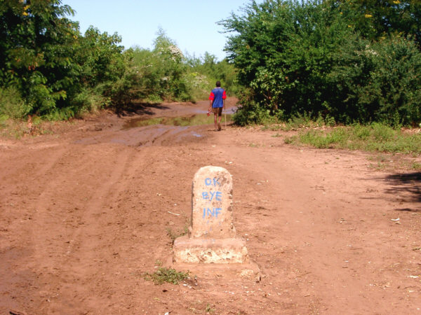
The sign leaving Analamisampy says "OK Bye!".
Later in the afternoon, I made another food stop, this time in the town of Ankaraobato. This town was a little more bustling than those to the north, with several hotelys and a sizable market. I enjoyed another meal of vary and, for the first time in several days, actually felt too full to eat much more. Nevertheless, I purchased a small watermelon at the market for an evening snack, and in the process was mobbed by dozens of friendly young people who wanted to get a peek at the strange-looking vhazaha. Melons throughout Madagascar, not just the one I bought in Andranopasy, were generally not very tasty. Most seemed to have more seeds than fruit, and were often sold before there were ripe. Of course, this could have been the wrong time of year for that particular crop.
It was now early evening, and as I moved on, I began to look for a place to stop. I was close to where I had expected to be, though if I had been able, I would have tried to get a little closer to Toliara. Darkness was approaching, however, and as I looked for a campsite, I experienced a bit of difficulty in finding an appropriate location for the first time on the tour. In this case, there were a series of small villages spread along several kilometers of roadway. They were close enough together that they almost merged into one long settlement, making it hard to find an isolated place to sleep. After crossing the Manombo River just before the village of Tsianisiha, I notice on the map that there would be even larger towns ahead, so I walked off the road along a sandy footpath. There were many people around, and I was worried that I would attract a lot of attention if someone saw me setting things up. After a little while, I spotted a low ditch that was separated from the path by some thick bushes. I decided to bed down there, and was fairly comfortable, though I could frequently hear people walking by only a few meters away.
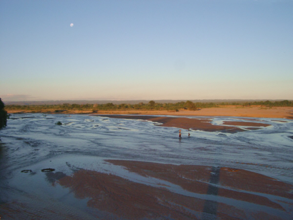
Evening at the Manombo River.
Shortly thereafter, as I was waiting to fall asleep, I realize where everyone had been going. Somewhere in the vicinity, there was a gathering of local folks where traditional music was being played for the people's enjoyment. Malagasy music of this area usually involves a lot of percussion, as well as various types of plucked string instruments. Harmonic vocals are also common to the area, but on this occasion I only heard instrumental pieces. The songs were long and rhythmic, and I imagined that people were dancing along with the concert, which began at sundown and gradually tapered off near midnight. I gave serious consideration to getting up and trying to find out where this was happening so I could listen in. After thinking it over, I decided to stay put, however. Mostly this was due to feeling very tired, but I also had terrifying fears of what might happen if the Malagasy musicians had somehow insisted that the visiting vhazaha join in the fun and embarrass himself by dancing.
Antanimieva to Tsianisiha
Distance: 89 km
Weather: Sunny, Maximum Temp: 32 C
Terrain: flat
Roads Traveled: Route National 9 (dirt)
April 15
The Stretch Run to Toliara
- or -
Nothing is Ever Easy on the Island
Wen morning arrived I was once again up early to vacate my tenuous quarters in the bushes and to get a good start on the short ride to Toliara. There were 58 kilometers to go, and if the conditions were good, I would arrive while they were still serving breakfast. If they were not good, it could take all day. So, it was best not to delay my start. Besides, the thought of the first shower that I would be able to have for almost two weeks was quite an incentive. Rolling along, the first part of the ride was not too tough, though there was more water and several cases where the road was in really bad shape while passing though the small villages. I stopped only briefly in one of these to get some breakfast.
According to the map, after about 16 kilometers the road would hit the coast, which it would then follow all the way to Toliara. It seemed that I had been riding forever, with no sign of the ocean, but then I realized that I had been traveling parallel to the beach for quiet a while, though my view was blocked by a range of low hills. It was a nice surprise to realize that I was further along than I had realized, but what I met next was most certainly an unwelcome surprise. Actually, it should not have come as a surprise at all, as I was very close to the beach, when the road surface suddenly became deep, soft sand. Sand would be my major nemesis on this trip and this was the worst patch of it since I had to turn back at Belo. There was no way to ride through this section at all, and as I had no choice but to go forward, that meant walking. I discovered then that nothing tires me out faster than pushing a loaded bike through soft sand.
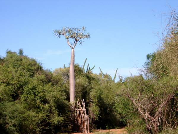
An odd-looking plant in the Spiny Desert near Itafy.
Tere were a few sections where it seemed hard enough to ride over, but these were discouragingly few and far between. It seemed that I would not make breakfast in Toliara after all. Eventually, I made it into Ifaty, the only settlement on this part of the coast. Ifaty was where most of the western-style resort hotels of the Toliara region were located, and so I had assumed that the road between these two towns would be of good quality. Instead, it was more sand, and while walking along I was forced off to the side a few times by "normal" tourists who were being taken to their hotels in luxury off-road vehicles. Since I would not make it to Toliara for a while I took the opportunity to stop for a refreshing drink and a short rest.
Continuing south, there were a few places that I could ride, but it seemed that most of the way continued to be covered with sand. After a while, the ocean became visible and as I looked down at the shoreline, I wondered if I might be better of riding along the beach, which seemed to be a harder surface. I discounted that idea as a good way to get completely lost, however. It was still fairly early and though I had not seen any indication of the distance left to Toliara for a while, I felt that It should not be too much farther. I was probably incorrect in that assessment, as if I was forced to continue walking it could take quite a long time to get there.
Just then, I caught another view of the beach and there was a man cycling along in the same direction that I was traveling. We shouted and waved for me to come down to the beach, indicating that it was, after all, the easiest place to ride. I took his advice, and moments later was moving along again at a reasonable speed. I followed him for quite a while, though, once again, his lack of gear and familiarity with the course made him tough to keep up with. We rode along the beach, usually fairly easily, for perhaps an hour before turning slightly inland along a narrow path through the grass. I probably would not have known to go this way were I on my own. Shortly thereafter, we emerged back on the main road, which was lined with several buildings. I assume that this was the edge of Toliara, but it was merely a small town about eight kilometers from the city. So, I decided to take a break here and shared an orange soda with the fellow who helped lead the way.
The remaining kilometers to Toliara were over a fairly smooth cement road, and with the wind at my back, it was fast and easy to travel the final distance. As we entered the city, the fellow that I had been following pointed the direction that I should go to reach my destination, the bungalows of Chez Alain. As with most cities on the island, it was not easy to navigate through the streets, which were typically crowded and unmarked. Eventually, I found what I was looking for and checked in, relieved to have a chance to rest and recover a little. In fact in the morning, while I was dragging the bike through the sand, I decided on a longer stay here. I was originally planned for one full day in Toliara, but now I would stay the rest of this day, plus two more. I felt that I deserved a nice break.
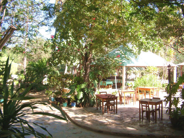
The courtyard at Chez Alain in Toliara was a pleasing change of pace.
Chez Alain was a pleasant place to stay, set back from the road a ways, with small individual bungalows scattered through the pretty gardens. There was a good restaurant there as well. The rate was about $22 per night for a bungalow with a private bath that was quite comfortable though the walls were very thin, which let in a lot of noise from the surrounding area. It was about 1:30 P.M. when I arrived and my plan for the rest of the day was to clean myself up, take a short walk around town, have a nice meal in the restaurant, and retire early. The dinner at the bungalows was notable for being my first non-rice meal since Morondava.
Tsianisiha to Toliara
Distance: 58 km
Weather: Sunny, Maximum Temp: 32 C
Terrain: flat
Roads Traveled: Route National 9 (dirt with difficult sections of sand)
March 16 & 17
Rest Days in Toliara
- or -
Eat, Sleep, Heal; Eat, Sleep, Heal
I quite enjoyed my short stay in the city of Toliara, on the southwest coast of the island. My preconceptions, based on the reading I had done at home, were significantly incorrect. I was expecting a "frontier" town, isolated and left out of the mainstream of urban Malagasy life (as if any places on the island could actually be referred to as "mainstream".) In fact, my original description would more appropriately have fit Morondava, or, later on, Fort-Dauphin, among other towns. Toliara had a friendly, somewhat cosmopolitan feel that took me a little by surprise. The residents were uniformly cheerful (with the possible exception of the somewhat pushy pousse-pousse men,) and though they noticed me and often shouted out a greeting to the scruffy vhazaha, I was not mobbed by crowds of curious locals as I had so often been during the previous weeks. This allowed me to relax a little more completely and enjoy my strolls around town. The town itself was more substantial than any place I had been since Tana, with many modern-style buildings in the city center. The town's market was also interesting, and a lot easier to navigate than most others. In many other places, the markets were crammed into one or two city blocks, making it challenging simply to walk through them. Here, the market lined both sides of several downtown streets and it was easy to walk along and look at all the stalls selling fabric, clothes, bike parts, food, and so on, and most of all observe the interesting citizens out and about. There were also indoor shops, of the type familiar to westerners, in the city center selling housewares, hardware, and even jewelry. Most of the activity, however, was out in the more informal city which was not too large to comfortably walk around.
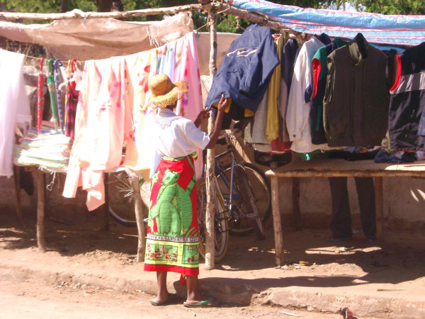
A woman wearing a lemur-print skirt shops at the Toliara market.
On Wednesday, my first full day in town, I had only three things that I wanted to accomplish; clean up the bike, find a bank to exchange some money, and find someplace to read and send e-mail. I was in no big hurry to get started on this list, which was a good thing, because when I awoke, at the leisurely hour of 8:00 A.M., it was raining rather hard. I thought that if it was going to rain that this seemed like the best time to do it, as opposed to a few days earlier, or later, when I would have been out riding across the dirt. In any case, I decided to accept a little free help, and wheeled the bike out under an eave of the bungalow, to receive a little free washing from the water streaming off the roof. In the meantime, I went back inside and crashed for a while. The efforts of the previous days were still lingering, and I felt a little drained, Additionally, I noticed that the sores on my legs, from my numerous run-ins with the bike's sharp parts, were now becoming infected. This was not very surprising, as I had heard that skin infections were common on the island, and with my propensity for walking across rivers and spending all day riding along while being splattered with zebu dung, there was no way that I could imagine preventing this occurrence. The effect of this problem was not particularly severe. It was a little painful to walk immediately after standing up, but this went away after a few steps. As far a looks were concerned, well that was another matter entirely, but I could live with that. Nevertheless, no infection should be taken lightly, and I did my best to keep the wounds clean to help promote healing, and to watch out for any signs of spreading or secondary problems. As it were, the issue remained unchanged, more or less, for the rest of the tour, not healing completely until after I had returned home.
After a while the rain stopped and I finished the job of removing several days worth of mud from the bike. It was about 11:00, and the now-shining Sun, was drying the place up, and consequently increasing the humidity on this rather warm day. So, I slowly rambled into town to complete my other two tasks. I still had a good bit of Francs but I wanted more to cover the next couple of weeks, at least. My first attempt at an exchange didn't work out. The Bank of Africa would not accept $100.00 US bills for exchange, which posed quite a problem, since that was the only denomination that I had brought along. I had slightly more luck at Credit Lyonnais, which would make the trade, but had to verify the bills first using some sort of optical scanner. This rather temperamental machine rejected all but two of the eight bills that I tried to swap. I had wanted to exchange three, but decided to settle for less for the time being. These two banks were the most common throughout the island, and I hoped that I would have more success in other cities later on.
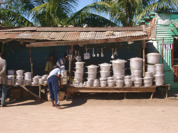
Cookware of all sizes is availabe in the market.
Next, I set out to get on the 'Net to check in with the rest of the world. There was only one place that I could find to do this, at a Net Café about one block from the city center. It turned out to not be the best of times to accomplish this task. The recent storm had affected the satellite link to the rest of the island, and the bandwidth available at the time was painstakingly slow. In fact, it took me about two and a half hours to read and briefly reply to eight messages. I also had a little difficulty adjusting to the Euro-style keyboards, which swapped a few letters around from the familiar qwerty pattern. The fee was a little higher here than elsewhere on the island as well, costing me about $15.00 for the session. But, it was nice to tell everyone that I was still alive and (fairly) well. With these jobs taken care of, I spent the remainder of the day simply relaxing and making an effort to eat as much as possible.
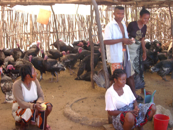
Turkeys and all sorts of other food could be obtained at the market.
The following day I had no specific plans. There was supposedly some nice places nearby to go snorkeling, but the clerk at the hotel said that the guides were not operating at this time of the year. I was not really up for that activity in any case, so I simply spent most of the day strolling about town and, of course, eating. The weather was pleasant and I was not in a rush to do anything, so this was a nice, relaxing time. One thing that I did discover was a way to rid myself of the increasingly bushy growth of hair on my cheeks. I had tried to bring a simple hand-powered clipper along for that purpose, but it just wasn't working at all. However, the Malagasy seemed to be quite concerned with having a nice coif, and in most large towns there were many basic places to get one's hair taken care of. These were usually small wooden huts that contained one or two barber-style chairs, a mirror, and enough cutting equipment to get the job done. I found one of these, and in a few moments got myself clean shaven for a charge of about $0.50.
I also spent considerable time that day debating with myself about what my next move should be. Toliara was one of the few places where a choice of subsequent routes actually existed, and I wanted to consider all the possibilities. There were essentially three choices. The first was the easiest, and also the shortest (884 km), way. This would involve following R.N. 7, which was an excellent paved road (except for two short rough sections) that ran from Toliara all the way back to Tana. This would allow me to visit the southern highlands, and Andringitra and Ranomafana National Parks, all of which were on my list of places to see. However, if I went that way, I would miss the heart of the Spiny Desert, Andohahela National Park, and the southeast coast, which I was also very excited to see. The second option would be to follow my original plan. Specifically, to cross the southern tip of the island to Fort-Dauphin, turn north and ride up the east coast for a while, then head inland toward the southern highlands and, eventually, Tana. This would hit all of the places that were on my list of highlights for the southern portion of the tour. However, it was the longest route (1816 km), and involved traveling along the notoriously bad road between Toliara and Fort-Dauphin. If I went this way I would also probably have to miss some areas I wanted to visit later during the northern part of the tour, due to time constraints. The final possibility would be to travel part of the way to Fort-Dauphin, then turn north, following another poor road, which met up with R.N. 7 at the lower end of the highlands. This was the least desirable option. Though it was shorter than going all the way to Fort-Dauphin (1462 km), it missed many of the sights I wanted to see and it still had the longest distance to ride over poor roads. So, it was a choice between the first two options, and I weight the pros and cons back and forth repeatedly, hoping to find some overlooked factor that would make the decision easier.
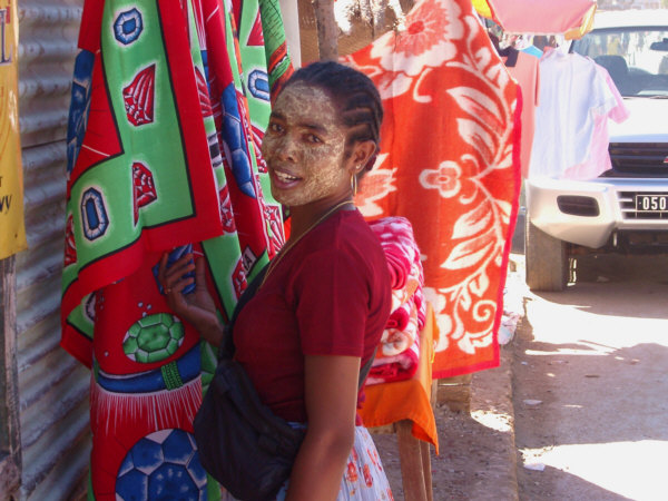
Many women in the Southwest wear this distinctive style of facial makeup.
In the evening, I set aside all the planning, and went out to find a nice dinner. I came upon a nice, and apparently new, restaurant at the corner of Boulevard Campan and Rue de L'Ecole Menagerie called Zanzibar where I had one of the finest meals of the trip. I filled up on soup, salad, a brick-oven pizza, desert and a beverage for about $12.00. Everything was delicious and afterwards the barman brought me a complimentary shot of brandy. While I was waiting for the food to arrive, one of the waiters came by and started asking me about my trip. He spoke clear French, and we could converse a little, at least. He asked where I was heading next, and I said that I would probably go to Fort-Dauphin. His response, that he believed that Fort-Dauphin was a much nicer place than Toliara, gave me more of an inclination to go that way. However, eventually he found out that I was travelling by bicycle, and then he obviously started trying to tell me something important about the route. Of course, at this point, with the speed at which he was speaking, my ability to understand his French completely disappeared. I was able to pick out the word "Beloha", which I recognized as the name of a town mid-way along the route. But what was he trying to tell me about it? Was he saying "Once you get to Beloha, it's all downhill from there!" or, "You'll never make it as far as Beloha!"? Considering the variable quality of the information I had received on road conditions to date, I didn't make too much of an effort to decipher this part of the conversation. Instead, I enjoyed my dinner, put off making a final route decision until the morning, and then went back to the bungalow and turned in early to get another good night's sleep.
Next: Did I Really Want To Go This Way?...
~Go There~