
Stage 5: The Home Stretch
After all, it has come to this
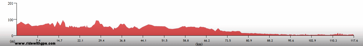
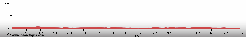
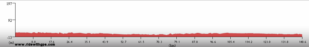
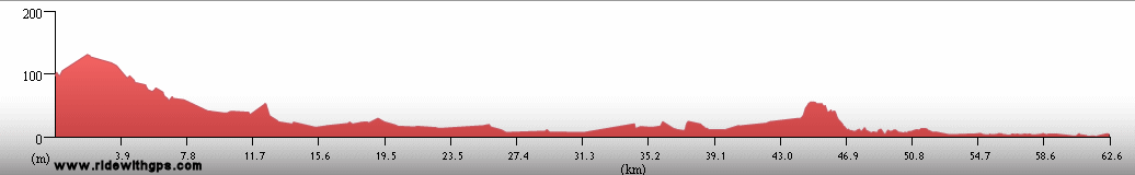
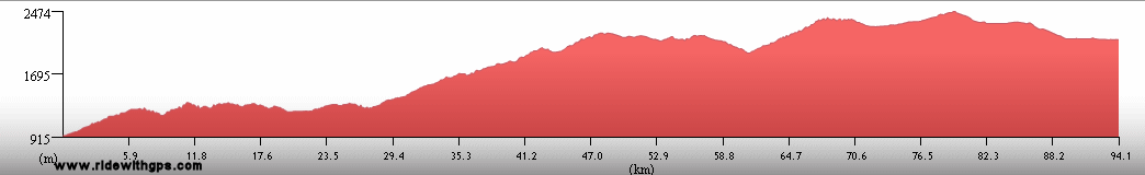
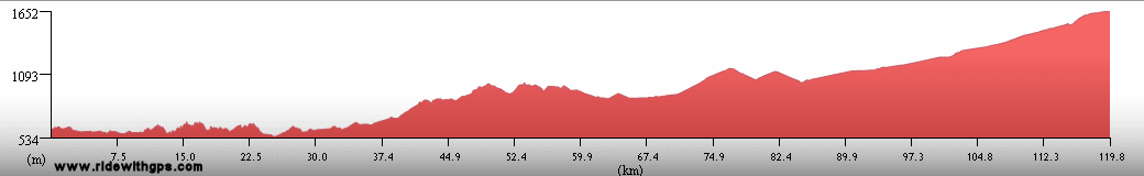
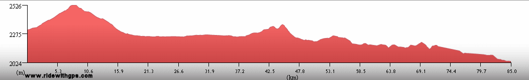
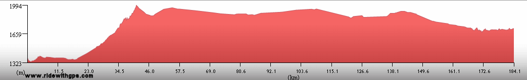
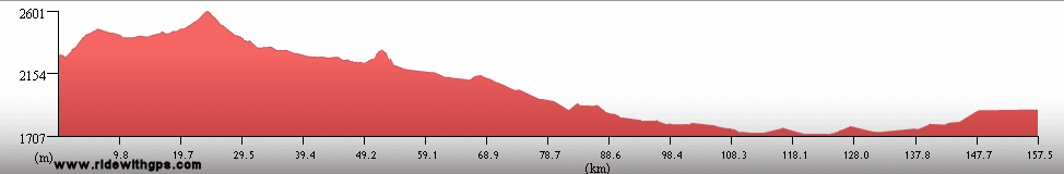
Stage 5 Actual Route

On this, and all other route maps, the blue lines represent travel by ship, red by airplane (Booo!), and green by bicycle.
Belize: No Entiendo Inglés!
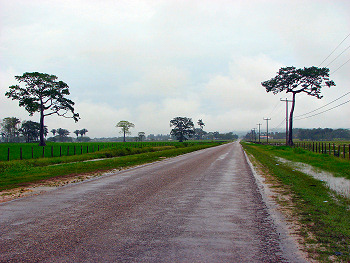
Belize, though being a very small country, was certainly a unique part of the Stage 5 route. The main reason for that being its status as the only English-speaking country in the region. After traveling through Latin America for over a year, that fact definitely made life easier for me. With the addition of some nice attractions in a small area, I had high hopes for my stay. However, while I certainly enjoyed the country, I was not really able to make the most of it due to the lingering presence of a schizophrenic tropical storm. Despite some less than ideal conditions, I entered the country at its western border, rode to the largest town, and former capital, Belize City, and then continued north to the border with Mexico. The primary attraction that I was able to work in was some nice diving at the Belize Barrier Reef
Tropical Storm Arthur soaks Belize
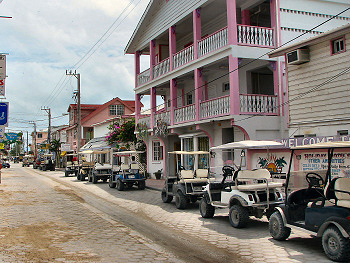
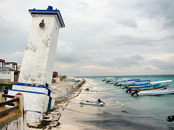
The island town of San Pedro
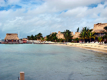
Beach at San Pedro
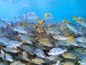
A school of fish at the Belize Barrier Reef
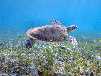
A Sea Turtle at the Belize Barrier Reef
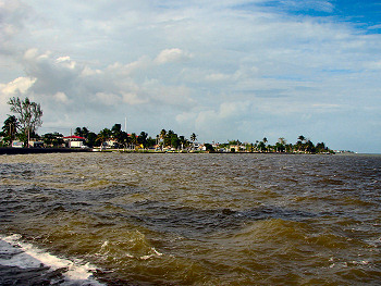
Corozal on the Caribbean Coast
Mexico: Such a Way to Go
Mexico is another country that contained such a large number of amazing destinations that trying to see them all proved to be a tough task. I did my best to do that, though the approaching end of the Tour, with the practical concerns that entailed, made doing so even more challenging. The sites that interested me the most were generally in the southern part of the country, so most of my time was spent there. I entered near Chetumal, and made an interesting, though occasionally problematic, circuit around the edges of the Yucatan Peninsula. In that area were some outstanding places of interest, the most important of which were the five separate Mayan ruins sites I was able to visit. Among those, Chitzen Itza, Uxmal, and Edzna were the most impressive examples. Also in that area were the historic towns of Merida and Izamal, and the threadbare little village of Puerto Chicxulub, the site of an ancient planetary impact, though no visible evidence of that disaster can be seen today. Continuing on I passed through the historic port town of Campeche, before turning west, towards the Pacific coast. The final attraction in that region was the final Mayan site I was able to see, the intriguing ruins at Palenque.
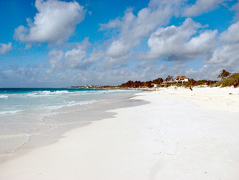
Beach at Tulum in the Yucatan
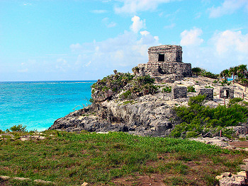
Mayan Ruins at Tulum
Puerto Morelos

Carvings at the Mayan Ruins of Chitzen Itza
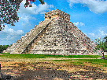
El Castillo at Chitzen Itza

Colonial town of Izamal
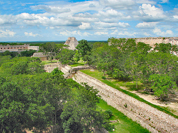
Mayan Ruins at Uxmal
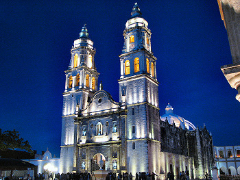
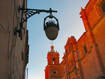
Campeche Cathedral
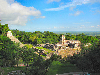
Mayan Ruins at Palenque
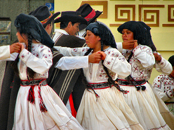
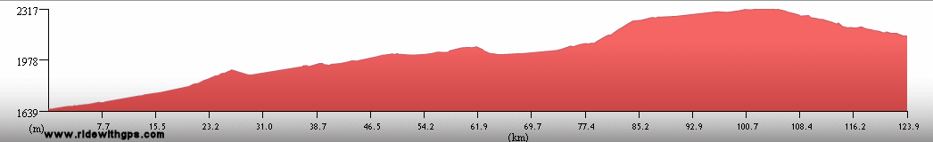
Continuing on, I completed my interesting tour of the southern part of the country, riding through Chiapas state, briefly visiting the interesting city of San Cristobal de Las Casas, before descending to the vicinity of the Pacific coast at the Isthmus of Tehuantepec, providing my last, albeit distant, encounter of the Tour with any ocean. From there I climbed back to the high altitudes found in the center of the country and began an interesting segment there. The highlights began with the somewhat stylistically different ruins of Zapotec cities at Mitla and Monte Alban, and the significantly fun city of Oaxaca. After those were the historic center of Puebla, the Franciscan Missions of the slopes of Volcan Popocatepetl, and the grand, starkly beautiful ancient city and pyramids at Teotihuacan. Riding through that part of the country was not a part of my original plan, but I appreciated the chance to see those sites, and certainly welcomed the cooler temperatures found in that area.

Dancers in Cintalapa
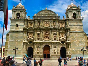
Oaxaca Cathedral
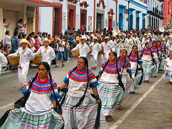
La Geualaguetza Festival Parade in Oaxaca
Dancers at La Geualaguetza Festival
Zapotec city ruins at Monte Alban

Angel at the Puebla Cathedral
Pyramid del Sol at the ancient city of Teotihuacan
The final part of my route through the country, in the northern states, was distinctly rushed, as my remaining time and resources were running low. Nevertheless, I continued to enjoy some surprisingly attractive places that lined my course to the border. Most of those were members of a string of historic towns built during a bygone Silver Boom, including Queretaro, San Miguel de Allende, Guanajuato, and Zacatecas. Beyond those lay only the big country of the states of Durango and Chihuahua, and I put forth an effort similar to what I had done in the early Stages of the Tour in order to make it across on time. The change in style to an open, arid landscape and a more intense cycling pace, resembling more closely that which I remembered from Outback Australia in Stage 1, gave me a nice opportunity to consider the vast distance that had gone by between there my location at the time. For the final border of the 78 I crossed during the Tour was just ahead.
One final post closes the Tour ~HERE~
A Sculpture in Queretaro
San Miguel de Allende
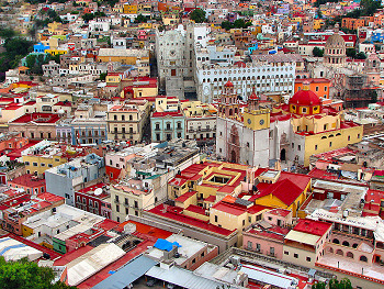
Guanajuato
Historic Center of Zacatecas
Museo de Mascaras in Zacatecas
Countryside in Durango
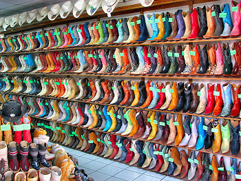
A Boot Shop in Chihuahua
United States: Can It Possibly Be True?
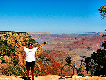
In a situation that I was never really 100% sure would eventually occur, the United States became the 44th country in which I traveled by bicycle during the Tour of Gondwana. Now far away from Tasmania, Ethiopia, Tierra del Fuego, Sri Lanka, Timor, Bolivia, Tibet, Madagascar, or even Nicaragua, along with hundreds of other places, I was suddenly closer to "home" than I had been in 1,200 days. A fairly long circuit around the southwest, including a number of the region's exceptional national parks, had been my intent for the final section of the Tour, with the ultimate destination being the Grand Canyon. However, since I was tired and broke, with a bike that was considerably worse for wear, and with promises that I would soon visit my family looming on the calendar, pieces of that plan had been progressively chopped off during the previous months. Since those places were not critical to the spirit of the Tour, I really didn't mind having to sacrifice them to the needs of practicality. In the end, the most I could manage was a quick northward tour from my entry point, at Columbus, N.M., through the border region with Arizona, arcing through Navajo Territory, with a quick diversion out to see Monument Valley, and then, finally to the Canyon, the Grand destination that had been my anticipated terminus of the Tour for so long that there was no way I could force myself to give it up. And on August 22, 02008, that's where I was, and an amazing sight it was, indeed.
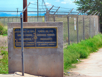
Fence at the USA-Mexico border
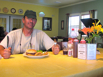
A genuine American Burger
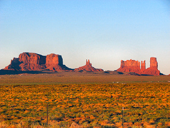
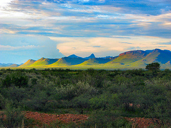
Monument Valley
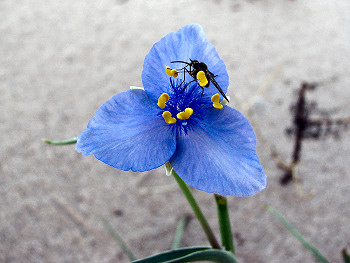
A blue wildflower
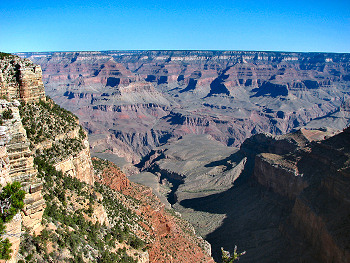
Grand Canyon
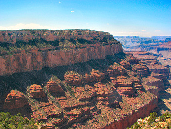
Grand Canyon
End of the Tour of Gondwana!
A Few Final Words
No matter what may happen to me in the remaining years that I will have the good fortune to spend on our Earth, the Tour of Gondwana will always be, personally, the most important of my experiences. From the time that the first tentative thoughts that I would seriously attempt a tour of that scale arose, through all the years of planning and preparations, when it seemed, more often than not, that the Tour would never really happen, and then, of course, together with the forty months in which it actually did, ten years, more or less, of my life revolved around the goal of bicycling through the southern continents, and returning to the Grand Canyon. In an earlier page on this site, I wrote that: ...if my will is strong, and luck is on my side, the Canyon will mark the end of the Tour of Gondwana. I can't even imagine how I will feel when I first look out over the rim.
I certainly never would have imagined that my actual feeling at that point would best be described as emptiness. In all honesty, however, I must say that that was, in fact, the case. The Tour was what I had always been meant to do and as I stood there at the edge of a beautiful overlook, I knew that I had done it. To be sure, the Tour gave me exactly what I was hoping it would; a first-hand understanding of the beauty and diversity of the natural world, knowledge of fascinating cultures, both ancient and contemporary, the prospect of continuous physical challenges, and the opportunity to meet thousands, upon thousands, of the most friendly people. With those goals achieved, I might have expected more triumphal thoughts to dominate my mood. But, for most of the previous ten years, the Grand Canyon seemed like just an ephemeral objective that could, with the slightest change in circumstances, never be met, and that provided an almost mythical goal that added focus and a unique perspective to my life. Somewhere toward the end of the Tour, I can't say for sure exactly when, possibly when I dropped down out of the Andes for the last time, and when a successful outcome appeared to be increasingly certain, I lost those aspects, and nothing was there to take their place.
Even today, it seems hard to imagine that any potential future projects will captivate my spirit as thoroughly as the Tour did, and, if they do, that I will, for a second time, be able to balance the forces of reality that conspire to extinguish such endeavors, and make them actually transpire. On the other hand, it is not out of the question that one day I will pull out some unexamined maps, and, while looking them over, start to feel again that twinge of curiosity that first struck me so long ago. For there are still lands yet unseen by me, and I have heard rumors that they are also filled with friendly people, beautiful birds, and testaments to the immense cycles of time. It may be that, for me, the Tour of Gondwana was an experience that can be equaled, but not surpassed. If that is true, I will not complain in the slightest. For if there is another event out there somewhere, which can even begin to approach its effect on my character, I, most certainly, will not hesitate for an instant to seek that out and attempt to make yet another journey come to pass.
Thank You,
Michael Ayers
Dates and Distances
Start: April 15, 02008
Finish: August 22, 02008
Actual Distance: 9,781 km
Ride days: 71
Rest days: 42
Unavoidably delayed days: 17
Highest Point
2,717 meters: Guanajuato-Santa Rosa Pass; Gto, Mexico
Entire Tour
Start: May 04, 02005
Finish: August 22, 02008
Actual Distance: 86,408 km
Total days: 1,207
Full-day ride equivalents : 561
Previous | Next
Main Index | Pre-Tour Index
Post-Tour Index | Articles Index
Slideshows
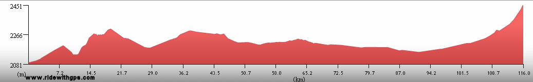
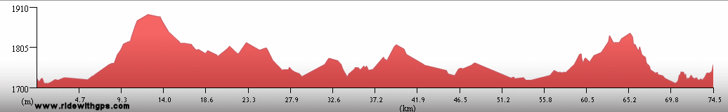
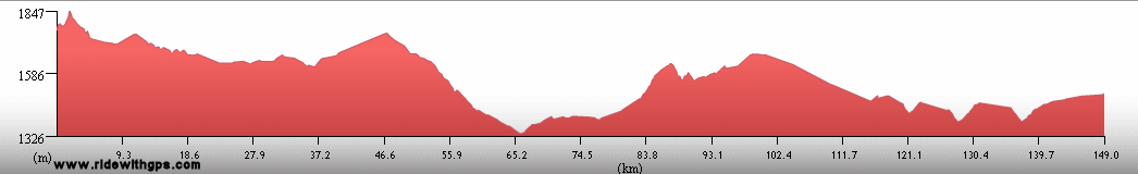
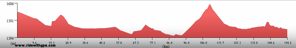
Stage 5 Log
(continued)
For a description of terms and symbols look: ~HERE~
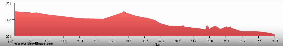
May 29-31, 02008
Cayo
Accommodation:

Comment: Rest/weather delay days in Cayo; tropical storm Alma/Arthur in area
June 1
Cayo to Belize City
Distance: 124 km
Terrain: Light rolling to flat
Max. Elevation: <300 m
Roads: Western Hwy.
Max. Temp: 27 °C
Weather: Light rain/drizzle through morning, becoming moderate to heavy showers in afternoon; moderate to strong headwinds in afternoon during showers
Accommodation:
Comment: Short, easy, but dreary day due to weather; final 30 km especially bleak; very heavy storms during night, with wind and local flooding
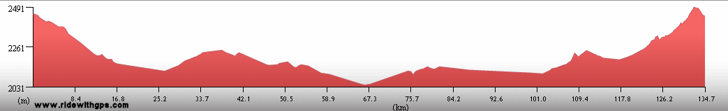
June 2
Belize City
Accommodation:
Comment: Weather delay in Belize City; road to north closed by flooding
June 3
Belize City
Accommodation:
Comment: Day trip to San Pedro on Ambergris Cay; diving/snorkling at Hol Chan Marine Reserve
June 4
Belize City to Corozal
Distance: 142 km
Terrain: Flat
Max. Elevation: <300 m
Roads: Northern Hwy. (1st 20 km with heavy traffic)
Max. Temp: 31 °C
Weather: Cloudy, with a few periods of very light drizzle; slight clearing in late afternoon; mild to light crosswinds
Accommodation:
Comment: A reasonable, though somewhat dreary day
June 5
Corozal to Chetumal, Mexico
Distance: 32 km
Max. Elevation: <300 m
Roads: Northern Hwy., MEX 186 (Mex)
Accommodation:
Comment: Short ride, then an unplanned rest day; decided to stop after wrong turn just past border; easy border procedures; entered final new country of tour!
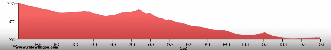
June 6
Chetumal to Felipe Carillo Puerto
Distance: 159 km
Terrain: Flat
Max. Elevation: <300 m
Roads: MEX 186, MEX 307
Max. Temp: 34 °C
Weather: Mostly cloudy; early light tailwinds, then light to moderate winds varying from cross/tail- to headwinds; 2 brief, light showers
Accommodation:
Comment: Mostly an easy day, though route was very uninteresting; completed second circumference of Earth; attacked by swarm of bees
June 7
Felipe Carillo Puerto to Tulum
Distance: 105 km
Terrain: Flat
Max. Elevation: <300 m
Roads: MEX 307 (section being widened)
Max. Temp: 32 °C
Weather: Partly cloudy to partly sunny; 1 brief light shower; light to moderate headwinds
Accommodation:
Comment: Short, uninteresting day to break at Tulum
June 8
Tulum
Distance: 38 km
Accommodation:
Comment: Sightseeing/rest day in Tulum; kayaking in Sian Ka'an Biosphere reserve
June 9
Tulum to Playa del Carmen
Distance: 76 km
Terrain: Flat

Max. Elevation: <300 m
Roads: MEX 307
Max. Temp: 36 °C
Weather: Mostly sunny; light to moderate crosswinds; heavy thunderstorm crossed route in afternoon, but minimal rain during ride;
Accommodation:
Comment: Tedious half day to break in Playa del Carmen; visited Mayan ruins at Tulum; may need to stop for a while due to bank mix-up
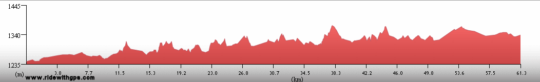
June 10
Playa del Carmen
Accommodation:
Comment: Errands/rest day; will need to wait a while longer
June 11-14
Puerto Morelos
Distance: 36 km
Accommodation:
Comment: Continued delay due to bank problem; moved to next town to north
June 15-27
Cancun
Distance: 33 km
Accommodation:
Comment: Completely frustrating delay; moved to Cancun for better communications
June 28
Cancun
Distance: 10 km
Accommodation:
Comment: Problem finally resolved; stayed at beach for one day
June 29
Cancun to Valladolid
Distance: 161 km
Terrain: Flat
Max. Elevation: <300 m
Roads: MEX 180
Max. Temp: 35 °C
Weather: Partly cloudy; brief light shower at start of day; light to moderate tailwinds, decreasing in afternoon
Accommodation:
Comment: Finally moving again; generally easy, though uninteresting day; felt just a little tired after long layoff
June 30
Valladolid to Piste
Distance: 46 km
Terrain: Flat
Max. Elevation: <300 m
Roads: MEX 180
Max. Temp: 35 °C
Weather: Partly sunny
Accommodation:
Comment: Short half day for sightseeing; visited Mayan city of Chichen Itza
July 1
Piste to Izamal
Distance: 74 km
Terrain: Flat to light rolling
Max. Elevation: <300 m
Roads: YUC 295, YUC 13
Max. Temp: 34 °C
Weather: Partly sunny; heavy thunderstorm in afternoon
Accommodation:
Comment: Planned on full day, but stopped early in nice town; should not cause much delay; first day in a long while on quiet roads
July 2
Izamal to Chicxulub Puerto
Distance: 138 km
Terrain: Flat
Max. Elevation: <300 m
Roads: Izamal-Temax Rd. (2 short sections good to excellent dirt/gravel, 1 under construction), Temax-Dzilam Gonzalez Rd. (single lane), MEX 176, YUC 27 (1st 40 km single lane)
Max. Temp: 31 °C
Weather: Mostly cloudy/overcast through morning, partly sunny with thundershowers in area in afternoon; 1 brief heavy shower then, a few periods of light rain/drizzle; mild to light crosswinds through morning, light tailwinds after turning west
Accommodation:
Comment: A rather easy day, but felt a little tired; pleasant lack of traffic for most of day
July 3
Chicxulub Puerto to Merida
Distance: 53 km
Terrain: Flat
Max. Elevation: <300 m
Roads: MEX 261, MEX 176
Max. Temp: 33 °C
Weather: Partly cloudy
Accommodation:
Comment: Short half day to break in Merida
July 4
Merida
Accommodation:
Comment: Maintenance/errands day in Merida
July 5
Merida to Uxmal
Distance: 88 km
Terrain: Flat; flat to light rolling; light to moderate rolling
Max. Elevation: <300 m
Roads: MEX 180, MEX 261
Max. Temp: 33 °C
Weather: Mostly sunny; early evening shower; light tail/cross- to head/crosswinds
Accommodation:
Comment: Late start, but reasonable half day to sightseeing break; visited ruins of Mayan City of Uxmal
July 6
Uxmal to 10 km N. of Edzna Ruins
Distance: 140 km
Terrain: Light to moderate rolling; flat to light rolling
Max. Elevation: <300 m
Roads: MEX 261, MEX 188
Max. Temp: 34 °C
Weather: Cloudy; heavy thundershower in afternoon; light cross- to tail/crosswinds
Accommodation:

Comment: A generally good day; covered desired distance despite having to wait through storm; first camping night of Stage; visited Mayan ruins at Kabah
July 7
10 km N. of Edzna Ruins to Campeche
Distance: 75 km
Terrain: Light to moderate rolling; flat to light rolling
Max. Elevation: <300 m
Roads: MEX 188, MEX 261, MEX 180
Max. Temp: 34 °C
Weather: Mostly sunny, mostly cloudy in late afternoon, with brief light shower; moderate to light tailwinds
Accommodation:
Comment: A fairly pleasant half day for sightseeing; visited Mayan ruins at Edzna, and Historic Center of Campeche
July 8
Campeche to Sabancuy
Distance: 140 km
Terrain: Flat; moderate to light rolling; flat
Max. Elevation: <300 m
Roads: MEX 180, MEX 259
Max. Temp: 35 °C
Weather: Mostly cloudy; thundershowers in area in afternoon, one moderate shower on route; light cross/tailwinds in morning, becoming moderate tailwinds in afternoon
Accommodation:
Comment: A rather nice, easy day, even enjoyed riding in rain; actual distance somewhat longer than map indicated
July 9
Sabancuy to Aguacatal
Distance: 138 km
Terrain: Flat
Max. Elevation: <300 m
Roads: MEX 259, MEX 186 (30 km section under construction)
Max. Temp: 35 °C
Weather: Mostly cloudy; periods of heavy rain in afternoon; light headwinds, becoming tail/crosswinds after turning south, diminishing in afternoon
Accommodation:
Comment: A decent start, but less pleasant when road construction, heavier traffic, and rain occurred simultaneously; wanted to go somewhat farther, but stopped to dry out
July 10
Aguacatal to Palenque
Distance: 113 km
Terrain: Flat; light to moderate rolling

Max. Elevation: <300 m
Roads: MEX 186
Max. Temp: 35 °C
Weather: Partly cloudy, becoming cloudy in afternoon, with one brief shower; occasional light cross/tailwinds
Accommodation:
Comment: Fairly short, but rather tedious day; planned on sightseeing at ruins, but arrived too late; will take unplanned day off, as also not feeling too well
July 11
Palenque
Accommodation:
Comment: Sightseeing/recovery day in Palenque; visited Mayan city of Palenque
July 12
Palenque to Ocosingo
Distance: 120 km
Terrain: 350-m climb; 300-m descent; hilly to moderate rolling; 850-m climb, rolling in sections; one small descent; 350-m climb; 490-m descent
Max. Elevation: 1,380 m
Roads: MEX 186
Max. Temp: 35 °C
Weather: Partly sunny through morning; cloudy in afternoon, two moderate showers, lingering drizzle after
Accommodation:
Comment: Late start and late finish, and a rather tough day overall; reasonable progress given conditions
July 13
Ocosingo to San Cristobal de Las Casas
Distance: 98 km
Terrain: 1,320-m climb, broken by a few small descents and flatter sections; one small descent; rolling 480-m climb; one small descent
Max. Elevation: 2,480 m
Roads: MEX 186, MEX 190
Max. Temp: 26 °C
Weather: Partly sunny
Accommodation:
Comment: Pleasantly cool and fresh conditions at altitude, but still another tiring day
July 14
San Cristobal de Las Casas to Ocozocoautla
Distance: 98 km
Terrain: One small climb; 1630-m descent; heavy to light rolling with 600-m gain; one small descent
Max. Elevation: 2,330 m
Roads: MEX 190-D (2-lane expressway w/ wide shoulders), MEX 190 (1st 30 km W. of Tuxtla Gutierrez narrow, poor road with very heavy traffic, sections under construction)
Max. Temp: 32 °C
Weather: Partly sunny
Accommodation:
Comment: A short but rather unpleasant day; stopped early to tend to errands without much success
July 15
Ocozocoautla to Tepanatepec
Distance: 131 km
Terrain: One small descent; light to heavy rolling; one small climb; 785-m descent, broken by short flat section
Max. Elevation: 1,105 m
Roads: MEX 190 (4-km section under construction)
Max. Temp: 29 °C
Weather: Partly sunny; light shower in afternoon; occasional mild tailwinds in afternoon
Accommodation:
Comment: Too much traffic on narrow road through morning, much better in afternoon; some nice scenery; planned on going somewhat farther
July 16
Tepanatepec to Juchitan de Zaragosa
Distance: 108 km
Terrain: Light rolling; flat to light rolling
Max. Elevation: 340 m
Roads: MEX 200 (alternating wide and narrow sections, and a few construction zones), MEX 185
Max. Temp: 34 °C
Weather: Mostly sunny; cloudy with heavy thundershower in afternoon
Accommodation:
Comment: Enjoyable when road condition good, otherwise tedious; planned to go considerably farther, but stopped early due to storm
July 17
Juchitan de Zaragosa to 14 km NW. of La Reforma
Distance: 114 km
Terrain: Flat; one small climb; moderate rolling; 680-m climb; one small descent; one small climb (incomplete)
Max. Elevation: 1,080 m
Roads: MEX 185, MEX 190
Max. Temp: 31 °C
Weather: Sunny; occasional mild tailwinds
Accommodation:
Comment: Lack of shade during climb made day very tiring; would have liked to have gone farther
July 18
14 km NW. of La Reforma to Totolapan
Distance: 93 km
Terrain: One small climb (continued, ~350m total); hilly; 480-m climb; 610-m descent; 590-m climb; 300-m descent
Max. Elevation: 1,330 m
Roads: MEX 190
Max. Temp: 34 °C
Weather: Sunny; occasional moderate to light winds, various directions, but often tailwinds
Accommodation:
Comment: Terrain much tougher than expected; wanted to go considerably farther
July 19
Totolapan to Oaxaca
Distance: 93 km
Terrain: 830-m climb; one small descent; moderate rolling to flat
Max. Elevation: 1,895 m
Roads: MEX 190
Max. Temp: 29 °C
Weather: Mostly cloudy, becoming partly sunny in afternoon; light to moderate winds, various directions in afternoon
Accommodation:
Comment: Fairly short, but tiring day to break in Oaxaca; includes short detours to visit archeological site at Mitla and weaving village of Teotitlan
July 20-21
Oaxaca
Accommodation:
Comment: Sightseeing/errands days in Oaxaca; visited historic city center and ancient Zapotec city at Monte Alban; watched events of La Guelaguetza Festival
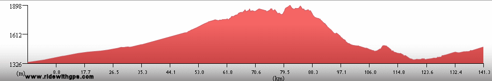
July 22
Oaxaca to Cuitcatlan
Distance: 121 km
Terrain: Light rolling; 500-m climb; hilly; 1,200-m descent; moderate rolling
Max. Elevation: 2,285 m
Roads: MEX 190, MEX 135 (some bumpy sections, inc. big descent)
Max. Temp: 30 °C
Weather: Mostly sunny, becoming partly cloudy in afternoon
Accommodation:
Comment: Actual distance somewhat longer than map indicated; stopped early to better space upcoming days
July 23
Cuitcatlan to Tehuacan
Distance: 122 km
Terrain: Heavy rolling to hilly; light to moderate rolling, with gradual elevation gain and 3 small climbs; 440-m climb
Max. Elevation: 1,670 m
Roads: MEX 135, PUE 730 (bumpy), PUE 908
Max. Temp: 32 °C
Weather: Partly sunny; becoming mostly cloudy in afternoon; rain threatened, but none on route; strong headwinds in early evening
Accommodation:
Comment: A tougher day than expected; nice conditions and great scenery on first part of route; actual distance slightly longer than map indicated
July 24
Tehuacan to Puebla
Distance: 126 km
Terrain: Light rolling to flat, with very gradual elevation gain
Max. Elevation: 2,330 m
Roads: MEX 150 (20 km section SE. of Tepeaca very narrow with too much traffic)
Max. Temp: 24 °C
Weather: Partly sunny; increasing clouds in afternoon , with rain beginning just before end of ride
Accommodation:
Comment: Mostly an easy, short day, though rather stressful on section of bad road; pleasantly cool weather;
July 25
Puebla to San Martin Texmelucan
Distance: 73 km
Terrain: Flat to light rolling, with one gradual small climb
Max. Elevation: 2,400 m
Roads: Local Rds.; Cholula-Calpan Rd.; Calpan-Huejotzingo Rd.; MEX 190
Max. Temp: 28 °C
Weather: Mostly sunny; cloudy in afternoon with light shower
Accommodation:
Comment: Intended a full day but delayed by difficulty navigating and sightseeing; visited Historic city center of Puebla, and Franciscan Missions in Calpan and Huejotzingo
July 26
San Martin Texmelucan to Teotihuacan
Distance: 112 km
Terrain: Moderate to heavy rolling, with gradual elevation gain and one small descent
Max. Elevation: 2,700 m
Roads: MEX 117, Popocatla-Calpulapan Rd. (usually somewhat bumpy); MEX 166; MEX 88 (narrow section with too much traffic); MEX 9; MEX 132
Max. Temp: 24 °C
Weather: Partly sunny; cloudy in afternoon with heavy thunderstorm just before end of ride
Accommodation:
Comment: A short day; generally pleasant over first half, but terrain tougher than expected; end of route less appealing
July 27
Teotihuacan to Tula de Allende
Distance: 88 km
Terrain: Light rolling; flat to light rolling, with a few small hills
Max. Elevation: 2,360 m
Roads: MEX 132, Teotihuacan-Tecamac Rd., MEX 85, Los Rey Acozac-Zumpango Hwy., MEX 9, Atitalaquia Cut-off, Tula Hwy.
Max. Temp: 27 °C
Weather: Partly sunny, becoming cloudy in late evening
Accommodation:
Comment: A nice half day after morning sightseeing; visited ancient city and pyramids at Teotihuacan
July 28
Tula de Allende to Queretaro
Distance: 175 km
Terrain: Light rolling to flat; hilly, with 2 small climbs/descents; light rolling to flat; heavy rolling
Max. Elevation: 2,530 m
Roads: Tula-Tepetitlan Rd. (some bumpy sections); Tepetitlan-Nopala Rd. (20-km section under construction, with 2 sections of good dirt); MEX 45; Huicapan-San Francisco Rd.; QRO 200
Max. Temp: 28 °C
Weather: Sunny; mostly cloudy in afternoon, with 1 moderate shower; occasional light tailwinds in afternoon
Accommodation:
Comment: A long, but generally good day; some terrain tougher than expected, and some poor roads, but achieved desired distance
July 29
Queretaro to San Miguel de Allende
Distance: 66 km
Terrain: Light rolling to flat, with 2 small climbs
Max. Elevation: 2,360 m
Roads: MEX 57 (expressway), MEX 111
Max. Temp: 25 °C
Weather: Mostly sunny; light shower just after sunset
Accommodation:
Comment: Easy, short half day; intended a full day, but late start after sightseeing, and stopped in nice town midway; visited historic city centers of Queretaro and San Miguel
July 30
San Miguel de Allende to Guanajuato
Distance: 94 km
Terrain: Moderate rolling to hilly, with one small descent

Max. Elevation: 2,365 m
Roads: MEX 51, GTO 51
Max. Temp: 29 °C
Weather: Mostly sunny; occasional light winds, various directions
Accommodation:
Comment: Long half day after a late start; visited historic city center of Guanajuato
July 31
Guanajuato to San Filipe
Distance: 110 km
Terrain: 500-m climb; slightly rolling 470-m descent; heavy rolling to hilly; moderate rolling, with one small climb/descent
Max. Elevation: 2,717 m
Roads: MEX 110, MEX 51
Max. Temp: 27 °C
Weather: Partly cloudy, becoming cloudy in afternoon with showers in area, but no real rain on route; light winds from various directions, becing moderate cross/headwinds in afternoon
Accommodation:
Comment: A rather disappointing day; wanted to go considerably farther, but stopped early due to threatening weather that never really arrived; first climb larger than expected
August 1
San Filipe to Pinos
Distance: 117 km
Terrain: One small climb/descent; light rolling to flat; flat; one gradual small climb
Max. Elevation: 2,600 m
Roads: MEX 51, ZAC 144
Max. Temp: 27 °C
Weather: Mostly cloudy; occasional light crosswinds in afternoon
Accommodation:
Comment: Could have gone considerably farther, but would have left short distance for next day; actual distance slightly longer than map indicated
August 2
Pinos to Zacatecas
Distance: 140 km
Terrain: One small descent; light rolling; flat; light rolling; one small climb<
 br>
Max. Elevation: 2,600 m
br>
Max. Elevation: 2,600 m Roads: ZAC 144, MEX 49 (semi-expressway), MEX 45 (expressway)
Max. Temp: 27 °C
Weather: Partly sunny; light tailwinds, diminishing in afternoon
Accommodation:
Comment: Mostly fast and easy day, until entrance to city with very difficult navigation; actual distance somewhat longer than map indicated
August 3-4
Zacatecas
Accommodation:
Comment: Rest/sightseeing days in Zacatecas; visited historic city center, El Eden Silver mine, Rafael Coronel Museum, and watched folklore festival parade
August 5
Zacatecas to 18 km S. of Juan Aldama
Distance: 192 km
Terrain: One small climb; light rolling to flat, with gradual descent; flat; hilly; light rolling

Max. Elevation: 2,615 m
Roads: MEX 45 (alternate sections of semi-expressway and old highway, soulders variable from wide to absent), MEX 49
Max. Temp: 29 °C
Weather: Sunny, partly cloudy in late afternoon; light to mild tailwinds, becoming moderate cross/headwinds in evening
Accommodation:
Comment: A good start for the final push to home; fast and easy until winds started in evening
August 6
18 km S. of Juan Aldama to Nazas
Distance: 168 km
Terrain: Light rolling, with gradual descent; one small climb/descent; light to moderate rolling
Max. Elevation: 2,365 m
Roads: MEX 49 (30-km section N. of Cuencame narrow, with very heavy truck traffic), MEX 34 (bumpy)
Max. Temp: 32 °C
Weather: Mostly sunny; scattered clouds in afternoon, with one brief light shower
Accommodation:
Comment: Another reasonably easy day; afternoon shower coincided with section of bad road
August 7
Nazas to Rodeo
Distance: 66 km
Terrain: Moderate to heavy rolling
Max. Elevation: 1,640 m
Roads: MEX 34, MEX 45
Max. Temp: 32 °C
Weather: Mostly cloudy, becoming partly sunny in afternoon
Accommodation:
Comment: Not feeling perfect in afternoon, stopped early after half day; lost time gained on previous days
August 8
Rodeo to Las Nieves
Distance: 178 km
Terrain: Light rolling; 585-m climb; light rolling; moderate to heavy rolling; light rolling, with slight descent
Max. Elevation: 2,225 m
Roads: MEX 45
Max. Temp: 29 °C
Weather: Partly sunny; becoming partly to mostly cloudy in afternoon, with ominous showers in vicinity, but no rain on route until light drizzle just before sunset; light headwinds when showers in area
Accommodation:
Comment: Terrain a bit tougher than expected for most of day, but still made good progress; felt much better than previous day
August 9
Las Nieves to Hidalgo de Parral
Distance: 87 km
Terrain: Moderate rolling, with one small climb
Max. Elevation: 2,165 m
Roads: MEX 45
Max. Temp: 28 °C
Weather: Partly sunny; increasing clouds in afternoon with one shower near sunset
Accommodation:
Comment: Unplanned half day; stopped for rest and to better schedule errands in upcoming days
August 10
Hidalgo de Parral to Satevo
Distance: 158 km
Terrain: Moderate to heavy rolling, with 2 small climbs and one small descent
Max. Elevation: 1,985 m
Roads: MEX 24
Max. Temp: 34 °C
Weather: Mostly sunny, partly sunny in late afternoon; moderate to light cross/headwinds in morning, diminishing at midday
Accommodation:
Comment: A generally good day, but felt like distance covered was longer than reality
August 11
Satevo to Chihuahua
Distance: 82 km
Terrain: Flat to light rolling, with gradual elevation gain; gradual 300-m climb; one small descent

Max. Elevation: 1,730 m
Roads: MEX 24, MEX 16 (narrow expressway)
Max. Temp: 34 °C
Weather: Sunny; occasionally light head- to head/crosswinds
Accommodation:
Comment: Half day to try to take care of errands in Chihuahua; felt very sluggish at morning
August 12
Chihuahua to 21 km SE. of Flores Magon
Distance: 171 km
Terrain: Flat to light rolling, one small climb/descent; flat to light rolling; flat; one small climb/descent

Max. Elevation: 1,700 m
Roads: MEX 45 (semi-expressway, sections w/o shoulder), CHIH 7 (2-lane toll road with shoulder)
Max. Temp: 33 °C
Weather: Sunny; occasional light tailwinds, period of light headwinds in afternoon; cloudy with scattered showers at sunset
Accommodation:
Comment: A very slow start, but a generally good day; highway conditions not quite a bad a feared, though very uninteresting for first 110 km, last section actually quite nice; somewhat minimal services after 1st 40 km
August 13
21 km SE. of Flores Magon to Nuevo Casas Grandes
Distance: 153 km
Terrain: Flat to light rolling, with 2 small climbs/descents
Max. Elevation: 1,585 m
Roads: CHIH 7, MEX 10, CHIH 7, MEX 10
Max. Temp: 25 °C
Weather: Cloudy to mostly cloudy, with light periods of drizzle through morning
Accommodation:
Comment: Another rather fast, easy day; took toll-road shortcut and rode straight through; arrived early enough to visit Paquime Archeological site on same day, extra 18 km to do so
August 14
Nuevo Casas Grandes to Ascension
Distance: 97 km
Terrain: Flat, with a few sections of light rolling
Max. Elevation: 1,445 m
Roads: MEX 10 (narrow, moderate traffic) MEX 2
Max. Temp: 35 °C
Weather: Partly sunny; cloudy with showers in late afternoon
Accommodation:
Comment: Unplanned half day, long but easy; stopped early due to being annoyed by flies(!); lost time gained on previous day
August 15
Ascension to Deming, NM, U.S.A.
Distance: 163 km
Terrain: Flat, with a few sections of light rolling
Max. Elevation: 1,415 m
Roads: MEX 2, NM-11 (USA), US 180
Max. Temp: 37 °C
Weather: Sunny; quickly becoming cloudy, with scattered showers, before sunset; occasional light tailwinds
Accommodation:
Comment: Final border crossing of Tour!; a generally easy day
August 16
Deming to Buckhorn
Distance: 146 km
Terrain: Flat, with gradual 400-m gain; moderate rolling; 355-m descent; light to moderate rolling, with slight descent
Max. Elevation: 1,905 m
Roads: US 180
Max. Temp: 28 °C
Weather: Cloudy; partly sunny in afternoon, with 1 rather long and intense thundershower; occasional mild to light tailwinds
Accommodation:
Comment: A sluggish start, and a longer than normal midday break for errands; would like to have gone somewhat farther; no place for shelter, so rode through soaking rain
August 17
Buckhorn to Luna
Distance: 114 km
Terrain: Moderate rolling, one small climb/descent; moderate rolling; 475-m climb; small descent
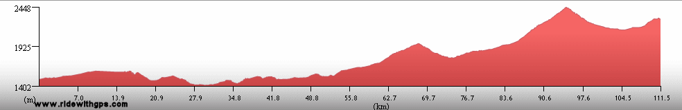
Max. Elevation: 2,450 m
Roads: US180
Max. Temp: 24 °C
Weather: Sunny; partly cloudy in afternoon, with 1 passing light shower during meal break
Accommodation:
Comment: A disappointing day; terrain a little tougher than expected, despite having ridden last section of route on a previous tour; stopped a little early, as not feeling too great
August 18
Luna to Witch Well, AZ
Distance: 158 km
Terrain: 380-m climb, broken by small descent and rolling section; one small descent; one small climb/descent; light rolling to flat, with gradual decline; one small climb
Max. Elevation: 2,590 m
Roads: US 180, US 191
Max. Temp: 30 °C
Weather: Mostly sunny; partly sunny, with widely scattered showers in afternoon , but no significant rain on route; light to moderate headwinds, periods of strong to moderate head- or crosswinds in afternoon
Accommodation:
Comment: Despite unexpected change in wind pattern, completed close to desiree distance , though would have preferred to go just slightly farther
August 19
Witch Well to 14 km S. of Chinle
Distance: 160 km
Terrain: All types between light rolling and hilly
Max. Elevation: 2,225 m
Roads: US 191, I-40 Frontage Rd., US 191
Max. Temp: 31 °C
Weather: Sunny; light to moderate cross/headwinds, beginning in late morning
Accommodation:
Comment: A fairly tiring day, but accomplished close to desired distance
August 20
14 km S. of Chinle to Monument Valley
Distance: 170 km
Terrain: All types between light rolling and hilly
Max. Elevation: 1,965 m
Roads: US 191, NAV-59, US 160, US 163
Max. Temp: 33 °C
Weather: Sunny; moderate to strong cross/head- to headwinds in afternoon
Accommodation:

Comment: A mixed day; nice conditions at first, very tough when going into wind; nice short-cut on secondary road; some impressive scenery
August 21
Monument Valley to 19 km NE. of Tuba City
Distance: 144 km
Terrain: Moderate rolling, with 2 small climbs, and one small descent
Max. Elevation: 2,135 m
Roads: US 163, US 160
Max. Temp: 33 °C
Weather: Sunny; strong to very strong headwinds beginning in morning, diminishing occasionally in afternoon
Accommodation:
Comment: Penultimate day of Stage 5 and entire Tour!; a tough one due to wind, though rode close to desired distance
August 22
19 km NE. of Tuba City to Grand Canyon
Distance: 155 km
Terrain: Light rolling, with 300-m descent; 930-m climb; moderate rolling with one small climb and 2 small descents
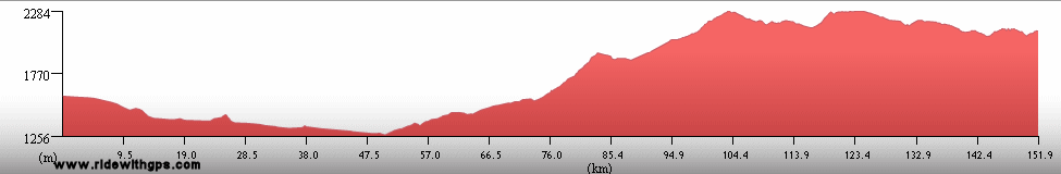
Max. Elevation: 2,220 m
Roads: US 160, US 89, AZ 64
Max. Temp: 35 °C
Weather: Sunny; occasional moderate winds, various directions, after midday
Accommodation:
Comment: The Tour is Complete!!
Index | Pre-Tour Site
Pre-Tour Stage 1 Stage 2 Stage 3 Stage 4 Stage 5 |