
Stage 1: The Tough Beginning
Rain, unanticipated hills, and breakdowns, but much fun as well
The Tour Reports section of the site now contains the posts that I sent to the Phred Touring List (now on Google Groups) during the Tour. Those from the early days of the Tour were rather thin, while later on, for some of the more unique countries, they contain much more thorough accounts of the ride, and an occasional amusing anecdote. Towards the end of the Tour, however, I frequently couldn't keep up with the chore of sending posts on time, so the last several were written after the Tour was complete. Look for links to the posts at the end of the short descriptions beginning below.
My Farewell Post, sent before the Tour, is: ~HERE~
Stage 1 Actual Route
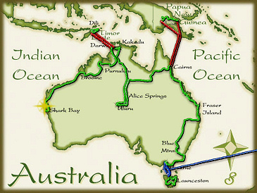
On this, and all future route maps, the blue lines represent travel by ship, red by airplane (Booo!), and green by bicycle. The actual route for Stage 1 was almost exactly the same as what I had originally planned prior to the tour, with the notable exception that I had to skip the last few days and end the Stage at Shark Bay instead of Perth in order to catch my next ship to Stage 2.
Melbourne: The Start of the Whole Affair
I had a choice of ports in which to start Stage 1. Most of the ships that make the North America to Australia circuit stop at both Melbourne and Sydney, though some call Sydney first and others Melbourne. If I had so desired, I could have stayed on board the Direct Kestrel for a few more days and disembarked at Sydney. I chose to start in Melbourne, however, for a few reasons. To me it seemed like it would be an easier city to exit, being a little smaller than Sydney. Also, it would give me a chance to explore the southeastern coast and, especially, Tasmania. I believe I made a good choice there. Melbourne seemed to me to be a fine town, with a nice city center that was easily walkable and lively. It was nice to relax on dry land there for a couple of days, and take care of a few final details before the ride started. Everything got off to a nice start as I left the port for the hotel I had chosen in the city center. I picked the place that was closest to the container terminal so I could have a relatively easy walk with the bike, and the very large box of "boat supplies" that I would be sending home shortly thereafter. It is not possible to walk around inside the container terminal, and most have a shuttle that takes crews, port staff, and the occasional globe-circling bike tourist from the ships to the main gate. In my case the friendly driver insisted on taking me right to the door of my hotel, which I definitely appreciated.
For the next couple of days, I spent most of my free time sampling the local cuisine, which is prepared with a bit more variety than the fare on board ship, and doing only a few touristy things. The Royal Botanical Gardens was a nice place for a walk, and the Queen Victoria Market provided a chance to experience a big crowd which seemed novel after the nearly deserted Direct Kestrel. Additionally, I went to see the Royal Exhibition Building and Carlton Gardens, and was pleasantly surprised to learn that they had been added to the UNESCO World Heritage list in 02004, a fact that had somehow escaped my notice. That brought the number of such sites on the Stage 1 route to 12, and enhanced my goal of seeing as many as possible. Though I was now firmly on the soil of Gondwana, I still did not feel like the tour had actually started, however.
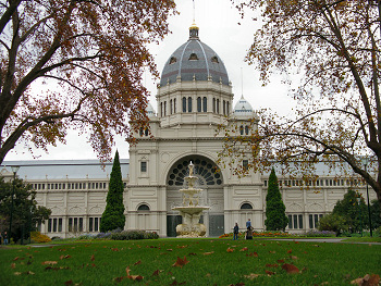
The Royal Exhibition Building
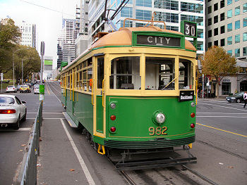
A famous Melbourne tram

Well-named clothing, Queen Victoria Market
Tasmania: Island of Rainbows
It was a short 5 km ride from the Melbourne city center to the ferry terminal of the Spirit of Tasmania, and that made it very easy to catch yet another boat for the overnight crossing of the Bass Straight to Devonport, Tasmania where the whole tour would officially start. The ferry was quite nice, not particularly full, and the business-class seat that I sprung for allowed me to get a little sleep along the way. Arriving at about 7:00 A.M., I was able to start off right away for a full day of riding after a quick change of clothes. It turned out that I needed every minute of that day, and more, as things were not very easy at the start.
As I feared, several weeks with minimal riding while I packed up my home and crossed the Pacific, significantly degraded my fitness, and I noticed that after only a few hours of riding. It was also cold, for most of the time I spent on the island, and as is often the case there during that time of years, it rained quite a bit. The biggest drawback, however, was the short length of daylight there during June. Nine and a half hours of useable sunlight made for a big challenge for me. The first few days were quite a struggle for those reasons, but I knew that on a long tour none of that lasts forever, so I was not worried too much.
In spite of all of that Tasmania was very nice. I looped around, heading to the west side first and visited the Gordon-Franklin Rivers area, another WHS, before crossing back to the east coast just north of Hobart, the capital, heading up the east coast, eventually through Launceston, before arriving back at Devonport for the ferry back to the mainland.
One of the interesting characteristics of ancient Gondwanaland that can still be seen today was its distinctive forests filled with species such as myrtle, beech, and tree ferns. Western Tasmania is one of the best places on Earth to see remnants of the ancient forest, and these species were all easily seen, as was the Huon pine, an endemic species that was once prized as a ship-building timber. Tasmania was one of the last places that I added to the whole tour route, and I'm glad that I did, as I enjoyed my visit there quite a bit.
My brief post about Tasmania is: ~HERE~
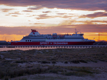
The Spirit of Tasmania ferry
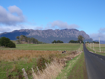
Mount Roland
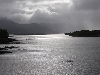
A shower approaches Lake Burbury
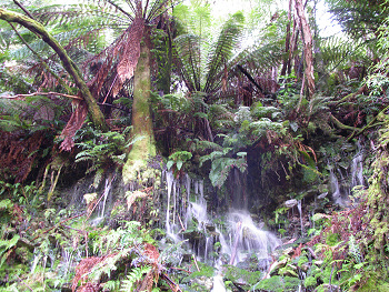
Waterfalls and ferns, Western Tasmanian rainforest
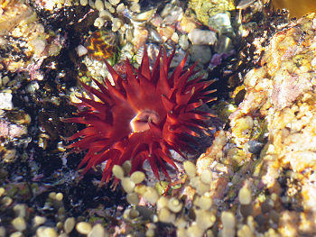
An anemone in a Bicheno tidepool
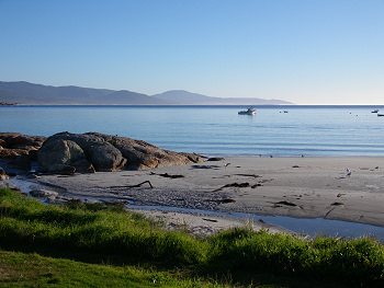
Morning at Bicheno
Victoria: A Small, but Pretty State
My route through Victoria was not especially long, and so I was only there for a few days, but the weather improved a little, and there was a bit of flat terrain along the coast, so I felt a little better. While there, I continued to notice what I first saw on Tasmania, namely that Australia is completely filled with beautiful birds. For many years I had always dreamt of seeing parrots in the wild, and though I caught a few brief glimpses of some during my tours in '02 and '03, I was completely taken aback by the frequency that they appeared in Australia. In one particular case, on a gray morning, in an area of rolling farmland in eastern Victoria, I happened across a flock of Black Cockatoos that must have numbered 150 individuals. They would normally be too shy for me to get very close to them, but with so many around, I was able to walk through the trees they occupied, and they could not fly away fast enough to escape my observations. They are quite large birds and their call sounds like someone opening a very squeaky door. Eventually, they all took off, squeaking away into the gray sky and I felt like I was standing in a real-life version of the "Flying Monkey" scene from The Wizard of Oz (the fictional Oz, that is).
Another brief post, about Victoria, is: ~HERE~
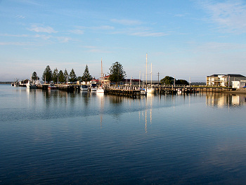
Port Albert marina
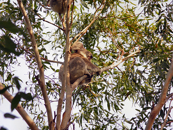
At the Phillip Island Koala Sanctuary

Galahs on wires
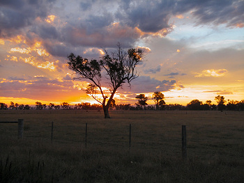
A Victoria Sunset
New South Wales, the Heart of Australia
My ride through New South Wales, Australia's most populated state, was, perhaps not as enjoyable as it could have been. There was some surprisingly rolling terrain along the southern coast, more wet, cold weather (I rode through a snowstorm on one occasion, a touring first for me), and a series of unexpected mechanical problems. All of these combined to increase the business-like nature of that section. My route ran along the south coast for a while, then turned inland to avoid the congestion of Sydney, and finally hit the coast again at the northeastern corner of the state. By the time I caught up from the weather delays, fixed everything that broke, and climbed up and down the Great Dividing Range a few times, I had little time to spend sightseeing or relaxing at the state's attractions. I did manage to make a quick half-day visit to the Blue Mountains, which were quite pretty, and towards the end of the section, when the weather began to improve, to Gibraltar Range and Washpol National Parks, all of which were very interesting from a botanical perspective. When I finally reached the north coast, at the margins of the tropics I was finally able to take a break that was actually relaxing at Iluka Beach.
One pleasant aspect of this part of Australia was that there are still many small to mid-sized towns that have retained a traditional city center, complete with shops along an easily-walkable main street. It was nice to see that again, though I unfortunately did not have enough time to lounge around one or two of them as I had hoped. It was certainly nice to finally reach the southern edge of the tropics, as I was definitely ready for some warmer weather to return. The Tour of Gondwana, is supposed to be a largely tropical tour, after all.Two posts about New South Wales are: ~HERE~
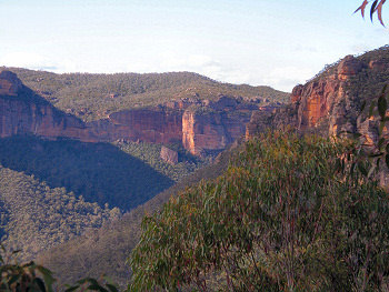
The Blue Mountains
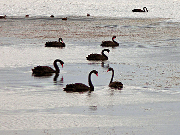
Black swans on a pond
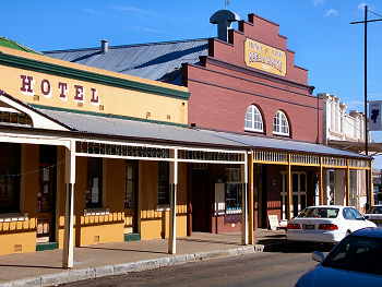
Prince of Wales Hotel, Gulgong
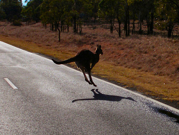
A 'Roo hops across my path
Previous | Next
Main Index | Pre-Tour Index
Post-Tour Index | Articles Index
Slideshows
Pre-Tour Stage 1 Stage 2 Stage 3 Stage 4 Stage 5 |
Stage 1 Log
For a description of terms and symbols look: ~HERE~
May 22, 02005
Melbourne
Accommodation:

Comment: Arrived in Melbourne!!
May 23
Melbourne
Accommodation:

Comment: Sightseeing in Melbourne
May 24
Melbourne to Devonport
Accommodation:

Comment: Overnight ferry to Tasmania
May 25
Devonport to Daisy Dell
Distance: 75 km
Terrain: Hilly, 440-m climb

Max. Elevation: 767 m
Roads: B14, C136, C132
Max. Temp: 10 °C
Weather: Mostly sunny, with two light showers; some moderate headwinds
Accommodation:

Comment: A tiring first day
May 26
Daisy Dell to 28 km N of Strahan
Distance: 122 km
Terrain: Hilly/heavy rolling, 450-m climb

Max. Elevation: 930 m
Roads: C132, A10, B27
Max. Temp: 9 °C
Weather: Fog/drizzle/light rain
Accommodation:

Comment: Better legs, more wet
May 27
28 km N of Strahan to Strahan
Distance: 29 km
Terrain: Light rolling

Max. Elevation: <300 m
Roads: B27
Max. Temp: 11 °C
Weather: Light showers/sun
Accommodation:

Comment: Rest/sightseeing day in Strahan; Gordon River cruise
May 28
Strahan to 20 km W. of Derwent Bridge
Distance: 108 km
Terrain: Hilly, rolling, 2 small climbs

Max. Elevation: 530 m
Roads: B24, A10
Max. Temp: 8 °C
Weather: Mixed sun/light showers, a little sleet
Accommodation:

Comment: Cold, but enjoyable ride through Franklin/Gordon Wild Rivers National Park
May 29
20 km W. of Derwent Bridge to 18 km W. of Ouse
Distance: 112 km
Terrain: Hilly, rolling, 450-m climb

Max. Elevation: 815 m
Roads: A10
Max. Temp: 9 °C
Weather: Cloudy and cold, but no rain
Accommodation:

Comment: Snow on ground at Lake St. Clair NP, no services east of Derwent Br.
May 30
18 km W. of Ouse to Orielton
Distance: 139 km
Terrain: Light to moderate rolling, 2 small climbs

Max. Elevation: 367 m
Roads: A10, B10, B32, C324, B31, C350
Max. Temp: 13 °C
Weather: Mostly cloudy, but no rain; occasional tailwinds
Accommodation:

Comment: An easier day
May 31
Orielton to Bicheno
Distance: 151 km
Terrain: Light to moderate rolling, a few small climbs

Max. Elevation: 330 m
Roads: A3
Max. Temp: 15 °C
Weather: Clearing; sunny by afternoon; frequent tailwinds
Accommodation:

Comment: A generally good day. A lot of traffic, inc. many log trucks in A.M. Better N of Triabunna
June 1
Bicheno to Diana's Basin
Distance: 71 km
Terrain: Flat to light rolling

Max. Elevation: <300 m
Roads: A3
Max. Temp: 17 °C
Weather: Sunny
Accommodation:

Comment: Half day for rest/sights in Bicheno, then a beautiful ride along the coast
June 2
Diana's Basin to Nabowla
Distance: 130 km
Terrain: Hilly, 500-m climb

Max. Elevation: 605 m
Roads: A3, B81
Max. Temp: 18 °C
Weather: Morning frost; sunny; no significant wind
Accommodation:

Comment: Some very beautiful cycling
June 3
Nabowla to Devonport
Distance: 152 km
Terrain: Hilly, a few small climbs

Max. Elevation: 400 m
Roads: B81, A7, B71
Max. Temp: 18 °C
Weather: Morning clouds, then sunny; minimal wind
Accommodation:

Comment: A rather long day to catch the ferry
June 4
Frankston, Victoria to Kilcunda
Distance: 78 km
Terrain: Flat to light rolling

Max. Elevation: <300 m
Roads: C777, C787, B420, B460
Max. Temp: 20 °C
Weather: Partly cloudy
Accommodation:

Comment: Overnight ferry from Tas., Commuter train to Frankston, Half day of easy riding. Visited Koala sanctuary
June 5
Kilcunda to Port Albert
Distance: 140 km
Terrain: Flat to light rolling w/ a few sections of small hills

Max. Elevation: <300 m
Roads: B460, C442, C443, C445, A440, C452
Max. Temp: 14 °C
Weather: Cloudy w/ just a few raindrops; clearing by evening; slight afternoon headwinds
Accommodation:

Comment: A fairly nice day; saw a lot of birds
June 6
Port Albert
Max. Temp: 14 °C
Weather: Partly cloudy
Accommodation:

Comment: Rest Day in Port Albert
June 7
Port Albert to 15 km W. of Bairnsdale
Distance: 138 km
Terrain: Flat to light rolling

Max. Elevation: <300 m
Roads: Old Sale Rd, A440, A1
Max. Temp: 18 °C
Weather: Sunny
Accommodation:

Comment: An easier day
June 8
15 km W. of Bairnsdale to 12 km E. of Orbost
Distance: 129 km
Terrain: Flat, then heavy/moderate rolling

Max. Elevation: <300 m
Roads: A1
Max. Temp: 22 °C
Weather: Sunny
Accommodation:

Comment: Fairly easy day, but feel tired
June 9
12 km E. of Orbost to Narrabarba, New South Wales
Distance: 146 km
Terrain: Hilly w/ 3 small climbs

Max. Elevation: 422 m
Roads: A1
Max. Temp: 18 °C
Weather: Partly cloudy
Accommodation:

Comment: A fairly tough day
June 10
Narrabarba to Murrah Lake
Distance: 123 km
Terrain: Moderate rolling w/ several steep hills

Max. Elevation: <300 m
Roads: A1, Tourist Rd. 11, Tourist Rd. 9
Max. Temp: 22 °C
Weather: Sunny, occasional headwinds
Accommodation:

Comment: Another slow day
June 11
Murrah Lake to Batemans Bay
Distance: 121 km
Terrain: Moderate/heavy rolling

Max. Elevation: <300 m
Roads: Tourist Dr. 9, A1
Max. Temp: 14 °C
Weather: Cloudy, headwinds, afternoon rain
Accommodation:

Comment: Decided to stay the night in Batemans Bay due to rain
June 12
Batemans Bay to Tirrannaville
Distance: 136 km
Terrain: Hilly, 700-m climb, then moderate rolling

Max. Elevation: 785 m
Roads: Hwy 52, Tourist Dr. 8
Max. Temp: 18 °C
Weather: Sunny, occasional headwinds
Accommodation:

Comment: A better day
June 13
Tirrannaville to Abercrombie River
Distance: 102 km
Terrain: Moderate rolling/hilly, w/ 1 steep descent/climb

Max. Elevation: 1030 m
Roads: Tourist Dr. 8, Taralga Rd.
Max. Temp: 14 °C
Weather: Morning sun but cold, afternoon rain
Accommodation:

Comment: A very hard day
June 14
Abercrombie River to Lithgow
Distance: 124 km
Terrain: Hilly

Max. Elevation: 1272 m
Roads: Taralga Rd., Abercrombie Rd, Tourist Dr. 1, Hwy 32
Max. Temp: 14 °C
Weather: Morning rain, headwinds, evening clearing
Accommodation:

Comment: A very bleak morning
June 15
Lithgow
Accommodation:

Comment: Rest day in Lithgow
June 16
Lithgow
Distance: 61 km
Terrain: Hilly

Max. Elevation: 1080 m
Roads: Hwy 32
Max. Temp: 10 °C
Weather: Partly sunny
Accommodation:

Comment: Half day to visit Blue Mountains N.P.
June 17
Lithgow to Illford
Distance: 79 km
Terrain: Moderate rolling with 1 small climb/descent

Max. Elevation: 1100 m
Roads: Hwy 86
Max. Temp: 8 °C
Weather: Partly cloudy; strong winds from various directions
Accommodation:

Comment: Half day after errands in Lithgow
June 18
Illford to 20 km S.E. of Coolah
Distance: 163 km
Terrain: Light rolling with several small hills

Max. Elevation: 825 m
Roads: Hwy 86, Cope Rd., Ulan Rd., Vinagaroy Rd.
Max. Temp: 14 °C
Weather: Sunny
Accommodation:

Comment: A long, but relatively easy day
June 19
20 km S.E. of Coolah to Coonabarabran
Distance: 110 km
Terrain: Hilly; moderate to light rolling

Max. Elevation: 760 m
Roads: Binnaway Rd.
Max. Temp: 10 °C
Weather: Rain; headwinds
Accommodation:

Comment: Another bleak day
June 20
Coonabarabran to Narrabri
Distance: 135 km
Terrain: Moderate to light rolling, then flat

Max. Elevation: 605 m
Roads: Hwy 39
Max. Temp: 18 °C
Weather: Mostly sunny
Accommodation:

Comment: A late start for repairs in Coona, but an easy day
June 21
Narrabri to Moree
Distance: 101 km
Terrain: Flat

Max. Elevation: <300 m
Roads: Hyw 39
Max. Temp: 17 °C
Weather: Cloudy, clearing by evening
Accommodation:

Comment: Half day for rest and repairs in Moree
June 22
Moree to Inverell
Distance: 153 km
Terrain: Flat, then gradual incline

Max. Elevation: 765 m
Roads: Hwy 38
Max. Temp: 15 °C
Weather: Mostly sunny, but scattered afternoon showers, inc. one short hailstorm; beautiful tailwinds
Accommodation:

Comment: A fairly easy day
June 23
Inverell to Glen Innes
Distance: 67 km
Terrain: Moderate rolling, then gradual climb

Max. Elevation: 1125 m
Roads: Hwy 38
Max. Temp: 4 °C
Weather: Rain, changing to snow
Accommodation:

Comment: Stopped early due to snow and for repairs
June 24
Glen Innes to Jackadagery
Distance: 134 km
Terrain: Moderate to light rolling, 900-m descent

Max. Elevation: 1110 m
Roads: Hwy 38
Max. Temp: 19 °C
Weather: Mostly sunny, minimal wind
Accommodation:

Comment: Finally, a really nice day; some short walks at Gibraltar Range and Washpool N.Ps.
June 25
Jackadagery to Iluka
Distance: 124 km
Terrain: Moderate to heavy rolling, then flat

Max. Elevation: <300 m
Roads: Hyw 38, Tourist Dr. 22, Bull Point Ferry, Yamba Rd., Clarence River Ferry
Max. Temp: 22 °C
Weather: Sunny; occasional tailwinds
Accommodation:

Comment: Another nice day
June 26
Iluka
Distance: 19 km
Max. Temp: 19 °C
Weather: Mostly sunny
Accommodation:

Comment: Rest day in Iluka; sightseeing in Iluka Nature Reserve and Bundjalung N.P.
June 27
Iluka to Lismore
Distance: 88 km
Terrain: Light to moderate rolling

Max. Elevation: <300 m
Roads: Hwy 1, Tourist Dr. 26
Max. Temp: 15 °C
Weather: Rain
Accommodation:

Comment: Stopped early due to weather and to repair tent
Continued on Next Page