
Stage 1: The Outback & More
The intriguing Red Center, a friendly island and the lonely West Coast
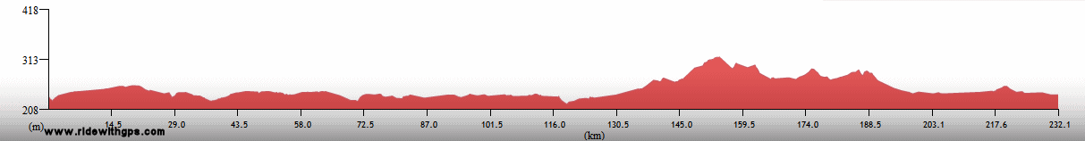
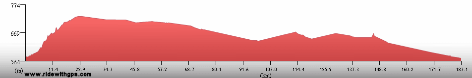
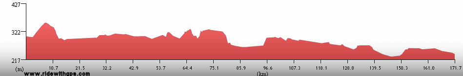
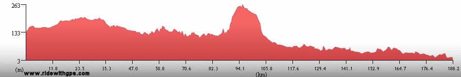
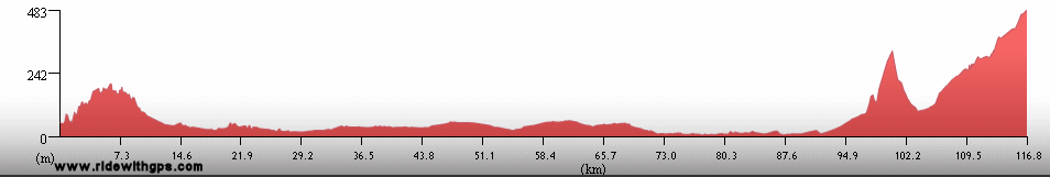
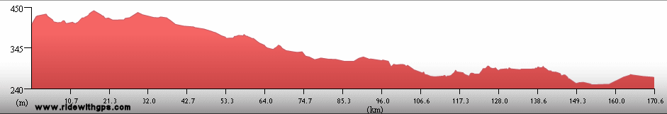
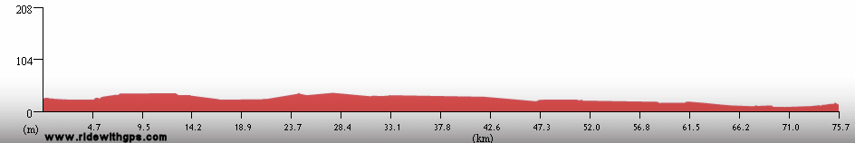
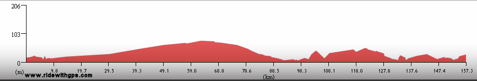
Stage 1 Actual Route
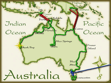
On this, and all other route maps, the blue lines represent travel by ship, red by airplane (Booo!), and green by bicycle.
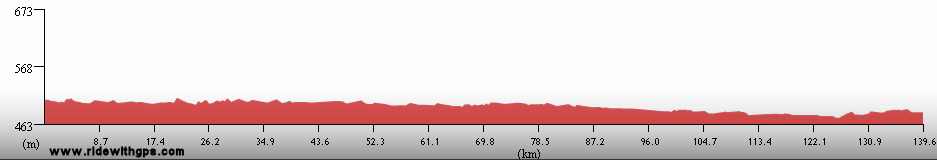
Northern Territory: The Red Center & Top End
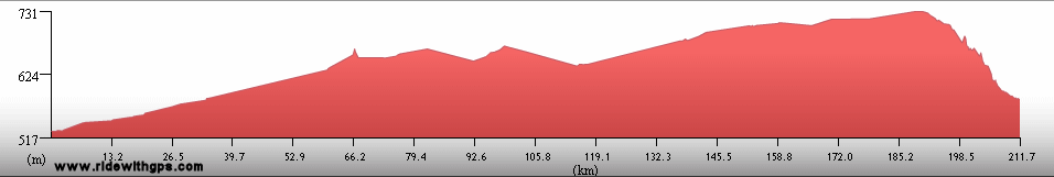
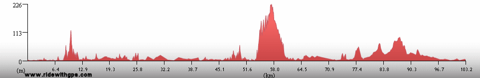
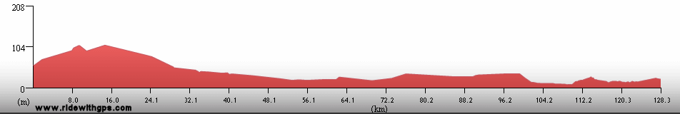
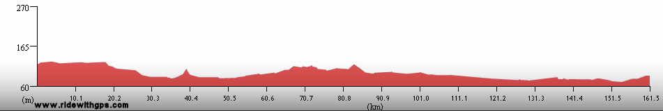
The Northern Territory is famous for its isolated towns, arid countryside, and also for some of the most appealing destinations in all of Australia. I found all of that to be true, as there were many long days of riding with not much of anything between the widely spaced roadhouses. Feeling relatively strong at that point, I took the opportunity to increase my pace and quickly traversed the open country in order to spend a little more times at the major destinations. My success at that plan depended largely on the nature of the wind on any particular day, which seemed to vary its strength and direction on just about every day. With the exception of a handful of days, I did not have too much trouble with that, which was very fortunate.
The two exceptional destinations in that section were Uluru-KataTjuta and Kakadu National Parks. Both provided unique experiences and were worth the extensions of my route that seeing them required. Kakadu was especially enjoyable, with the most varied and beautiful collection of birds of the whole Stage. All in all, the Northern Territory was one of the most appealing sections of my route in Australia.
A rather short post for a large Territory is: ~HERE~
The Barkly Highway
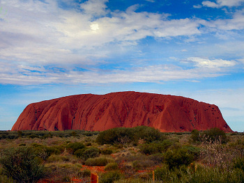
Uluru
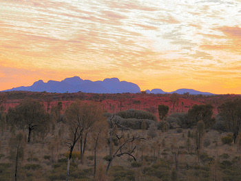
KataTjuta at Sunset
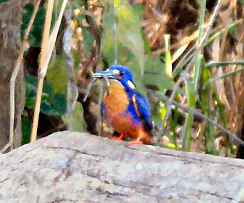
An azure kingfisher
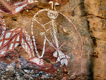
Ancient rock art, Anabangbang Gallery, Kakadu N.P.
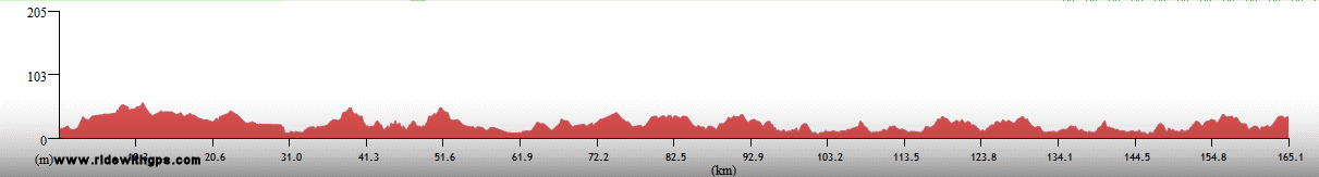
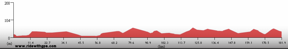
Timor Leste: A Young, Peaceful, Island Nation
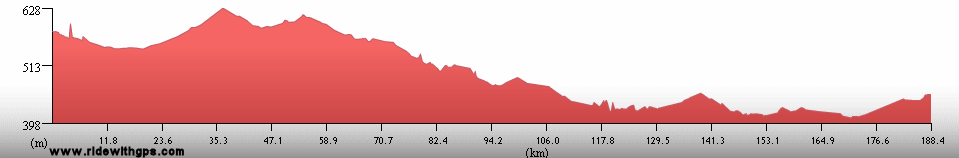
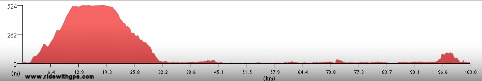
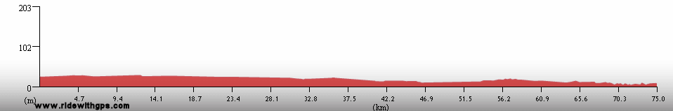
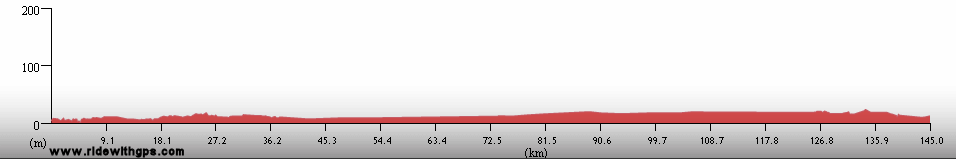
After reaching Darwin, it was time for another venture away from the Australian mainland. I chose to make a short trip to Timor Leste, the world's newest nation, to spend a short time touring there. Timor Leste occupies the eastern half of the island of Timor, about 500 km northwest of Darwin. The geologic status of the island is a little ambiguous, at least as far as my searches could determine. It is said to be composed of land originally from the Australian continental shelf, but on the other hand, it lies beyond the ocean trench that runs through the Timor Sea north of Darwin. So, if not an actual part of Gondwanaland, it is at least a land body which was uplifted due to the collision of Australia with southeast Asia.
Again, it was just an amazing experience. Despite years of oppression and conflict the people of Timor Leste were exceptionally friendly and good-natured. Additionally, the much of countryside was ideal for cycling with both easy coastal roads and some excellent mountain crossings. So I had quite a nice time on my loop along the north and south coasts, beginning and ending at the capital, Dili. Only a couple of sections of poor roads detracted from my route there.
The country has not yet completely rebuilt from the destruction of the independence crisis of 01999, but the U.N. soldiers are mostly gone, replaced by aid workers from various NGO's. However, it was a little difficult for me to distinguish which aspects of the somewhat chaotic society were due to the damage from the war, and which were typical facets of smaller out-of-the-way countries. My visit to Timor Leste was added to my route in order to avoid some Australian visa complications, and for once I'm glad that red tape got in the way, and sent me off to another interesting island.
A post of fond memories of Timor Leste is: ~HERE~
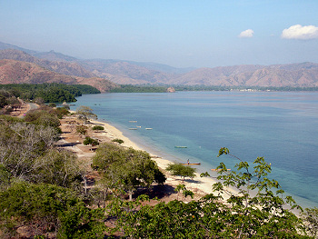
Timor's northern coast
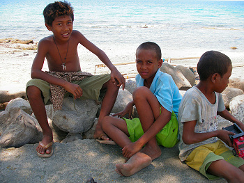
Boys in Manatuto
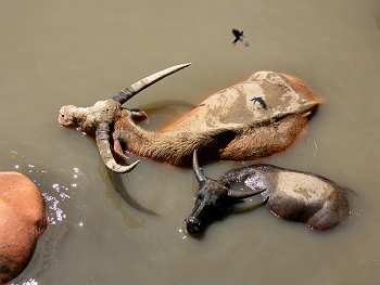
Buffalo take a swim
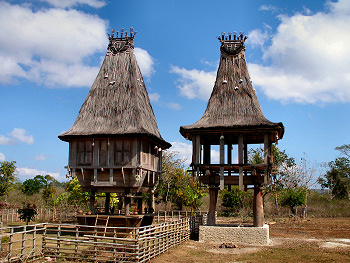
Traditional village buildings
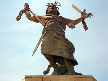
A dramatic statue in Dili
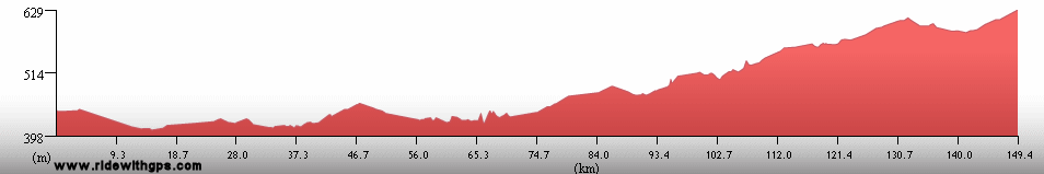
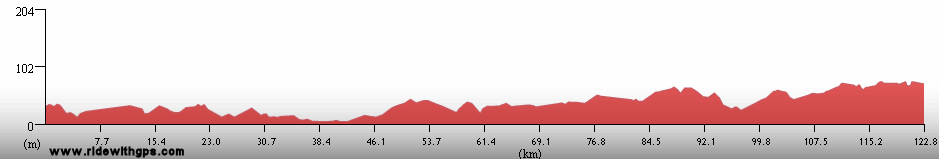
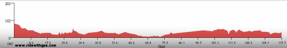
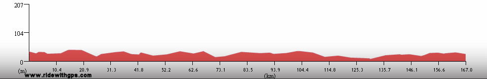
Western Australia: Large & Lonely
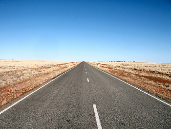
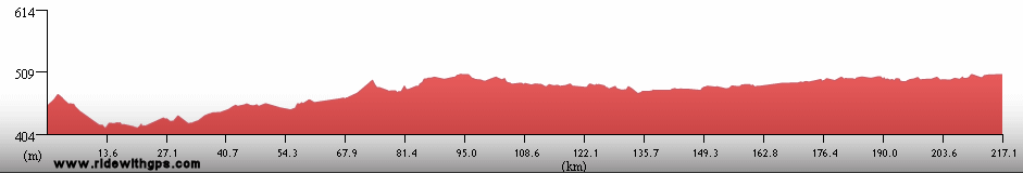
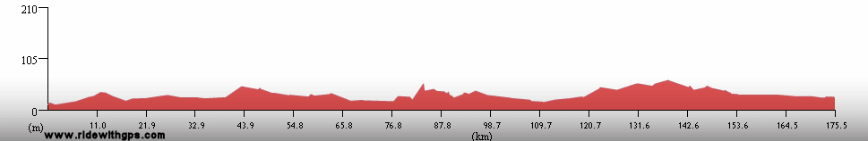
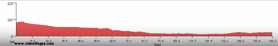
The final section of Stage 1 was a long ride to, and along the Indian coast of Western Australia. I suspected in planning my route that this would be a very difficult section, due to the long distances between services, which were even longer than those in the Northern Territory, and the potential for very hot weather. Both of these factors came into play in reality and they made the actual ride largely match my original suspicions. The heat of spring began shortly after I left Darwin, with daily maximums averaging 39 °C for most of the first three weeks, and a few days with maximums of 43 °C. With distances of up to 300 km between services, there were several significantly strenuous days.
After reaching Broome, on the Indian coast, the weather cooled down a little, which helped, but the long distances continued, and the wind began to be a real problem. In spite of that I was just barely on track to make my intended end point, Perth, on time to catch the ship connection for Stage 2. Of course, nothing is ever straightforward, and I learned just a week before the end that the ship would not be stopping at Perth after all. Instead, I needed to end the ride at Shark Bay, which was a fairly nice place to make the official end, and then transfer to Adelaide in order to board the ship there. That was definitely a major annoyance, and required me to pack the bike for the bus/air transfer, something I really did not want to do. But, the total distance of 16,602 km felt like it was adequate to get a good feel for the continent of Australia and its neighbors, the first part of Gondwanaland now being completed. With that I felt rather confident that the remaining four stages would be as successful.
The final posts from Stage 1 are: ~HERE~
Sunset at the first sighting of the Indian Ocean
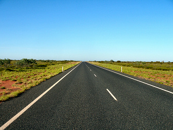
The North West Coastal Highway
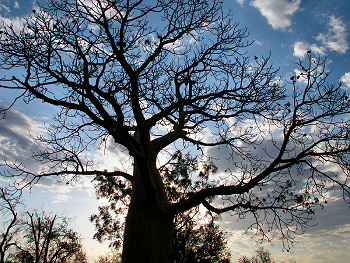
A big Boab tree
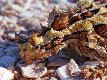
A horned lizard
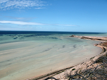
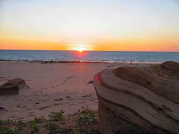
Shark Bay, near the end of Stage 1
Dates and Distances
Start: May 25, 02005
Finish: October 24, 02005
Actual Distance: 16,602 km
Ride days: 105
Rest days: 51
Highest Point
2,780 meters: Hagen Pass, Papua New Guinea
Previous | Next
Main Index | Pre-Tour Index
Post-Tour Index | Articles Index
Slideshows
Stage 1 Log
(continued)
For a description of terms and symbols look: ~HERE~
August 14, 02005
Camooweal to 30 km E. of Barkly Roadhouse, Northern Territory
Distance: 239 km
Terrain: Flat, with a section of light rolling
Max. Elevation: 310 m
Roads: Hwy 66
Max. Temp: 25 °C
Weather: Sunny; light to moderate tailwinds, diminishing by afternoon
Accommodation:

Comment: Easy conditions allow for my longest day of cycling ever
August 15
30 km E. of Barkly Roadhouse to Three Ways
Distance: 214 km
Terrain: Flat to light rolling
Max. Elevation: 340 m
Roads: Hwy 66
Max. Temp: 30 °C
Weather: Sunny; tailwinds
Accommodation:
Comment: Rather monotonus riding; could only take short breaks due to annoying flies
August 16
Three Ways to Wycliffe Well
Distance: 164 km
Terrain: Flat with a few gentle hills
Max. Elevation: 480 m
Roads: Hwy 87
Max. Temp: 27 °C
Weather: Sunny; very strong cross/headwinds in morning, diminishing during afternoon
Accommodation:
Comment: Slow going early due to bad wind, otherwise an unremarkable day
August 17
Wycliffe Well to 10 km N. of Ti Tree
Distance: 182 km
Terrain: Flat to light rolling with gradual elevation gain
Max. Elevation: 610 m
Roads: Hwy 87
Max. Temp: 26 °C
Weather: Sunny; mild crosswinds, only at midday
Accommodation:
Comment: Another uneventful day
August 18
10 km N. of Ti Tree to Alice Springs
Distance: 214 km
Terrain: Flat, with gradual elevation gain, then slight decrease
Max. Elevation: 810 m
Roads: Hwy 87
Max. Temp: 28 °C
Weather: Sunny; light tailwinds
Accommodation:

Comment: Surprising change in winds made for an easy day, rode farther than planned
August 19
Alice Springs
Max. Temp: 23 °C
Weather: Sunny; strong winds from south
Accommodation:
Comment: Rest Day in Alice Springs
August 20
Alice Springs to 13 km N. of Erldunda
Distance: 193 km
Terrain: Flat to light rolling, with gradual elevation loss
Max. Elevation: 700 m
Roads: Hwy 87
Max. Temp: 22 °C
Weather: Sunny; moderate crosswinds
Accommodation:
Comment: A fairly easy day; some pretty scenery, and many wildflowers in bloom
August 21
13 km N. of Erldunda to 42 km E. of Yulara
Distance: 219 km
Terrain: Flat to light rolling
Max. Elevation: 530 m
Roads: Hwy 87, Hwy 4
Max. Temp: 23 °C
Weather: Sunny; nice tailwinds
Accommodation:
Comment: An uneventful day; got as close as possible to Uluru
August 22
Uluru-Kata Tjuta N.P.
Distance: 51 km
Terrain: Light rolling
Max. Elevation: <300 m
Roads: Hwy 4
Max. Temp: 23 °C
Weather: Sunny; windy
Accommodation:

Comment: Short ride to rest day at Uluru-Kata Tjuta N.P.
August 23
Uluru-Kata Tjuta N.P.
Max. Temp: 23 °C
Weather: Sunny; windy
Accommodation:
Comment: Sightseeing day at Uluru-KataTjuta N.P.
August 24
Uluru-Kata Tjuta N.P. to Junction Hwys 4 & 6
Distance: 145 km
Terrain: Flat to light rolling
Max. Elevation: 530 m
Roads: Hwy 4
Max. Temp: 22 °C
Weather: Mostly cloudy; strong headwinds
Accommodation:
Comment: Start of 1000-km retrace of route back to Tennant Creek; very tiring riding due to winds
August 25
Junction Hwys 4 & 6 to 13 km N. of Erldunda
Distance: 126 km
Terrain: Flat to light rolling
Max. Elevation: 530 m
Roads: Hwy 4, Hwy 87
Max. Temp: 27 °C
Weather: Mostly sunny; very strong headwinds
Accommodation:
Comment: One of the most tiring days so far due to wind
August 26
13 km N. of Erldunda to 40 km S. of Alice Springs
Distance: 151 km
Terrain: Flat to light rolling with gradual elevation gain
Max. Elevation: 700 m
Roads: Hwy 87
Max. Temp: 28 °C
Weather: Mostly sunny; strong cross/headwinds, somewhat less in afternoon
Accommodation:
Comment: Harder than expected due to winds
August 27
Alice Springs
Accommodation:

Comment: Short ride to a Rest day in Alice Springs
August 28
Alice Springs to 20 km S. of Ti Tree
Distance: 183 km
Terrain: Flat to light rolling, with gradual elevation gain
Max. Elevation: 810 m
Roads: Hwy 87
Max. Temp: 30 °C
Weather: Sunny; moderate mornig crosswinds, calm by afternoon
Accommodation:
Comment: A much easier, though uneventful day
August 29
20 km S. of Ti Tree to 30 km S. of Wycliffe Well
Distance: 173 km
Terrain: Flat to light rolling
Max. Elevation: 700 m
Roads: Hwy 87
Max. Temp: 30 °C
Weather: Sunny; moderate headwinds at midday
Accommodation:
Comment: A rather dull day
August 30
30 km S. of Wycliffe Well to Wauchope
Distance: 51 km
Terrain: Flat to light rolling
Max. Elevation: 560 m
Roads: Hwy 87
Max. Temp: 30 °C
Weather: Sunny; very strong headwinds
Accommodation:
Comment: Stopped early due to bad winds; half rest day at Wauchope
August 31
Wauchope to 37 km S. of Banka Banka
Distance: 188 km
Terrain: Flat to light rolling
Max. Elevation: 480 m
Roads: Hwy 87
Max. Temp: 34 °C
Weather: Sunny; strong cross/headwinds during late morning, otherwise calmer
Accommodation:
Comment: A long, hot, tedious day; completed duplicate portion of route by evening
September 1
37 km S. of Banka Banka to 20 km S. of Elliot
Distance: 176 km
Terrain: Light to moderate rolling
Max. Elevation: 420 m
Roads: Hwy 87
Max. Temp: 33 °C
Weather: Sunny; moderate to strong tailwinds
Accommodation:
Comment: A little easier day due to winds, but feeling a little tired
September 2
20 km S. of Elliot to 12 km N. of Highway Inn
Distance: 184 km
Terrain: Flat to light rolling
Max. Elevation: 320 m
Roads: Hwy 87
Max. Temp: 35 °C
Weather: Sunny; moderate crosswinds
Accommodation:
Comment: A long, hot, and uneventful day
September 3
12 km N. of Highway Inn to Mataranka Homestead
Distance: 168 km
Terrain: Flat, then light rolling
Max. Elevation: 320 m
Roads: Hwy 87
Max. Temp: 35 °C
Weather: Sunny; moderate cross/tailwinds
Accommodation:
Comment: Another uneventful day
September 4
Mataranka Homestead
Accommodation:
Comment: Rest day at Mataranka. Thermal pools!
September 5
Mataranka Homestead to Cullen River
Distance: 188 km
Terrain: Flat, then light to moderate rolling
Max. Elevation: <300 m
Roads: Hwy 87
Max. Temp: 35 °C
Weather: Sunny; mild winds from various directions
Accommodation:
Comment: An easy, but rather monotonous day
September 6
Cullen River to Cooinda (Kakadu N.P.)
Distance: 199 km
Terrain: Light to moderate rolling with 1 small hill
Max. Elevation: <300 m
Roads: Hwy 87, Hwy 21
Max. Temp: 39 °C
Weather: Sunny; mild to light winds from various directions
Accommodation:
Comment: A very hot, very long day
September 7
Cooinda
Max. Temp: 36 °C
Weather: Sunny
Accommodation:
Comment: Rest/sightseeing day in Kakadu; S. Alligator River boat cruise
September 8
Cooinda to Jabiru (Kakadu N.P., inc. Anbangbang and Ubirr)
Distance: 170 km
Terrain: Flat to light rolling
Max. Elevation: <300 m
Roads: Hwy 21, Nourlangie Rd, Hwy 21, Oenpelli Rd.
Max. Temp: 37 °C
Weather: Sunny; occasional light winds from various directions
Accommodation:
Comment: A facsinating day in Kakadu; visited Anbangbang and Ubirr rock art sites
September 9
Jabiru to Pt. Stuart Rd.
Distance: 126 km
Terrain: Flat to light rolling
Max. Elevation: <300 m
Roads: Hwy 36
Max. Temp: 33 °C
Weather: Mostly sunny; occasional mild tailwinds
Accommodation:
Comment: A light day for a little more sightseeing in Kakadu
September 10
Pt. Stuart Rd. to Darwin
Distance: 142 km
Terrain: Light to moderate rolling
Max. Elevation: <300 m
Roads: Hwy 36, Hwy 1
Max. Temp: 33 °C
Weather: Sunny; moderate headwinds at midday
Accommodation:
Comment: A fast day into Darwin
September 11
Darwin
Max. Temp: 32 °C
Weather: Sunny
Accommodation:
Comment: Rest/chores day in Darwin
September 12
Darwin to Dili, Timor Leste
Distance: 20 km
Accommodation:
Comment: Air transfer to Dili
September 13
Dili to 30 km W. of Baucau
Distance: 130 km
Terrain: Light to moderate rolling, 250-m climb, a few smaller climbs
Max. Elevation: <300 m
Roads: North Coast Rd.
Max. Temp: 32 °C
Weather: Sunny, minimal wind
Accommodation:
Comment: Some very beautiful cycling
September 14
30 km W. of Baucau to Com
Distance: 118 km
Terrain: 500-m climb/descent, then flat with a dew small hills
Max. Elevation: 510 m
Roads: North Coast Rd
Max. Temp: 33 °C
Weather: Sunny, minimal wind
Accommodation:
Comment: Another very beautiful day
September 15
Com
Max. Temp: 32 °C
Weather: Sunny
Accommodation:
Comment: Very nice rest day in Com
September 16
Com to 11 km W. of Iliomar
Distance: 111 km
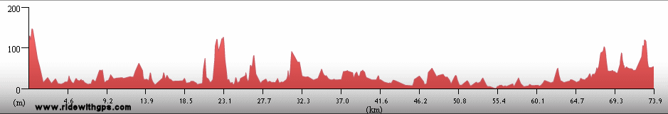
Terrain: 480-m climb, then moderate rolling, then hilly, 400-m climb
Max. Elevation: 750 m
Roads: Com-Los Palos Rd. (some rough gravel); Los Palos-Viqueque Rd. (very rough pavement/gravel)
Max. Temp: 29 °C
Weather: Sunny; occasional light winds from various directions
Accommodation:
Comment: A much harder day; included 28 km due to wrong turn before Los Palos
September 17
11 km W. of Iliomar to Viqueque
Distance: 83 km
Terrain: Flat to light rolling with a few small hills
Max. Elevation: <300 m
Roads: Los Palos-Viqueque Rd. (pavement with some rough/gravel sections; two bridges washed out)
Max. Temp: 31 °C
Weather: Sunny, occasional light winds
Accommodation:
Comment: Half day for a brief rest in Viqueque; somewhat better conditions, but still slow riding
September 18
Viqueque to Same
Distance: 126 km
Terrain: Short hilly section, then flat, 480-m climb (incomplete)
Max. Elevation: 486 m
Roads: Viqueque-Same Rd. (some rough patches near start, improving along the way; two bridges washed out)
Max. Temp: 32 °C
Weather: Sunny, occasional light crosswinds
Accommodation:
Comment: Better conditions than expected, made an easier day. Swam in the Timor Sea
September 19
Same to Dili
Distance: 123 km
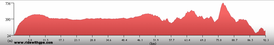
Terrain: Mountainous; 1,330-m climb, 400-m climb, a few smaller climbs, descent to sea level

Max. Elevation: 1,815 m
Roads: Same-Dili Rd. (one gravel/dirt section under repair otherwise good pavement)
Max. Temp: 30 °C
Weather: Sunny with some afternoon clouds at altitude; a little windy at the passes
Accommodation:
Comment: Some beautiful scenery, longer distance than expected
September 20
Dili to Darwin, Australia
Distance: 5 km
Accommodation:
Comment: Air transfer to Darwin
September 21
Darwin
Max. Temp: 34 °C
Weather: Sunny
Accommodation:
Comment: Rest/chores day in Darwin
September 22
Darwin to 20 km S. of Adelaide River
Distance: 183 km
Terrain: Flat to light rolling
Max. Elevation: <300 m
Roads: Cullen Bay Ferry, Hwy 37 (5-km gravel section), Hwy 87
Max. Temp: 39 °C
Weather: Sunny; occasional afternoon crosswinds
Accommodation:
Comment: A hot, rather tedious day; took ferry to Cox Peninsula to avoid Darwin sprawl
September 23
20 km S. of Adelaide River to Edith River
Distance: 141 km
Terrain: Moderate to light rolling
Max. Elevation: <300 m
Roads: Hwy 87
Max. Temp: 37 °C
Weather: Sunny; moderate to light cross/headwinds
Accommodation:
Comment: Another hot, tiring day; stopped earlier than planned
September 24
Katherine
Distance: 43 km
Terrain: Flat
Max. Elevation: <300 m
Roads: Hwy 87
Weather: Sunny
Accommodation:
Comment: Short ride to rest day in Katherine
September 25
Katherine to 16 km E. of Victoria River
Distance: 185 km
Terrain: Flat to moderate rolling
Max. Elevation: 307 m
Roads: Hwy 1
Max. Temp: 38 °C
Weather: Mostly sunny; occasional light tail/crosswinds
Accommodation:
Comment: A few morning and evening clouds blocked the sun a little, but still a long, hot day; no services on route
September 26
16 km E. of Victoria River to 50 km W. of Timber Creek
Distance: 161 km
Terrain: Light rolling
Max. Elevation: <300 m
Roads: Hwy 1
Max. Temp: 38 °C
Weather: Sunny; light to moderate cross/headwinds
Accommodation:
Comment: Still hot, a little slower due to wind; some nice scenery at morning
September 27
50 km W. of Timber Creek to Kununurra
Distance: 186 km
Terrain: Flat to moderate rolling
Max. Elevation: <300 m
Roads: Hwy 1
Max. Temp: 38 °C
Weather: Sunny; occasional moderate crosswinds
Accommodation:
Comment: A hot, exhausting day; no services on route; rode hard to reach rest day at Kununurra
September 28
Kununurra
Weather: Sunny
Accommodation:
Comment: Rest day in Kununurra
September 29
Kununurra to Warmun
Distance: 203 km m
Terrain: Light to moderate rolling with a few small hills
Max. Elevation: 365 m
Roads: Hwy 1
Max. Temp: 39 °C
Weather: Sunny; moderate tailwinds after turning south
Accommodation:
Comment: A long and hot, but relatively easy day; some nice scenery
September 30
Warmun to Halls Creek
Distance: 171 km
Terrain: Moderate to heavy rolling with a small climb and elevation gain

Max. Elevation: 480 m
Roads: Hwy 1
Max. Temp: 40 °C
Weather: Sunny; occasional moderate to strong crosswinds
Accommodation:
Comment: A hot and tedious day
October 1
Halls Creek
Weather: Sunny
Accommodation:
Comment: Rest day in Halls Creek; air tour of Purnululu N.P.
October 2
Halls Creek to 125 km E. of Fitzroy Crossing
Distance: 171 km
Terrain: Flat to light rolling
Max. Elevation: 430 m
Roads: Hwy 1
Max. Temp: 39 °C
Weather: Mostly sunny; light to moderate cross/tailwinds
Accommodation:
Comment: Morning clouds blocked sun which helped,but another hot tedious day; no services on route
October 3
125 km E. of Fitzroy Crossing to Fitzroy Crossing
Distance: 129 km
Terrain: Light rolling to flat
Max. Elevation: 305 m
Roads: Hwy 1
Max. Temp: 43 °C
Weather: Sunny; moderate to strong head/crosswinds
Accommodation:
Comment: A nearly calamatous day, hottest so far, bad winds, tired and thirsty from the start, no services on route; luckily found small water source
October 4
Fitzroy Crossing
Weather: Sunny
Accommodation:
Comment: Rest day in Fitzroy Crossing
October 5
Fitzroy Crossing to 30 km W. of Jimbalakudunj
Distance: 140 km
Terrain: Light rolling, then flat
Max. Elevation: <300 m
Roads: Hwy 1
Max. Temp: 38 °C
Weather: Sunny, moderate to strong headwinds
Accommodation:
Comment: Rode 50% of distance after dark to avoid heat and wind; wind blew anyway; no services on route
October 6
30 km W. of Jimbalakudunj to Bedunburra
Distance: 150 km
Terrain: Flat to light rolling
Max. Elevation: <300 m
Roads: Hwy 1
Max. Temp: 38 °C
Weather: Sunny; moderate to strong head/crosswinds
Accommodation:
Comment: Still slow going but roadhouse on route, with a nice pool, helped make a better day
October 7
Bedunburra to Broome
Distance: 126 km
Terrain: Flat to light rolling
Max. Elevation: <300 m
Roads: Hwy 1, Broome Hwy
Max. Temp: 38 °C
Weather: Sunny; Occasional light winds, various directions
Accommodation:
Comment: A little cooler and less wind in morning so a better day; shorter ride to a long rest break in Broome
October 8
Broome
Distance: 27 km
Max. Temp: 34 °C
Weather: Sunny
Accommodation:
Comment: Rest day in Broome
October 9
Broome
Max. Temp: 34 °C
Weather: Sunny
Accommodation:
Comment: Sightseeing day in Broome; visited Beagle Bay Community
October 10
Broome to Frazier Downs
Distance: 182 km
Terrain: Flat to light rolling
Max. Elevation: <300 m
Roads: Broome Hwy, Hwy 1
Max. Temp: 36 °C
Weather: Sunny; light to moderate winds, various directions
Accommodation:
Comment: Another tedious day; no services for final 80% of route
October 11
Frazier Downs to 25 km S. of Sandfire Roadhouse
Distance: 171 km
Terrain: Flat to light rolling
Max. Elevation: <300 m
Roads: Hwy 1
Max. Temp: 35 °C
Weather: Sunny; very strong morning cross/headwinds, light afternoon cross/tailwinds
Accommodation:
Comment: A slow day due to wind; no services for first 85% of route
October 12
Eighty Mile Beach
Distance: 30 km
Accommodation:
Comment: Rest Day at Eighty Mile Beach; swam in Indian Ocean
October 13
Eighty Mile Beach to DeGrey River
Distance: 174 km
Terrain: Flat to light rolling
Max. Elevation: <300 m
Roads: Hwy 1
Max. Temp: 33 °C
Weather: Sunny; mild morning headwinds, strong afternoon cross/headwinds
Accommodation:
Comment: Heat down somewhat; bland scenery; one roadhouse on route
October 14
DeGrey River to South Hedland
Distance: 83 km
Terrain: Flat to light rolling
Max. Elevation: <300 m
Roads: Hwy 1
Max. Temp: 31 °C
Weather: Sunny; strong headwinds
Accommodation:
Comment: Half day with rest at South Hedland
October 15
South Hedland to 21 km E. of Roebourne
Distance: 171 km
Terrain: Flat to light rolling with one small hill
Max. Elevation: <300 m
Roads: Hwy 1
Max. Temp: 31 °C
Weather: Sunny; light morning crosswinds, strong afternoon head/crosswinds
Accommodation:
Comment: A little more interesting scenery
October 16
21 km E. of Roebourne to 16 km N. of Fortescue River Roadhouse
Distance: 147 km
Terrain: Flat to light rolling with one small hill
Max. Elevation: <300 m
Roads: Hwy 1
Max. Temp: 32 °C
Weather: Partly cloudy; moderate morning headwinds, very strong by afternoon through evening
Accommodation:
Comment: Terrible winds made for an agonizing day
October 17
16 km N. of Fortescue River Roadhouse to 35 km N. of Nanutarra Roadhouse
Distance: 145 km
Terrain: Light rolling
Max. Elevation: <300 m
Roads: Hwy 1
Max. Temp: 28 °C
Weather: Sunny; light to very strong headwinds
Accommodation:
Comment: Another slow day; rode a little after dark for calmer wind
October 18
35 km N. of Nanutarra Roadhouse to Winning Station Rd.
Distance: 176 km
Terrain: Light to moderate rolling
Max. Elevation: <300 m
Roads: Hwy 1
Max. Temp: 32 °C
Weather: Sunny; occasional light crosswinds (!)
Accommodation:
Comment: Got back on track somewhat thanks to break in the wind
October 19
Winning Station Rd. to Cooralya Station Rd
Distance: 161 km
Terrain: Light rolling
Max. Elevation: <300 m
Roads: Hwy 1
Max. Temp: 28 °C
Weather: Sunny; light morning crosswinds, strong afternoon head/crosswinds
Accommodation:
Comment: Stronger winds, but tolerable; saw many emus
October 20
Cooralya Station Rd to Carnarvon
Distance: 72 km
Terrain: Flat to light rolling
Max. Elevation: <300 m
Roads: Hwy 1
Max. Temp: 25 °C
Weather: Sunny; moderate to strong head/crosswinds
Accommodation:
Comment: Half day to a rest break in Carnarvon
October 21
Carnarvon
Accommodation:
Comment: Rest day in Carnarvon; learned that ship will not call Fremantle
October 22
Carnarvon to Gladstone
Distance: 147 km
Terrain: Flat to light rolling
Max. Elevation: <300 m
Roads: Hwy 1
Max. Temp: 25 °C
Weather: Sunny; light headwinds, strong evening crosswinds
Accommodation:
Comment: Fairly easy ride; spent a lot of time making new transfer arrangements for Stage 2
October 23
Gladstone to 12 km N. of Nanga Bay
Distance: 161 km
Terrain: Flat, then moderate to light rolling
Max. Elevation: <300 m
Roads: Hwy 1, Denham Rd
Max. Temp: 28 °C
Weather: Sunny; light winds, stronger in evening, various directions
Accommodation:
Comment: Next to last day, went farther into Shark Bay area; saw Hamelin Pool Stromatolites
October 24
12 km N. of Nanga Bay to Denham
Distance: 186 km
Terrain: Moderate to light rolling
Max. Elevation: <300 m
Roads: Denham Rd.
Max. Temp: 24 °C
Weather: Mostly cloudy; strong tailwinds most of day
Accommodation:
Comment: End of Stage 1!!, rode back to main Hwy for transfer to Adelaide via Perth
Index | Next Page
Pre-Tour Stage 1 Stage 2 Stage 3 Stage 4 Stage 5 |