Stage 4: The Continent's Cone
Wind, cold, wind, loneliness,
wind & wind
The Tour Reports section of the site now contains the posts that I sent to the Phred Touring List (now on Google Groups) during the Tour. Those from the early days of the Tour were rather thin, while later on, for some of the more unique countries, they contain much more thorough accounts of the ride, and an occasional amusing anecdote. Towards the end of the Tour, however, I frequently couldn't keep up with the chore of sending posts on time, so the last several were written after the Tour was complete. Look for links to the posts at the end of the short descriptions beginning below.
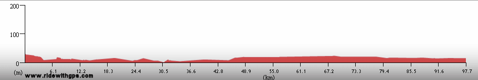
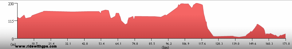
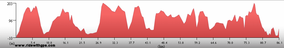
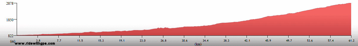
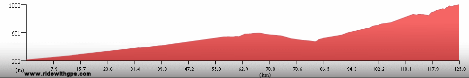
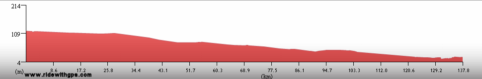
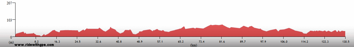
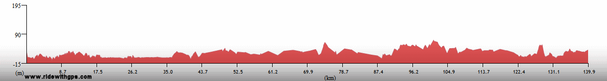
Stage 4 Actual Route

On this, and all other route maps, the blue lines represent travel by ship, red by airplane (Booo!), and green by bicycle.
Argentina: Pampas, Patagonia, & Littoral
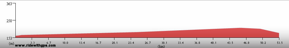
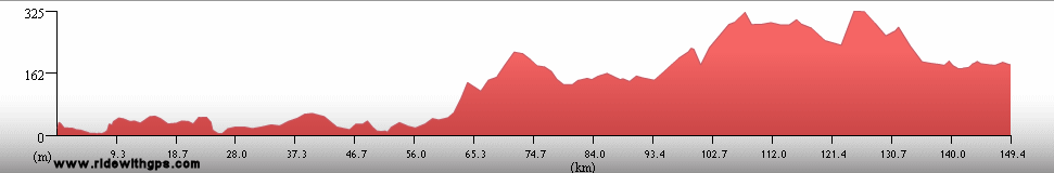
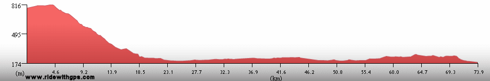
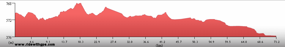
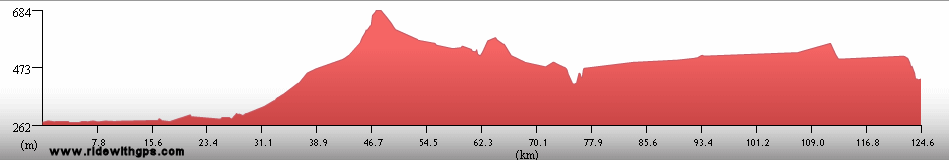
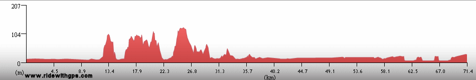
The first six months of Stage 4 were spent in only two countries, Argentina and Chile, with my route crossing the borders between those nations on six occasions. Up first was a section along the east coast of Argentina to Tierra del Fuego and the most southerly city in the world, Ushuaia, a mecca for cyclists touring the Americas. Most things went fairly well for me in that region, though, to be sure, there were some long, lonely distances to be overcome, and, as I suspected reports of the ferocity of the winds in the region had not been exaggerated. In spite of that, the mix of broad Patagonian landscapes and the refinement of Argentine towns, proved to be quite a refreshing change of pace from the environs I experienced through most of Stage 3. Highlights of that section were the famous wildlife-viewing areas on Peninsula Valdez, though I visited there at a time of year that was less than ideal, the colony of Magellanic Penguins at Punta Tombo, and Tierra del Fuego itself, whose unique environment defined its place as the southernmost part of the Tour.
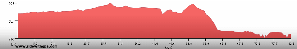
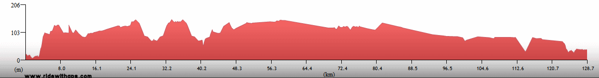
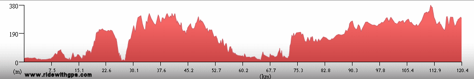
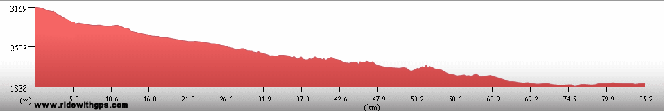
The second section in Argentina was included as a means to avoid the roadless areas of southern Chile, and the Southern Patagonian Ice Cap, and involved a route 1,500 kilometers in length along the eastern edge of the Andes from Fuentes del Coyle to Rio Mayo. However, that deviation was not necessarily a disadvantage as there were some excellent things to be seen in that part of the country. Parque Nacional Los Glaciares, home to the famous Perito Moreno Glacier, was one of those, though I would have preferred just slightly better weather while I was there. Perhaps my favorite visit in that section was the rather out-of-the way pictographs site at Cuevas de Las Manos, which displayed one of the most impressive assemblages of Rock Art I saw during the entire Tour. On the other hand, this area proved to be one of the most difficult of the Stage, with great distances between services, the often-rough surface of Ruta 40, and, of course, the ever-present wind. Without a doubt that part of Patagonia ended up claiming the prize for the windiest region of the Tour. My northerly progress, back towards the north, and the warmer parts of the continent, was significantly held back by the toughness of travel through that area.
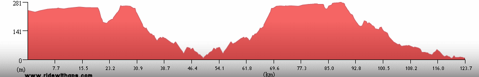
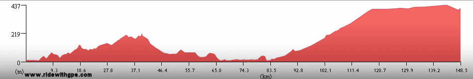
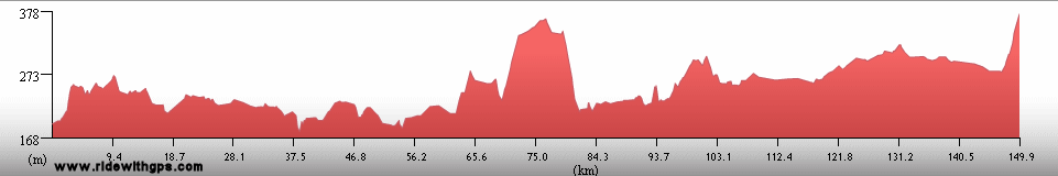
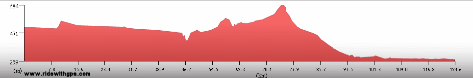
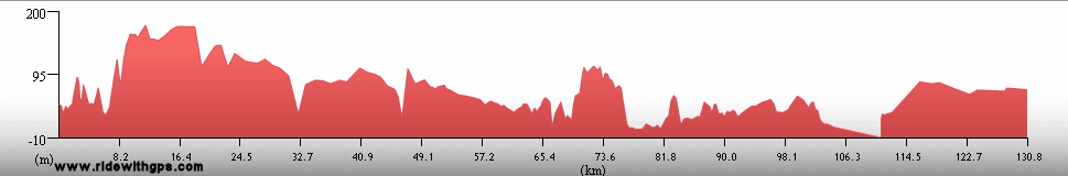
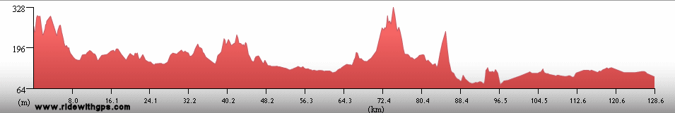
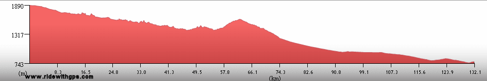
The final of the three initial sections of the route in Argentina, came a little later, after my visit to Chile was complete. Beginning at the Paso Libertadores, the Andean crossing closet to Santiago, Chile and Mendoza, Argentina, which is actually a tunnel, I then turned north for a while, and then finally eastward, as I crossed back to the Atlantic side of the continent, for my long-awaited return to the tropics. The climate was generally much more agreeable during that section, which helped me keep a steady pace, at least for the a while. Though major attractions were fewer and less grand in that area, the more relaxed feel of the towns and cities in the western half of that section was enjoyable in its own right. Interesting stops were at Ischigualasto Provincial Park, the historic center of Cordoba, and at a shrine to the historic heroine Difunta Correa, excessively outlandish in a typically Argentinean way. East of Cordoba, I needed to cross the region known as El Littoral, the agricultural zone north of Buenos Aires, bisected by the Rio Parana, which would have been pleasant enough were it not for the horrendously bad traffic throughout that area. If I had to pick one section of the Tour to have avoided, that might have been the one. Once safely though that stressful area, I was set for a change scene in Uruguay and Brazil, though I was not finished with Argentina just yet.
Three tours though the country in two posts: ~HERE~

A busy shopping street in Buenos Aires

Pampas south of Buenos Aires

A family of Guanacos in Patagonia

Ruta 3 crossing southern Patagonia

Magellanic Penguins at Punta Tombo

Extreme southern Andes on Tierra del Fuego

Parque Nacional Tierra del Fuego

Perito Moreno Glacier; Parque Nacional Los Glaciares

Lonely Ruta 40 in western Patagonia

Pictographs at Cuevas de las Manos

Domes of Cordoba Cathedral
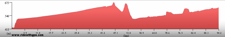
Chile: The Bottom of the World and Back
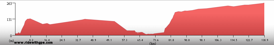
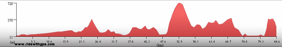
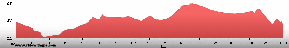
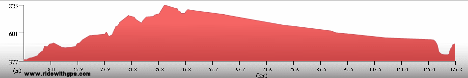
Like Argentina, my route through Chile was split into more than one section. The major segments included a fairly short ride though the extreme southern province of the country, and later a much longer route, beginning in the temperate rainforests of Chilean Patagonia, continuing across Chiloe Island, and then north through the most populated and fertile part of the country, and finally turning east, climbing the Andes, and departing the country into Argentina. The first section began at the Tours southernmost point, Isla Navarino, at a latitude just shy of 56 degrees south, and while Ushuaia, Argentina can claim to be the most southerly city in the world, my starting point in Chile, Puerto Williams, can actually best that, and is the world's most southerly small town. However, to reach the only roads in the region, I first needed to take an incredibly scenic ferry trip through the Canal Beagle and the Strait of Magellan , to the main city of the region, Punta Arenas. Other highlights of this section were the pleasant little town of Puerto Natales, and Parque Nacional Torres del Paine, though the rapid approach of the Austral winter made the weather during the latter stop a little less than ideal.
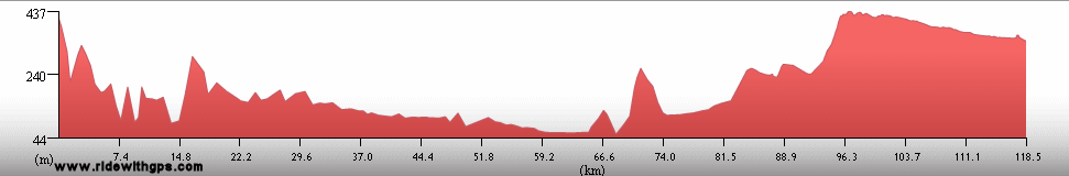
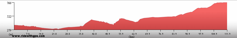
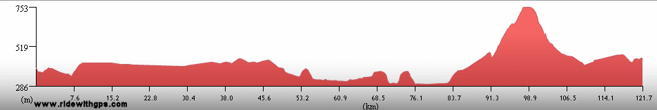
The following section was where I spent the most time in the country, starting in the pleasant southern city of Coyhaique. From there I rode a section of the famous Carretera Austral as far as the nice little town of Chaiten, which, unfortunately, may never exist again thanks to subsequent eruptions of a nearby volcano. A quick tour of Chiloe Island, and its historic wooden churches, came next, and marked my return to the mild climate of central Chile. The remainder of the route through the country lacked any spectacular destinations, but was well stocked with good touring facilities. The rather busy Highway 5 the southern end of the Panamerican Highway, and the stubborn head cold I caught in Santiago, were the only real drawbacks I encountered. Other interesting places on the route were the coastal cities of Valdivia, Concepcion, and Valparaiso, with its historic port. The end of the section came after the first long climb of the Stage, ending at the base of the highest peak in the western hemisphere, the cloud-obscured Cerro Aconcagua.
A fairly long post for a long country: ~HERE~

Puerto Williams, Southernmost point of the Tour

The Canal Beagle and Cordillera Darwin

Ferdinan Magellan statue in Punta Arenas

Parque Nacional Torres del Paine

The Carretera Austral in Patagonia

The coastal town of Chaiten, abandoned one year later due to volcano

Santiago Cathedral

A Pacific sunset at Zapallar

Lago del Inca in the Andes
Uruguay: Small But Welcoming
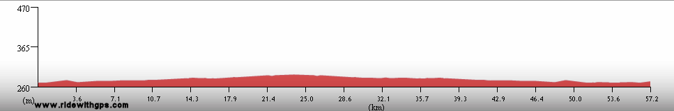
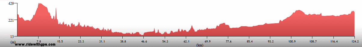
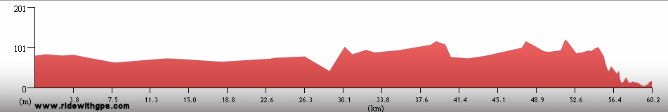
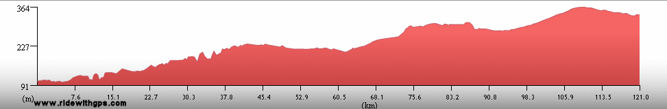
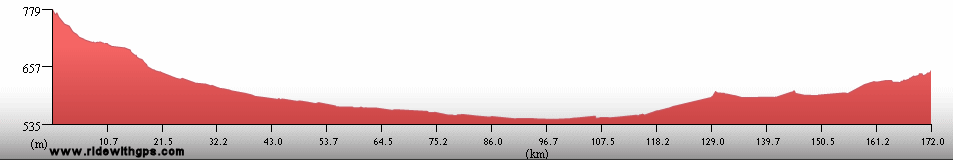
Uruguay was the smallest county in Stage 4, but, nevertheless, was an enjoyable place to visit. A big reason for that was its generally excellent network of roads, which were among the best of the Stage. Without any first-level destinations, I primarily enjoyed the basic pleasures of touring while there, namely nice riding, friendly people, and good food. Though I would have liked to tour the country's interior, my route followed closely its three "coastslines", the western coast formed by the Rio Uruguay, the southern cost of the Rio de la Plata, and the eastern coast formed by, of course, the Atlantic Ocean. Important points along that course were Colonia del Sacramento, an historic former contraband port, the capital, Montevideo, and my reacquaintance with the Atlantic. However, as the country is located in a temperate zone, and with winter fast approaching, I did not waste much time while passing through on my way back to the warmth of the tropics.
A post with a little detail for a little country: ~HERE~

The Rio Uruguay

Historic Colonia del Sacramento

Montevideo

Faro Jose Ignacio on the Atlantic coast
Previous | Next
Main Index | Pre-Tour Index
Post-Tour Index | Articles Index
Slideshows
Stage 4 Log
For a description of terms and symbols look: ~HERE~
February 19, 02007
Buenos Aires to Coronel Brandsen
Distance: 80 km
Terrain: Flat
Max. Elevation: <300 m
Roads: Av. 9 de Julio, Av. Hipolito Yrigoyen, RP 29
Max. Temp: 29 °C
Weather: Sunny; mild crosswinds
Accommodation:

Comment: 1st day of Stage 4!; Half day due to late start and very poor fitness after long layoff
February 20
Coronel Brandsen to Real Audiencia
Distance: 126 km
Terrain: Flat
Max. Elevation: <300 m
Roads: RP 29
Max. Temp: 29 °C
Weather: Sunny; occasional light winds, various directions
Accommodation:

Comment: Wanted to go considerably farther, but poor fitness still a big slowdown
February 21
Real Audiencia to Ayacucho
Distance: 132 km
Terrain: Flat
Max. Elevation: <300 m
Roads: RP 29
Max. Temp: 28 °C
Weather: Sunny through afternoon, then cloudy; light tailwinds, occasionally moderate to strong at midday
Accommodation:
Comment: Felt a little stronger, but decided to stop for an extra rest day; saw many birds
February 22
Ayacucho
Accommodation:
Comment: Rest day in Ayacucho
February 23
Ayacucho to 45 km N. of Necochea
Distance: 165 km
Terrain: Flat; flat to light rolling
Max. Elevation: <300 m
Roads: RP 29, RN 226 (narrow with heavy traffic), RP 55
Max. Temp: 27 °C
Weather: Mostly cloudy to cloudy, just a few evening raindrops; mild tail/crosswinds
Accommodation:
Comment: Felt somewhat better, and easy conditions made for first productive day of Stage; actual distance 25 km longer than map indicated
February 24
45 km N. of Necochea to 18 km W. of Energia
Distance: 119 km
Terrain: Flat
Max. Elevation: <300 m
Roads: RP 55, RN 227, RN 228
Max. Temp: 30 °C
Weather: Mostly sunny; moderate crosswinds, strong cross/headwinds in afternoon
Accommodation:
Comment: A disappointingly short and tiring day, mostly due to hard winds
February 25
18 km W. of Energia to 40 km E of Coronel Dorrego
Distance: 137 km
Terrain: Flat, one section flat to light rolling
Max. Elevation: <300 m
Roads: RN 228, RA 3 (narrow with heavy traffic)
Max. Temp: 31 °C
Weather: Sunny, quickly clouding over in late afternoon; moderate cross/headwind, then cross/tailwind late morning through late afternoon
Accommodation:
Comment: Somewhat better day, but wanted to go farther; stopped after tiring of traffic and upon finding a decent camp spot
February 26
40 km E of Coronel Dorrego to Bahia Blanca
Distance: 147 km
Terrain: Flat
Max. Elevation: <300 m
Roads: RA 3
Max. Temp: 28 °C
Weather: Sunny, increasing clouds in evening; occasional light tailwinds
Accommodation:
Comment: A reasonably easy day; stayed in town to clean up
February 27
Bahia Blanca to Mayor Buratovich
Distance: 102 km
Terrain: Flat; flat to light rolling; flat
Max. Elevation: <300 m
Roads: RA 3
Max. Temp: 27 °C
Weather: Sunny; strong to very strong headwinds
Accommodation:
Comment: A late start and bad winds caused a short, tiring day
February 28
Mayor Buratovich to Carmen des Patagones
Distance: 190 km
Terrain: Flat; flat to light rolling
Max. Elevation: <300 m
Roads: RA 3
Max. Temp: 29 °C
Weather: Sunny, partly sunny in late afternoon; moderate to very strong tailwinds
Accommodation:
Comment: A relatively easy day thanks to fortunate reversal of winds
March 1
Carmen des Patagones
Accommodation:
Comment: Rest day in Carmen des Patagones
March 2
Carmen des Patagones to Viedma
Distance: 60 km
Terrain: Flat

Max. Elevation: <300 m
Roads: RA 3
Accommodation:
Comment: Began ride, but had to return to Viedma after tire failures; found suitable replacemnt in town
March 3
Viedma
Accommodation:
Comment: Planned to ride, but very sleepy, so took extra rest day
March 4
Viedma to 70 km E. of San Antonio Oeste
Distance: 116 km
Terrain: Flat; light rolling to flat
Max. Elevation: <300 m
Roads: RA 3
Max. Temp: 28 °C
Weather: Sunny to mostly sunny; moderate to strong cross- to cross/headwinds
Accommodation:
Comment: Wanted to go somewhat further, but late start and stopped early after worn down by wind; no services on route
March 5
70 km E. of San Antonio Oeste to 80 km N. of Sierra Grande
Distance: 120 km
Terrain: Light rolling to flat
Max. Elevation: <300 m
Roads: RA 3
Max. Temp: 25 °C
Weather: Sunny, some clouds in late afternoon; light to strong cross/headwinds, becoming headwinds
Accommodation:
Comment: Another day shorter than planned; expected tailwinds when road turned south, but got headwinds instead; stopped early again because of that
March 6
80 km N. of Sierra Grande to 27 km N. of Sierra Grande
Distance: 53 km
Terrain: Light rolling
Max. Elevation: <300 m
Roads: RA 3
Max. Temp: 13 °C
Weather: Cloudy; light rain morning through afternoon; strong headwinds
Accommodation:
Comment: A miserable half day due to weather; no services on route; stopped to wait out storm
March 7
27 km N. of Sierra Grande to Puerto Madryn
Distance: 171 km
Terrain: Light rolling; moderate rolling; flat

Max. Elevation: <300 m
Roads: RA 3
Max. Temp: 19 °C
Weather: Cloudy; moderate tail/crosswinds
Accommodation:
Comment: Finally, another productive day thanks to change in winds
March 8-10
Puerto Madryn
Accommodation:
Comment: Rest/weather delay/sightseeing days in Puerto Madryn; visited Peninsula Valdez
March 11
Puerto Madryn to 60 km S. of Trelew
Distance: 131 km
Terrain: Light rolling to flat, with a few small hills and one small climb
Max. Elevation: <300 m
Roads: RA 3 (most with shoulder, 1st in S.A.)
Max. Temp: 25 °C
Weather: Sunny; moderate to strong head/crosswinds
Accommodation:
Comment: Another tough wind day, and slightly late start; actual route longer than map indicated; did not get as far as hoped
March 12
60 km S. of Trelew to 22 km N. of Cabo Raso
Distance: 120 km
Terrain: Light rolling; 1 small descent/climb
Max. Elevation: 306 m
Roads: RP 75, RP 1 (good gravel), Punta Tombo Rd. (good to fair gravel), RP 1 (fair to good Gravel)
Max. Temp: 23 °C
Weather: Sunny; strong crosswinds
Accommodation:
Comment: A reasonable day considering conditions, but would have liked to have gone a little farther; visited Punta Tombo penguin colony; also saw many guanacos
March 13
22 km N. of Cabo Raso to 50 km W. of Camarones
Distance: 150 km
Terrain: Light to moderate rolling; gradual 400-m climb
Max. Elevation: 460
Roads: RP 1 (fair to good gravel), RP 30
Max. Temp: 21 °C
Weather: Sunny, then cloudy in afternoon; mild tailwinds in late afternoon
Accommodation:
Comment: A good day considering long section on gravel; first calm wind day in a long time; beautiful solitude
March 14
50 km W. of Camarones to 20 km N. of Pampas de Salamanca
Distance: 119 km
Terrain: Very slow elevation gain; flat to light rolling
Max. Elevation: 626 m
Roads: RP 30, RA 3
Max. Temp: 17 °C
Weather: Partly cloudy; strong head/crosswinds, becoming more cross- and diminishing slightly in evening
Accommodation:
Comment: A rather unpleasant day; return of winds and too much traffic; could have gone a little farther, but stopped after tiring of traffic; next day short in any case
March 15
20 km N. of Pampas de Salamanca to Comodoro Rivadavia
Distance: 98 km
Terrain: Flat to light rolling; 480-m descent; light rolling
Max. Elevation: 705 m
Roads: RA 3
Max. Temp: 23 °C
Weather: Sunny
Accommodation:
Comment: Another beautiful reversal; easy half day to rest break in Comodoro Rivadavia; winds calm
March 16
Comodoro Rivadavia
Accommodation:
Comment: Rest day in Comodoro Rivadavia
March 17
Comodoro Rivadavia to Fitz Roy
Distance: 159 km
Terrain: Moderate rolling; light rolling to flat; with one small climb
Max. Elevation: <300 m
Roads: RA 3
Max. Temp: 24 °C
Weather: Sunny; strong crosswinds, becoming moderate tailwinds in afternoon
Accommodation:
Comment: Despite late start a relatively easy, productive day; some nice coastal scenery; somewhat less traffic
March 18
Fitz Roy to 30 km N. of Tres Cerros
Distance: 108 km
Terrain: Flat; moderate rolling
Max. Elevation: <300 m
Roads: RA 3
Max. Temp: 25 °C
Weather: Cloudy, strong tailwinds; sunny, very very strong crosswinds by midday
Accommodation:
Comment: A completely messed up day; expected to go much farther with good conditions in morning, but after change of wind, had to stop, as riding was unsafe; no services on route
March 19
30 km N. of Tres Cerros to Puerto San Julian
Distance: 177 km
Terrain: Light rolling to flat; moderate rolling; one small descent
Max. Elevation: <300 m
Roads: RA 3
Max. Temp: 19 °C
Weather: Sunny, partly cloudy at midday; strong to moderate crosswinds midday through evening
Accommodation:
Comment: Long day without aid from wind, but reasonably easy
March 20
Puerto San Julian
Accommodation:
Comment: Rest day in Puerto San Julian; boat tour of estuary; saw many sea birds
March 21
Puerto San Julian to Comandante Luis Piedra Buena
Distance: 127 km
Terrain: Light to moderate rolling; flat, light rolling
Max. Elevation: <300 m
Roads: RA 3
Max. Temp: 19 °C
Weather: Sunny, partly cloudy in late afternoon; moderate crosswinds, becoming strong head/crosswinds in afternoon
Accommodation:
Comment: A very tedious, monotonous day; wanted to go a little farther, but decided to stay in town to recover a little; no services on route
March 22
Comandante Luis Piedra Buena to Rio Coig
Distance: 160 km
Terrain: Light rolling; one small climb; flat to light rolling
Max. Elevation: 385 m
Roads: RA 3
Max. Temp: 17 °C
Weather: Cloudy to mostly cloudy, one small shower crossed route ahead, clearing at sunset; moderate crosswinds, becoming moderate to strong tail/crosswinds, then strong crosswinds
Accommodation:
Comment: A better day despite grey, cool conditions, slower after weather degraded in afternoon; only one service stop on route
March 23
Rio Coig to Rio Gallegos
Distance: 85 km
Terrain: Flat; light to moderate rolling one small descent; flat
Max. Elevation: <300 m
Roads: RA 3
Max. Temp: 17 °C
Weather: Mostly cloudy, moderate crosswinds, then tailwinds
Accommodation:
Comment: Fairly easy half day to Rio Gallegos
March 24
Rio Gallegos to 12 km N. of Cerro Sombrero, Chile
Distance: 159 km
Terrain: Flat to light rolling
Max. Elevation: <300 m
Roads: RA 3, Hwy 257 (Chl), Punta Delgada Ferry, Hwy 257
Max. Temp: 11 °C
Weather: Cloudy, some light drizzle/rain at midday, and late evening; light to moderate tailwinds in afternoon
Accommodation:
Comment: A surprisingly good day considering cool, damp conditions; expected long sections of route to be gravel, but found them paved; crossed the Strait of Magellan onto Tierra del Fuego(!)
March 25
12 km N. of Cerro Sombrero to San Sebastian
Distance: 122 km
Terrain: Light to moderate rolling; moderate to heavy rolling
Max. Elevation: <300 m
Roads: Hwy 257 (10 km paved, 50 km fair gravel, 60 km fair to poor gravel)
Max. Temp: 15 °C
Weather: Cloudy, damp from overnight rains, mostly cloudy in afternoon with very strong head/crosswinds
Accommodation:
Comment: A grim day. Hoped to go somewhat farther, but poor road and wind slowed progress
March 26
San Sebastian to 35 km N. of Tolhuin, Argentina
Distance: 182 km
Terrain: Light to moderate rolling
Max. Elevation: <300 m
Roads: RA 3 (1st 15 km fair gravel)
Max. Temp: 12 °C
Weather: Sunny, becoming cloudy in late afternoon; moderate tail/crosswinds, moderate to strong tailwinds in afternoon
Accommodation:
Comment: A much better day; distance includes extra 15 km from getting lost leaving Rio Grande
March 27
35 km N. of Tolhuin to Ushuaia
Distance: 149 km
Terrain: Moderate rolling; one small climb/descent; 300-m climb/descent
Max. Elevation: 425 m
Roads: RA 3
Max. Temp: 13 °C
Weather: Partly sunny to partly cloudy; occasional moderate winds from various directions in afternoon
Accommodation:
Comment: An incredibly beautiful day to long break in Ushuaia
March 28-29
Ushuaia
Accommodation:
Comment: Rest/sightseeing days in Ushuaia; visited Glaciar Martial and Tierra del Fuego National Park
March 30
Puerto Williams, Chile Accommodation:

Comment: Zodiac transfer to Isla Navarino, Chile
March 31
Puerto Williams
Accommodation:
Comment: Rest/sightseeing day in Puerto Williams while awaiting ferry transfer
April 1
Bahia Azul Ferry
Accommodation:
Comment: Ferry transfer to Punta Arenas
April 2
Punta Arenas
Distance: 6 km
Accommodation:
Comment: Midday arrival in Punta Arenas
April 3
Punta Arenas
Accommodation:
Comment: Chores/weather/rest day in Punta Arenas
April 4
Punta Arenas to Morro Chico
Distance: 150 km
Terrain: Flat to light rolling; moderate rolling with gradual elevation gain
Max. Elevation: 340 m
Roads: Hwy 9
Max. Temp: 15 °C
Weather: Sunny through early morning, then cloudy with a few short periods of light drizzle in afternoon; light cross/headwinds, moderate to strong headwinds in afternoon
Accommodation:
Comment: A better weather day than previous, though not ideal; minimal services on route; saw many flamingoes
April 5
Morro Chico to Puerto Natales
Distance: 104 km
Terrain: Moderate to light rolling

Max. Elevation: <300 m
Roads: Hwy 9
Max. Temp: 19 °C
Weather: Cloudy, occasional drizzle
Accommodation:
Comment: Short day to Puerto Natales
April 6
Puerto Natales
Accommodation:
Comment: Rest day in Puerto Natales
April 7
Puerto Natales to Torres del Paine N.P.
Distance: 90 km
Terrain: Light rolling; heavy rolling with one small climb/descent
Max. Elevation: <300 m
Roads: Hwy 9, Milodon Rd. (excellent to good gravel, last 30 closed to motor vehicles while upgrade being completed)
Max. Temp: 10 °C
Weather: Partly cloudy; strong to very strong head/crosswinds, occasionally shielded by mountains
Accommodation:
Comment: Cold and slow, but beautiful day to break at Torres del Paine; visited Mylodon Cave and ethnographic sculpture park
April 8
Torres del Paine N.P.
Distance: 36 km
Accommodation:
Comment: Sightseeing day in Torres del Paine N.P.
April 9
Torres del Paine N.P.
Weather: Light rain, with periods of sun
Accommodation:
Comment: Weather delay day in Torres del Paine
April 10
Torres del Paine N.P. to Fuentes del Coyle, Argentina
Distance: 129 km
Terrain: Heavy rolling to hilly; one small climb/descent; light rolling, one small climb
Max. Elevation: 557 m
Roads: Torres del Paine Rd. (Fair to excellent gravel, one long section fair to poor), Cerro Castillo border Rd. (fair gravel) (Arg), RA 40
Max. Temp: 8 °C
Weather: Early morning sun, then cloudy
Accommodation:
Comment: A reasonable day considering conditions; expected Ruta 40 to be gravel, but found pavement (!)
April 11
Fuentes del Coyle to 28 km S. of Rio Bote
Distance: 115 km
Terrain: Light to moderate rolling, with gradual 400-m elevation gain
Max. Elevation: 768 m
Roads: RA 40 (65-km section of fair to poor gravel)
Max. Temp: 5 °C
Weather: Sunny to partly sunny; strong tailwind, becoming head/crosswind
Accommodation:
Comment: A frigid, tough day; good wind only when road was bad, when pavement returned, road turned into wind; minimal services on route
April 12
28 km S. of Rio Bote to El Calafate
Distance: 82 km
Terrain: Light to moderate rolling; 520-m descent
Max. Elevation: 827 m
Roads: RA 40, RP 11
Max. Temp: 13 °C
Weather: Sunny through morning, then mostly cloudy; strong to very strong head/crosswinds, becoming headwinds
Accommodation:
Comment: Late start, then an exhausting, cold half day to break in El Calafate; slightly warmer after big descent; no services on route, had to detour to airport for food
April 13-14
El Calafate
Accommodation:
Comment: Sightseeing days in El Calafate; visited Perito Moreno Glacier at Los Glaciares N.P.; would have had better weather on first day
April 15
El Calafate to 16 km S. of Tres Lagos
Distance: 150 km
Terrain: Light to moderate rolling, with one small climb
Max. Elevation: 316 m
Roads: RP 11, RA 40 (50 km section fair to poor gravel/dirt much of which under repair)
Max. Temp: 10 °C
Weather: Cloudy, with a few brief periods of light drizzle; occasional light crosswinds around midday
Accommodation:
Comment: A dreary, but productive day; nice break from winds; minimal services on route
April 16
16 km S. of Tres Lagos to 86 km N. of Tres Lagos
Distance: 108 km
Terrain: Light rolling, with two small climbs
Max. Elevation: 630 m
Roads: RA 40 (fair to good gravel)
Max. Temp: 14 °C
Weather: Cloudy through morning, becoming partly to mostly sunny, with moderate to very strong cross- to tail/crosswinds
Accommodation:
Comment: Wanted to go slightly farther, but otherwise reasonable day; minimal services on route
April 17
86 km N. of Tres Lagos to 27 km W. of Gobernador Gregores
Distance: 121 km
Terrain: Moderate to heavy rolling, with gradual descent; light to moderate rolling
Max. Elevation: 530 m
Roads: RA 40 (fair gravel), G. Gregores Rd. (fair to poor gravel), RP 521 (fair to poor gravel)
Max. Temp: 14 °C
Weather: Cloudy and very cold through morning, clearing to sunny and slightly warmer in afternoon
Accommodation:
Comment: A tough, frigid start, but a reasonable day considering conditions; no services on main highway, took longer, rougher route to reach only town in area
April 18
27 km W. of Gobernador Gregores to 30 km E. of Tamel Aike
Distance: 55 km
Terrain: One small climb; moderate to light rolling
Max. Elevation: 470 m
Roads: RP 521 (fair to poor gravel), RA 40 (fair to poor gravel)
Max. Temp: 16 °C
Weather: Light rain through early morning; becoming mostly sunny; very strong headwinds
Accommodation:
Comment: Outrageously hard day; late start as rain turned campsite and road into mud bath; after sun dried out, winds made riding almost impossible, stopped early
April 19
30 km E. of Tamel Aike to 36 km S. of Bajo Caracoles
Distance: 121 km
Terrain: Light rolling to flat, with gradual elevation gain
Max. Elevation: 765 m
Roads: RA 40 (fair to poor gravel - some sections under maintenance)
Max. Temp: 6 °C
Weather: Sunny to partly sunny, strong to very strong headwinds, then cross/tailwinds
Accommodation:
Comment: Another tough day; first section hardest, much better after road turned away from wind; would have gone farther if road was in better condition; no services on route; had to get food from road construction camp mess hall
April 20
36 km S. of Bajo Caracoles to Bajo Caracoles
Distance: 36 km
Terrain: Light rolling, with one small descent/climb
Max. Elevation: 765 m
Roads: RA 40 (fair to poor gravel - some sections under maintenance)
Max. Temp: 5 °C
Weather: Partly sunny; very strong headwinds
Accommodation:
Comment: Worst wind of tour forced a weather break/rest day, after a short, but painfully slow ride to B. Caracoles
April 21
Bajo Caracoles to Rio Ecker
Distance: 55 km
Terrain: Moderate to light rolling
Max. Elevation: 730 m
Roads: RA 40 (fair gravel)
Max. Temp: 15 °C
Weather: Sunny; occasional moderate cross- to cross/tailwinds in afternoon
Accommodation:
Comment: Nice, short half day after sightseeing in Bajo Caracoles; finally a break in the weather!; visited Cuevas de Las Manos and Rio Pintadas Canyon
April 22
Rio Ecker to Perito Moreno
Distance: 74 km
Terrain: Moderate to heavy rolling; light to moderate rolling
Max. Elevation: 730 m
Roads: RA 40 (fair gravel, last 45 km pavement)
Max. Temp: 11 °C
Weather: Sunny; very strong head- to head/crosswinds beginning in late morning
Accommodation:
Comment: Temperature plunged overnight, frigid morning and disappointingly slow half day to rest/cleanup/hot food break in Perito Moreno; wind returned just as pavement started
April 23
Perito Moreno to Rio Mayo
Distance: 127 km
Terrain: Rolling, gradual 470-m climb; flat with gradual decrease in elevation
Max. Elevation: 910 m
Roads: RP43, RA 40 (poor to fair gravel)
Max. Temp: 13 °C
Weather: Sunny, partly cloudy in afternoon, with 1 very brief, very light shower; very strong head/crosswinds, becoming tail/crosswinds
Accommodation:
Comment: A very tedious day, mostly due to poor road; getting very tired of constant winds; no services on route
April 24
Rio Mayo to Sarmiento
Distance: 129 km
Terrain: Light rolling, with a few small climbs; 400-m descent; light rolling to flat
Max. Elevation: 630 m
Roads: RP 22, RP 20
Max. Temp: 13 °C
Weather: Partly sunny; strong to moderate tailwinds
Accommodation:
Comment: Deviated from main route to the east to visit Sarmiento area; finally an easy day with great tailwinds, not looking forward to return ride, though
April 25
Sarmiento
Distance: 61 km
Terrain: Flat
Max. Elevation: <300 m
Roads: Bosque Petrificados Rd. (fair gravel)
Max. Temp: 19 °C
Weather: Mostly sunny; strong crosswinds
Accommodation:
Comment: Half day for sightseeing near Sarmiento; visited Jose Ormanchea Petrified Forest
April 26
Sarmiento to Rio Mayo
Distance: 130 km
Terrain: Flat to light rolling; 400-m climb, light rolling with a few small descents
Max. Elevation: 630 m
Roads: RP 20, RP 22
Max. Temp: 13 °C
Weather: Mostly sunny, becoming mostly cloudy in afternoon; moderate head/crosswinds, occasionally shielded by hills
Accommodation:
Comment: Extremely fortunate decrease in winds made for a relatively nice day
April 27
Rio Mayo to Alto Rio Mayo
Distance: 94 km
Terrain: Flat to light rolling; moderate to heavy rolling; light rolling
Max. Elevation: 630 m
Roads: RA 40 (fair to poor gravel), RP 74, (fair to poor gravel)
Max. Temp: 13 °C
Weather: Sunny; moderate headwinds, becoming strong in afternoon
Accommodation:
Comment: A rather tiresome day, but reasonable considering conditions; would have liked to have gone slightly farther, as actual distance seems longer than maps indicated
April 28
Alto Rio Mayo to Coyhaique, Chile
Distance: 85 km
Terrain: Light rolling; heavy rolling; 440-m descent
Max. Elevation: 775 m
Roads: RP 74 (fair to poor gravel), Hwy 240 (Chile) (poor to good gravel )
Max. Temp: 15 °C
Weather: Mostly sunny; moderate to strong headwinds
Accommodation:
Comment: A slower day than hoped, mostly due to rough road, though it improved just in time for big descent
April 29-May 3
Coyhaique
Accommodation:
Comment: Rest/weather/ferry schedule delay in Coyhaique
May 4
Coyhaique to 30 km S. of Villa Amengual
Distance: 125 km
Terrain: One small climb; 320-m descent; light to heavy rolling
Max. Elevation: 455 m
Roads: Hwy 7, Hwy 240, Manihuales Rd., Hwy 7 (last 10 km poor to fair gravel)
Max. Temp: 12 °C
Weather: Mostly to partly cloudy; occasional light winds from various directions, and a few strong gusts
Accommodation:
Comment: Back on the move again, and a pretty good day overall; some nice scenery
May 5
30 km S. of Villa Amengual to 30 km S. of Puyuhuapi
Distance: 78 km
Terrain: Moderate to heavy rolling; 400-m climb (rough); 600 m-descent (rough and slow)
Max. Elevation: 600 m
Roads: Hwy 7 (poor to fair gravel)
Max. Temp: 7 °C
Weather: Light rain through morning, partly cloudy during midday, occasional light showers (inc. sleet) in afternoon
Accommodation:
Comment: A harder day than had hoped for, would like to have gone somewhat farther; some beautiful scenery
May 6
30 km S. of Puyuhuapi to La Junta
Distance: 92 km
Terrain: Moderate to light rolling
Max. Elevation: <300 m
Roads: Hwy 7 (poor to fair gravel, improving to fair to good)
Max. Temp: 9 °C
Weather: Partly sunny, cloudy in afternoon with brief drizzle
Accommodation:
Comment: A reasonable day, given conditions; visited Parque Nacional Quelat
May 7
La Junta to 16 km S. of Puerto Cardenas
Distance: 89 km
Terrain: Moderate to heavy rolling; 440-m climb/descent
Max Elevation: 660 m
Roads: Hwy 7 (fair to good gravel)
Max. Temp: 14 °C
Weather: Partly to mostly cloudy
Accommodation:
Comment: Better weather and better road made for a better day; would have gone a little further if not for late start; minimal services on route
May 8
16 km S. of Puerto Cardenas to Chaiten
Distance: 62 km
Terrain: Light rolling to flat
Max. Elevation: <300 m
Roads: Hwy 7 (fair gravel, last 30 km pavement)
Max. Temp: 16 °C
Weather: Sunny
Accommodation:
Comment: An easy half day to Chaiten; finally a beautiful day
May 9
Quellon
Accommodation:
Comment: Ferry crossing to Quellon on Chiloe Island
May 10
Quellon to Castro
Distance: 92 km
Terrain: Moderate rolling to hilly
Max. Elevation: <300 m
Roads: Hwy 5
Max. Temp: 13 °C
Weather: Partly sunny to mostly cloudy
Accommodation:
Comment: A pleasant, long half day to break at Castro; saw historic wooden churches
May 11
Castro
Accommodation:
Comment: Rest day in Castro
May 12
Castro to Pargua
Distance: 123 km
Terrain: Light rolling; moderate to heavy rolling
Max. Elevation: <300 m
Roads: Hwy 5, Canal Chacao Ferry; Hwy 5
Max. Temp: 16 °C
Weather: Partly to mostly cloudy
Accommodation:
Comment: A fairly easy, though rather short day
May 13
Pargua to Puerto Montt
Distance: 64 km
Terrain: Light to moderate rolling
Max. Elevation: <300 m
Roads: Hwy 5
Max. Temp: 14 °C
Weather: Cloudy, occasional drizzle in morning, and rain in afternoon; light to strong head/crosswinds
Accommodation:
Comment: Felt a little off, and decided to stop in P. Montt after half day, to rest, do maintenance and hopefully let weather improve
May 14
Puerto Montt
Weather: Partly cloudy a few periods of drizzle/light rain
Accommodation:
Comment: Weather delay in Puerto Montt
May 15
Puerto Montt to Osorno
Distance: 120 km
Terrain: One small climb; light rolling to flat
Max. Elevation: <300 m
Roads: Hwy 5
Max. Temp: 12 °C
Weather: Partly cloudy a few periods of drizzle/light rain
Accommodation:
Comment: Mostly better conditions, though a little damp, and rather unenjoyable as highway became expressway; stayed in town to make repairs
May 16
Osorno to 30 km N. of Valdivia
Distance: 145 km
Terrain: Flat to light rolling; moderate rolling with one small climb/descent
Max Elevation: <300 m
Roads: Hwy 5, Valdivia Cut-off
Max. Temp: 11 °C
Weather: Cloudy, with period of mist; mostly cloudy and drier in afternoon
Accommodation:
Comment: A productive day, though more enjoyable after leaving main highway
May 17
30 km N. of Valdivia to Temuco
Distance: 148 km
Terrain: Light to moderate rolling
Max. Elevation: <300 m
Roads: Valdivia Cut-off,
Hwy 5
Max. Temp: 13 °C
Weather: Cloudy, clearing in late afternoon
Accommodation:
Comment: An uneventful day; back on the highway again
May 18
Temuco
Accommodation:
Comment: Rest/chores/
repairs day in Temuco
May 19
Temuco to 13 km W. of Los Sauces
Distance: 137 km
Terrain: Moderate rolling to hilly
Max. Elevation: 330 m
Roads: Temuco-CholChol Rd, CholChol-Traiguen Rd, Victoria-Los Sauces Rd, Angol-Canete Rd
Max. Temp: 11 °C
Weather: Cloudy/foggy, sunny in late afternoon
Accommodation:
Comment: A rather easy day; nice to leave the big highway, but would have preferred a sunny day as had been forecast
May 20
13 km W. of Los Sauces to 17 km N. of Tres Pinos
Distance: 116 km
Terrain: Moderate to heavy rolling; 310-m climb; 400-m descent
Max Elevation: 445 m
Roads: Angol-Canete Rd, Hwy 116
Max. Temp: 15 °C
Weather: Cloudy with mist/fog and 1 light shower through morning; partly cloudy in afternoon; occasional mild crosswinds in afternoon
Accommodation:
Comment: A rather slow, short day, but did not need to go much farther; as with previous day, much nicer once Sun appeared
May 21
17 km N. of Tres Pinos to Concepcion
Distance: 100 km
Terrain: Moderate rolling to hilly, with a few flat sections; flat
Max Elevation: <300 m
Roads: Hwy 116
Max. Temp: 14 °C
Weather: Sunny
Accommodation:
Comment: Fast, short day to a break in Concepcion; first completely sunny day in a while
May 22
Concepcion
Accommodation:
Comment: Rest/repairs/
sightseeing day in Concepcion; visited museum and university
May 23
Concepcion to 21 km N. of Quirihue
Distance: 123 km
Terrain: Hilly to light rolling; 420-m climb
Max. Elevation: 455 m
Roads: Tome Hwy, Hwy 126
Max. Temp: 16 °C
Weather: Sunny
Accommodation:
Comment: First 22 km on rough highway with too much traffic; after that a pretty nice day
May 24
21 km N. of Quirihue to Talca
Distance: 142 km
Terrain: Light rolling to hilly; flat to light rolling
Max. Elevation: 310 m
Roads: Hwy 126, Hwy 5
Max. Temp: 7 °C
Weather: Fog, with a brief period of sun in afternoon, and another at dusk
Accommodation:
Comment: Fog made for a cold day; rode farther than necessary to keep warm
May 25
Talca to San Fernando
Distance: 127 km
Terrain: Flat to light rolling
Max. Elevation: 405 m
Roads: Hwy 5
Max. Temp: 7 °C
Weather: Fog
Accommodation:
Comment: Could have gone somewhat farther, but got tired of fog and busy expressway; a generally unpleasant day
May 26
San Fernando to Rancagua
Distance: 57 km
Terrain: Flat to light rolling
Max. Elevation: 550 m
Roads: Hwy 5
Max. Temp: 8 °C
Weather: Fog
Accommodation:
Comment: Short half day to avoid arrival in Santiago during weekend; happy to be finished with expressway
May 27
Santiago
Distance: 3 km
Accommodation:
Comment: Short rail transfer into Santiago
May 28-June 2
Santiago
Accommodation:
Comment: Came down with head/chest cold, had to stay in town for several days; unsuccessfully tried to get Brazil visa
June 3
Valparaiso
Accommodation:
Comment: Bus transfer to Valparaiso; wanted to ride, but did not feel well enough
June 4-6
Valparaiso
Accommodation:
Comment: Recovery/sightseeing days in Valparaiso; visited historic city center; feeling a little better
June 7
Valparaiso to Zapallar
Distance: 97 km
Terrain: Light to moderate rolling
Max Elevation: <300 m
Roads: Local Rds. (1st 20 km poor, with heavy traffic), F 30-E
Max. Temp: 17 °C
Weather: Sunny, some haze in afternoon; occasional mild cross/tailwind
Accommodation:
Comment: Moving again, but far from 100%; decided to take a half day to ease back in, and to spend a night at the beach; several kilometers extra due to difficulty navigating in Vina del Mar, and from trying to find accommodation in Zapallar
June 8
Zapallar to 45 km E. of Cabildo
Distance: 101 km
Terrain: Light rolling with a few small climbs; 830-m climb
Max. Elevation: 1,200 m
Roads: F 30-E, E 41
Max. Temp: 14 °C
Weather: Cloudy to mostly cloudy; occasional light winds at midday, various directions
Accommodation:
Comment: Felt somewhat better, but wore out completely on (unexpected) big climb; wanted to go somewhat further; distance 20 km longer than map indicated
June 9
45 km E. of Cabildo to Los Andes
Distance: 62 km
Terrain: One small climb; 430-m descent; flat to light rolling with gradual elevation loss, then gain
Max. Elevation: 1,440 m
Roads: E 41, local roads, E 71, local roads, E 85
Max. Temp: 14 °C
Weather: Sunny
Accommodation:
Comment: Decided to take a short half day for some more recovery time and bike maintenance before start of big climb
June 10
Los Andes to Portillo
Distance: 62 km
Terrain: Mountainous; 2,120-m climb (1st third gradual, then steeper)
Max Elevation: 3,055 m
Roads: Hwy 60
Max. Temp: 9 °C
Weather: Overcast; light tailwinds around midday
Accommodation:
Comment: All things considered, a reasonable day, though would have preferred sunshine; many trucks on route; could have crossed pass, but didn't really need to, stayed at ski lodge instead
June 11
Portillo to Uspallata, Argentina
Distance: 90 km
Terrain: Mountainous; one small climb; 1,300-m descent; light rolling
Max Elevation: 3,205 m
Roads: Hwy 60, RA 7
Max. Temp: 13 °C
Weather: Light snow, ending and becoming cloudy after losing 500 meters of altitude, then sunny; light tail/crosswinds, becoming very strong tailwinds when sun returned
Accommodation:
Comment: After frigid, snowy start, an easy, long half day; shuttled through long tunnel at summit of pass by border authorities
June 12
Uspallata to Mendoza
Distance: 131 km
Terrain: Very gradual 1,150-m descent, broken by one small climb
Max. Elevation: 1,909 m
Roads: RA 7, RA 40 (bad expressway with heavy traffic)
Max. Temp: 16 °C
Weather: Cloudy, becoming partly cloudy; moderate to strong tailwinds, occasionally affected by terrain, diminishing after leaving mountains
Accommodation:
Comment: A fast, easy day; actual distance at least 35 km longer than maps and signs indicated; some extra distance from extreme difficulty navigating in town
June 13-15
Mendoza
Accommodation:
Comment: Rest/errands day in Mendoza; lingering effects of Santiago cold almost gone
June 16
Mendoza to San Juan
Distance: 174 km
Terrain: Flat
Max. Elevation: 765 m
Roads: RA 40
Max. Temp: 14 °C
Weather: Sunny; occasional mild to light tailwinds
Accommodation:
Comment: Easy conditions made for a fast day
June 17
San Juan to Marayes
Distance: 139 km
Terrain: Light rolling to flat, with two small climbs/descents
Max Elevation: 775 m
Roads: RA 20, RA 141, RP 510
Max. Temp: 15 °C
Weather: Sunny, occasional mild crosswinds
Accommodation:
Comment: A rather nice day; stopped at Difunta Correa Shrine
June 18
Marayes to 20 km S. of San Augustin de Valle Fertile
Distance: 101 km
Terrain: Light rolling; 320-m climb, one small descent; moderate to heavy rolling
Max. Elevation: 835 m
Roads: RP 510
Max. Temp: 16 °C
Weather: Sunny; strong to moderate head/crosswinds
Accommodation:
Comment: An unexpectedly difficult day; first bad wind day in weeks; outrageous number of tire punctures due to incredible number of thorns; expected to go considerably farther
June 19
San Augustin de Valle Fertile
Distance: 19 km
Accommodation:
Comment: Unplanned rest/repairs day in San Augustin
June 20
San Augustin de Valle Fertile
Accommodation:
Comment: Unbelievably untimely failure of camera. Had to spend a day off to figure out what to do
June 21
Ischigualasto Provincial Parque to 12 km W. of Patquia
Distance: 75 km
Terrain: Flat to light rolling, with gradual loss of 700 m
Max Elevation: 1,350 m
Roads: RA 150
Max. Temp: 14 °C
Weather: Sunny, with a few cloudy periods in afternoon; two brief periods of moderate headwinds, otherwise mild
Accommodation:
Comment: Afternoon half day after sightseeing tour to Ischigualasto Park; completely annoyed by lack of camera, but copied some images from friendly tourists
June 22
12 km W. of Patquia to 13 km W. of Serrezuela
Distance: 166 km
Terrain: Flat, with several sections of very gradual incline/decline
Max Elevation: 530 m
Roads: RA 150, RA 38
Max. Temp: 22 °C
Weather: Sunny; occasional mild crosswinds
Accommodation:
Comment: An easy and productive, but quite monotonous day; first relatively warm day in weeks!
June 23
13 km W. of Serrezuela to Capilla del Monte
Distance: 131 km
Terrain: Flat, with very gradual 680-m gain in elevation, broken by one small descent/climb; moderate rolling
Max. Elevation: 1,030 m
Roads: RA 38
Max. Temp: 19 °C
Weather: Partly sunny; occasional moderate cross headwinds
Accommodation:
Comment: A reasonable day, slightly tougher than expected; planned on going slightly farther, but not really necessary
June 24
Capilla del Monte to Cordoba
Distance: 103 km
Terrain: Moderate rolling, with gradual elevation gain; rolling 600-m descent; moderate to light rolling
Max. Elevation: 1200 m
Roads: RA 38, RP E-55
Max. Temp: 17 °C
Weather: Sunny; light tailwinds
Accommodation:
Comment: A rather easy, short day to a break in Cordoba
June 25
Cordoba
Accommodation:
Comment: Shopping day in Cordoba; acquired new camera and bike supplies
June 26
Cordoba
Accommodation:
Comment: Sightseeing day in Cordoba; visited historic Jesuit buildings
June 27
Cordoba to Sacanta
Distance: 143 km
Terrain: Flat
Max. Elevation: 455 m
Roads: RA 19 (heavy traffic), RP 10, RP 13 (rough, and heavy traffic)
Max. Temp: 15 °C
Weather: Sunny; mild crosswinds, becoming moderate in afternoon
Accommodation:
Comment: A not very pleasant day mostly due to heavy traffic on narrow roads; switched to alternate route, but not much improvement
June 28
Sacanta to San Francisco
Distance: 128 km
Terrain: Flat
Max. Elevation: <300 m
Roads: RP 13, RA 158 (heavy traffic), R19
Max. Temp: 16 °C
Weather: Thick morning fog, then sunny; strong cross/tailwinds, becoming head/crosswinds
Accommodation:
Comment: Another tedious day due to heavy traffic and wind; saw many birds
June 29
San Francisco to Santa Fe
Distance: 142 km
Terrain: Flat
Max. Elevation: <300 m
Roads: RA 19 (heavy traffic), RA 11
Max. Temp: 9 °C
Weather: Fog and moderate cross/tailwinds in morning, then cloudy
Accommodation:
Comment: A very unpleasant day due to narrow road and fast trucks
June 30
Santa Fe
Accommodation:
Comment: Rest day in
Santa Fe
July 1
Santa Fe to Parana
Distance: 38 km
Max. Elevation: <300 m
Roads: RA 153
Accommodation:
Comment: Intended to ride a full day, but after difficulty navigating through Parana and continued lack of sunshine, decided to stop in town; had to find a shuttle through Rio Parana Tunnel, as ferry was not running
July 2
Parana to Sola
Distance: 152 km
Terrain: Light rolling to flat
Max. Elevation: <300 m
Roads: RA 12, RP 39
Max. Temp: 12 °C
Weather: Cloudy through morning, clearing to sunny by evening
Accommodation:
Comment: Road a little rough early, and more traffic late, but better conditions at midday; distance somewhat farther than map indicated; nice to see the Sun again
July 3
Sola to Colon
Distance: 166 km
Terrain: Light rolling to flat
Max. Elevation: <300 m
Roads: RP 39, RA 14, RA 135
Max. Temp: 14 °C
Weather: Mostly to partly cloudy
Accommodation:
Comment: A rather uneventful day, conditions sometimes good, other times not; expected to cross border, but actual distance longer than map indicated
July 4
Colon to 20 km N of Mercedes, Uruguay
Distance: 136 km
Terrain: Light to moderate rolling
Max. Elevation: <300 m
Roads: RA 135, Hwy 3 (Urug.), Hwy 24
Max. Temp: 18 °C
Weather: Partly cloudy to partly sunny
Accommodation:
Comment: Significant improvement in riding conditions; planned to go farther, but delayed by slightly late start, and border crossing
July 5
20 km N of Mercedes to 35 km NW of Colonia
Distance: 172 km
Terrain: Moderate to light rolling
Max. Elevation: <300 m
Roads: Hwy 2, Hwy 21 (16 km section of dirt, under slow repair)
Max. Temp: 21 °C
Weather: Partly cloudy; occasional light tailwinds
Accommodation:
Comment: A long, but quite pleasant day; wanted to reach town, but actual distance longer than map indicated
July 6
Colonia del Sacramento
Distance: 41 km
Accommodation:
Comment: Short ride to a break in Colonia
July 7
Colonia del Sacramento
Accommodation:
Comment: Sightseeing day in Colonia; visited museums, aquarium, and historic Portuguese quarter
July 8
Colonia del Sacramento to Montevideo
Distance: 187 km
Terrain: Light rolling
Max. Elevation: <300 m
Roads: Hwy 1
Max. Temp: 9 °C
Weather: Cloudy; strong crosswinds, diminishing somewhat but becoming head/crosswinds in afternoon
Accommodation:
Comment: A rather tiresome day, due to return of cold and wind
July 9-11
Montevideo
Accommodation:
Comment: Rest/chores days in Montevideo; three days needed to obtain visa for Brazil
July 12
Montevideo to Maldonado
Distance: 148 km
Terrain: Flat; flat to moderate rolling
Max. Elevation: <300
Roads: Montevideo Ramblas, Barra de Carrasco-El Pinar Rd., Hwy 1, Hwy 1B, Hwy 10, Hwy 1B, local road, Hwy 39
Max. Temp: 12 °C
Weather: Sunny; mild tailwinds
Accommodation:
Comment: A pleasant, easy day, but rather chilly
July 13
Maldonado to 19 de Abril
Distance: 141 km
Terrain: Light rolling; moderate rolling; light rolling to flat
Max. Elevation: <300 m
Roads: Hwy 10, Faro Jose Ignacio Rd (good dirt), Hwy 9
Max. Temp: 14 °C
Weather: Mostly sunny in morning, becoming cloudy by afternoon; light headwinds
Accommodation:
Comment: A slower day due to wind; wanted to go slightly farther
July 14
19 de Abril to Santa Vitoria do Palmar, Brazil
Distance: 131 km
Terrain: Flat to light rolling
Max. Elevation: <300 m
Roads: Hwy 9, BR 471 (Brazil)
Max. Temp: 13 °C
Weather: Cloudy, with brief drizzle, quickly clearing to partly sunny in afternoon; moderate cross/tailwinds, becoming very strong crosswinds in afternoon
Accommodation:
Comment: A rather tedious, but reasonable day; slower than would have liked due to wind and border crossing; visited 18th century Portuguese/Spanish fort in Parque National Santa Teresa
Continued on Next Page
Index | Next Page
Pre-Tour Stage 1 Stage 2 Stage 3 Stage 4 Stage 5 |